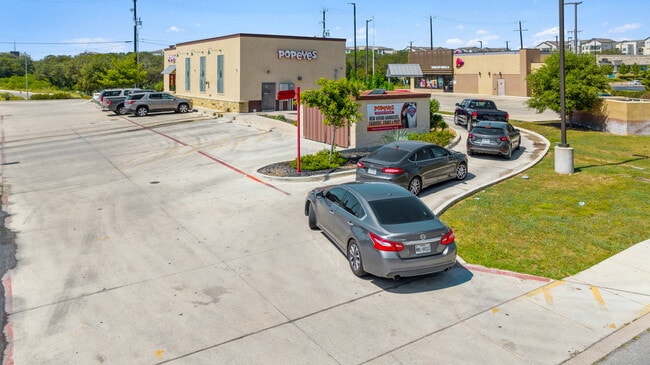
Property Record
17718 Bulverde Rd, San Antonio, TX 78259


NEARBY LISTINGS FOR SALE OR LEASE
Property Detail
17718 Bulverde Rd
San Antonio-New Braunfels, TX
Ncb 17728 (Nec Bulverde Retail Center)
17728-010-0090
NCB 17728 (NEC BULVERDE RETAIL CENTER), BLOCK 10 LOT 9 2016 NEW ACCT PER PLAT 9682/18-25 FILED 04-10-15
Restaurantdrivein
Bexar
X
Texas
48029C0260G
9
2024
0.64 AC
2025
Far North Central
121910
San Antonio
2,611 SF
DEMOGRAPHICS near 17718 Bulverde Rd
1 Mile
3 Mile
5 Mile
2024 Total Population
6,261
85,702
205,658
2029 Population
6,629
90,626
219,083
Pop Growth 2024-2029
+ 5.88%
+ 5.75%
+ 6.53%
Average Age
39
39
38
2024 Total Households
2,490
33,120
79,726
HH Growth 2024-2029
+ 5.94%
+ 5.96%
+ 6.71%
Median Household Inc
$103,809
$81,599
$77,325
Avg Household Size
2.50
2.50
2.50
2024 Avg HH Vehicles
2.00
2.00
2.00
Median Home Value
$270,020
$251,937
$256,437
Median Year Built
1998
1992
1994
Nearby Places
Map Layers
Map Styles
 Street
 Aerial
- Restaurants
- Banks
- Shops
- Fitness
- Groceries
PUBLIC TRANSPORTATION
AIRPORT
San Antonio International
DRIVE
WALK
Distance
San Antonio International
15 min
10.1 mi
Freight Ports
Calhoun Port
DRIVE
WALK
Distance
Calhoun Port
183 min
152.7 mi
SALE & LEASE HISTORY
LISTING DATE
SALE/LEASE

Oct 26, 2022
For Sale
Nearby Properties
Address
Land Use
TOTAL SIZE
Lot Size
Zoning
Address
Land Use
TOTAL SIZE
Lot Size
Zoning
621,591 SF
15.25 AC
Address
Land Use
TOTAL SIZE
Lot Size
Zoning
435,882 SF
27.85 AC
Address
Land Use
TOTAL SIZE
Lot Size
Zoning
37,195 SF
1,118.06 AC
Address
Land Use
TOTAL SIZE
Lot Size
Zoning
311,728 SF
7.47 AC
Address
Land Use
TOTAL SIZE
Lot Size
Zoning
383,541 SF
12.41 AC
Address
Land Use
TOTAL SIZE
Lot Size
Zoning
298,710 SF
11.36 AC
Address
Land Use
TOTAL SIZE
Lot Size
Zoning
307,210 SF
14.26 AC
Address
Land Use
TOTAL SIZE
Lot Size
Zoning
441,676 SF
19.99 AC
Address
Land Use
TOTAL SIZE
Lot Size
Zoning
306,523 SF
16.29 AC
Address
Land Use
TOTAL SIZE
Lot Size
Zoning
290,188 SF
14.60 AC
Address
Land Use
TOTAL SIZE
Lot Size
Zoning
341,841 SF
22 AC
Address
Land Use
TOTAL SIZE
Lot Size
Zoning
249,562 SF
9.65 AC
Address
Land Use
TOTAL SIZE
Lot Size
Zoning
340,570 SF
19.15 AC
Address
Land Use
TOTAL SIZE
Lot Size
Zoning
907.40 AC
Address
Land Use
TOTAL SIZE
Lot Size
Zoning
240,644 SF
16.35 AC
Address
Land Use
TOTAL SIZE
Lot Size
Zoning
281,805 SF
14.52 AC
Address
Land Use
TOTAL SIZE
Lot Size
Zoning
297,882 SF
17.16 AC
Address
Land Use
TOTAL SIZE
Lot Size
Zoning
258,951 SF
15.43 AC
Address
Land Use
TOTAL SIZE
Lot Size
Zoning
146,700 SF
56.18 AC
Address
Land Use
TOTAL SIZE
Lot Size
Zoning
256,497 SF
16.53 AC
Address
Land Use
TOTAL SIZE
Lot Size
Zoning
148,944 SF
29.35 AC
Address
Land Use
TOTAL SIZE
Lot Size
Zoning
212,072 SF
10.66 AC
Address
Land Use
TOTAL SIZE
Lot Size
Zoning
540,551 SF
21.09 AC
Address
Land Use
TOTAL SIZE
Lot Size
Zoning
364,250 SF
48.51 AC
Address
Land Use
TOTAL SIZE
Lot Size
Zoning
154,112 SF
9.31 AC
Address
Land Use
TOTAL SIZE
Lot Size
Zoning
171,219 SF
17.76 AC
Address
Land Use
TOTAL SIZE
Lot Size
Zoning
160,936 SF
15.04 AC
Address
Land Use
TOTAL SIZE
Lot Size
Zoning
180,590 SF
10 AC
Address
Land Use
TOTAL SIZE
Lot Size
Zoning
351,802 SF
43.07 AC
Address
Land Use
TOTAL SIZE
Lot Size
Zoning
284,788 SF
20.52 AC
The World's #1 Commercial Real Estate Marketplace
Connect with us
© 2025 CoStar Group
The information above has been obtained from sources believed reliable. While we do not doubt its accuracy we have not verified it and make no guarantee, warranty or representation about it. It is your responsibility to independently confirm its accuracy and completeness. Any projections, opinions, assumptions, or estimates used are for example only and do not represent the current or future performance of the property. The value of this transaction to you depends on tax and other factors which should be evaluated by your tax, financial, and legal advisors. You and your advisors should conduct a careful, independent investigation of the property to determine to your satisfaction the suitability of the property for your needs.