Property Record
1772 Panola Rd, Ellenwood, GA 30294

NEARBY LISTINGS FOR SALE OR LEASE
Property Detail
1772 Panola Rd
0025-01-008-000
LAND LOT: 197 /LAND DISTRICT: 12; COMMERCIAL
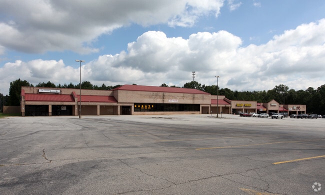
Stripcommercialcenter
Henry
X
Georgia
13151C0080D
7.20 AC
2025
Forest Park/Morrow
2025
Atlanta
070127
Atlanta-Sandy Springs-Roswell, GA
54,142 SF
DEMOGRAPHICS near 1772 Panola Rd
1 Mile
3 Mile
5 Mile
2024 Total Population
3,434
35,958
113,688
2029 Population
3,671
37,335
115,847
Pop Growth 2024-2029
+ 6.90%
+ 3.83%
+ 1.90%
Average Age
41
40
39
2024 Total Households
1,201
12,360
39,220
HH Growth 2024-2029
+ 6.99%
+ 3.93%
+ 1.92%
Median Household Inc
$68,918
$72,693
$68,355
Avg Household Size
2.80
2.90
2.80
2024 Avg HH Vehicles
2.00
2.00
2.00
Median Home Value
$198,717
$218,680
$199,378
Median Year Built
1979
1996
1992
Nearby Places
Map Layers
Map Styles
 Street
 Aerial
- Restaurants
- Banks
- Shops
- Fitness
- Groceries
PUBLIC TRANSPORTATION
AIRPORT
Hartsfield - Jackson Atlanta International
DRIVE
WALK
Distance
Hartsfield - Jackson Atlanta International
26 min
12.8 mi
Freight Ports
Georgia Ports - Savannah
DRIVE
WALK
Distance
Georgia Ports - Savannah
269 min
236.7 mi
SALE & LEASE HISTORY
LISTING DATE
SALE/LEASE

Sep 24, 2016
For Lease
Nov 01, 2021
For Lease
Aug 15, 2017
For Lease
Nearby Properties
Address
Land Use
TOTAL SIZE
Lot Size
Zoning
Address
Land Use
TOTAL SIZE
Lot Size
Zoning
80,431 SF
9.53 AC
C2
Address
Land Use
TOTAL SIZE
Lot Size
Zoning
101,848 SF
19.95 AC
C1
Address
Land Use
TOTAL SIZE
Lot Size
Zoning
5,320 SF
1,148.42 AC
X
Address
Land Use
TOTAL SIZE
Lot Size
Zoning
68,272 SF
7.52 AC
C1
Address
Land Use
TOTAL SIZE
Lot Size
Zoning
4,288 SF
77.44 AC
M2
Address
Land Use
TOTAL SIZE
Lot Size
Zoning
82,557 SF
4.89 AC
C3
Address
Land Use
TOTAL SIZE
Lot Size
Zoning
62,520 SF
18.01 AC
Address
Land Use
TOTAL SIZE
Lot Size
Zoning
5,168 SF
99.20 AC
C
Address
Land Use
TOTAL SIZE
Lot Size
Zoning
138,279 SF
26.47 AC
R2
Address
Land Use
TOTAL SIZE
Lot Size
Zoning
17,232 SF
2.18 AC
Address
Land Use
TOTAL SIZE
Lot Size
Zoning
54,142 SF
7.20 AC
C3
Address
Land Use
TOTAL SIZE
Lot Size
Zoning
13,320 SF
4.51 AC
OI
Address
Land Use
TOTAL SIZE
Lot Size
Zoning
131,929 SF
6.59 AC
C3
Address
Land Use
TOTAL SIZE
Lot Size
Zoning
10,020 SF
3.14 AC
TND
Address
Land Use
TOTAL SIZE
Lot Size
Zoning
10,517 SF
1.04 AC
C2
Address
Land Use
TOTAL SIZE
Lot Size
Zoning
12,996 SF
1.71 AC
C1
Address
Land Use
TOTAL SIZE
Lot Size
Zoning
19,127 SF
34.23 AC
RA
Address
Land Use
TOTAL SIZE
Lot Size
Zoning
7,070 SF
24.97 AC
C2
Address
Land Use
TOTAL SIZE
Lot Size
Zoning
64,875 SF
2.11 AC
C1
Address
Land Use
TOTAL SIZE
Lot Size
Zoning
2,852 SF
39.77 AC
RMH
Address
Land Use
TOTAL SIZE
Lot Size
Zoning
41,057 SF
6.83 AC
R100
Address
Land Use
TOTAL SIZE
Lot Size
Zoning
18,879 SF
2.33 AC
C1
Address
Land Use
TOTAL SIZE
Lot Size
Zoning
1,920 SF
19.04 AC
AG
Address
Land Use
TOTAL SIZE
Lot Size
Zoning
32.45 AC
C1
Address
Land Use
TOTAL SIZE
Lot Size
Zoning
4,160 SF
5.50 AC
HI
Address
Land Use
TOTAL SIZE
Lot Size
Zoning
32,375 SF
12.59 AC
C1
Address
Land Use
TOTAL SIZE
Lot Size
Zoning
1,386 SF
2.16 AC
HI
Address
Land Use
TOTAL SIZE
Lot Size
Zoning
3.26 AC
LCRA1*
Address
Land Use
TOTAL SIZE
Lot Size
Zoning
5,000 SF
1.61 AC
C2
Address
Land Use
TOTAL SIZE
Lot Size
Zoning
3,720 SF
1.84 AC
C1
The World's #1 Commercial Real Estate Marketplace
Connect with us
© 2026 CoStar Group
The information above has been obtained from sources believed reliable. While we do not doubt its accuracy we have not verified it and make no guarantee, warranty or representation about it. It is your responsibility to independently confirm its accuracy and completeness. Any projections, opinions, assumptions, or estimates used are for example only and do not represent the current or future performance of the property. The value of this transaction to you depends on tax and other factors which should be evaluated by your tax, financial, and legal advisors. You and your advisors should conduct a careful, independent investigation of the property to determine to your satisfaction the suitability of the property for your needs.