Property Record
17721 Sw 104Th St, Miami, FL 33196


NEARBY LISTINGS FOR SALE OR LEASE
Property Detail
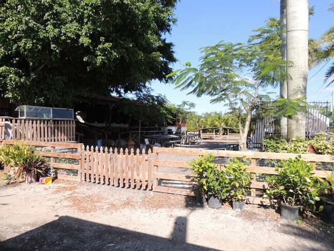
17721 Sw 104Th St
30-5801-000-0080
Acreage & Unrec
Agriculturalland
01 55 38 6.65 AC BEG 40.00FTN & 4722.26FTE OF SW COR OF SEC TH N 02 DEG W 619.97FT N 89 DEG E 467.50FT S 02 DEG E 594.26FT SWLY AD 39.97FT S 89 DEG W 441.79FT TO POB FAU 30 5801 000 0011 OR 20838-2284 11 2002 1
AH
Miami/Dade
12086C0440L
Florida
2024
6.65 AC
2025
Outlying Miami-Dade Cnty
018200
South Florida
1,995 SF
Miami-Miami Beach-Kendall, FL
DEMOGRAPHICS near 17721 Sw 104Th St
1 Mile
3 Mile
5 Mile
2024 Total Population
1,830
53,538
172,516
2029 Population
1,832
52,006
167,194
Pop Growth 2024-2029
+ 0.11%
(2.86%)
(3.08%)
Average Age
33
40
41
2024 Total Households
560
16,528
54,752
HH Growth 2024-2029
(0.18%)
(3.26%)
(3.48%)
Median Household Inc
$77,931
$80,366
$76,264
Avg Household Size
3.10
3.10
3.00
2024 Avg HH Vehicles
2.00
2.00
2.00
Median Home Value
$435,784
$386,535
$378,052
Median Year Built
2011
1993
1990
Nearby Places
Map Layers
Map Styles
 Street
 Aerial
- Restaurants
- Banks
- Shops
- Fitness
- Groceries
PUBLIC TRANSPORTATION
AIRPORT
Miami International
DRIVE
WALK
Distance
Miami International
37 min
20.4 mi
Freight Ports
Port of Miami
DRIVE
WALK
Distance
Port of Miami
45 min
28.9 mi
SALE & LEASE HISTORY
LISTING DATE
SALE/LEASE

May 23, 2018
For Sale
Jan 29, 2018
For Sale
Jan 08, 2019
For Sale
Dec 10, 2019
For Sale
Dec 04, 2019
For Sale
Nearby Properties
Address
Land Use
TOTAL SIZE
Lot Size
Zoning
Address
Land Use
TOTAL SIZE
Lot Size
Zoning
827,208 SF
27.66 AC
6400
Address
Land Use
TOTAL SIZE
Lot Size
Zoning
507,701 SF
17.94 AC
3800
Address
Land Use
TOTAL SIZE
Lot Size
Zoning
336,145 SF
17.04 AC
3900
Address
Land Use
TOTAL SIZE
Lot Size
Zoning
298,178 SF
10.39 AC
3900
Address
Land Use
TOTAL SIZE
Lot Size
Zoning
276,816 SF
9.63 AC
3900
Address
Land Use
TOTAL SIZE
Lot Size
Zoning
207,583 SF
20.16 AC
6400
Address
Land Use
TOTAL SIZE
Lot Size
Zoning
357,573 SF
33.93 AC
8900
Address
Land Use
TOTAL SIZE
Lot Size
Zoning
186,899 SF
8.19 AC
3800
Address
Land Use
TOTAL SIZE
Lot Size
Zoning
199,308 SF
9.67 AC
3800
Address
Land Use
TOTAL SIZE
Lot Size
Zoning
208,613 SF
26.33 AC
6400
Address
Land Use
TOTAL SIZE
Lot Size
Zoning
133,279 SF
2.31 AC
4802
Address
Land Use
TOTAL SIZE
Lot Size
Zoning
62,481 SF
11.88 AC
6400
Address
Land Use
TOTAL SIZE
Lot Size
Zoning
95,665 SF
8.88 AC
8900
Address
Land Use
TOTAL SIZE
Lot Size
Zoning
84,814 SF
6.84 AC
6200
Address
Land Use
TOTAL SIZE
Lot Size
Zoning
108,000 SF
6 AC
8900
Address
Land Use
TOTAL SIZE
Lot Size
Zoning
172,227 SF
14.01 AC
6200
Address
Land Use
TOTAL SIZE
Lot Size
Zoning
143,636 SF
15 AC
8900
Address
Land Use
TOTAL SIZE
Lot Size
Zoning
96,425 SF
0.99 AC
6600
Address
Land Use
TOTAL SIZE
Lot Size
Zoning
96,565 SF
7.53 AC
6200
Address
Land Use
TOTAL SIZE
Lot Size
Zoning
84,373 SF
6.91 AC
6200
Address
Land Use
TOTAL SIZE
Lot Size
Zoning
94,433 SF
7.39 AC
3800
Address
Land Use
TOTAL SIZE
Lot Size
Zoning
90,180 SF
9.43 AC
6200
Address
Land Use
TOTAL SIZE
Lot Size
Zoning
87,674 SF
2.64 AC
6400
Address
Land Use
TOTAL SIZE
Lot Size
Zoning
56,570 SF
4.74 AC
6200
Address
Land Use
TOTAL SIZE
Lot Size
Zoning
56,485 SF
8.76 AC
4802
The World's #1 Commercial Real Estate Marketplace
Connect with us
© 2025 CoStar Group
The information above has been obtained from sources believed reliable. While we do not doubt its accuracy we have not verified it and make no guarantee, warranty or representation about it. It is your responsibility to independently confirm its accuracy and completeness. Any projections, opinions, assumptions, or estimates used are for example only and do not represent the current or future performance of the property. The value of this transaction to you depends on tax and other factors which should be evaluated by your tax, financial, and legal advisors. You and your advisors should conduct a careful, independent investigation of the property to determine to your satisfaction the suitability of the property for your needs.