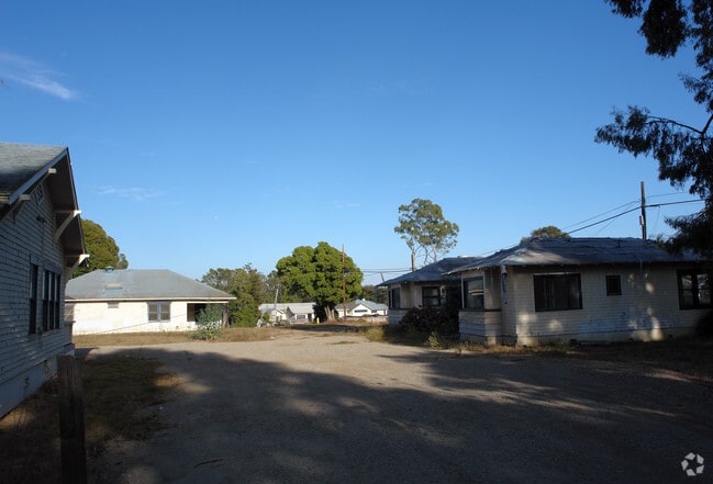
Property Record
1773 S Jameson Ln, Santa Barbara, CA 93108


NEARBY LISTINGS FOR SALE OR LEASE
Property Detail
1773 S Jameson Ln
Santa Maria-Santa Barbara, CA
Oceanside
009-372-001
OCEANSIDE TR LOT 1A
Hotel
Santa Barbara
AE
California
06083C1392H
1a
2024
1.02 AC
2025
Santa Barbara/Santa Maria
001403
Santa Barbara/Sta Maria/Goleta
16,816 SF
DEMOGRAPHICS near 1773 S Jameson Ln
1 mile
3 mile
5 mile
2024 Total Population
3,450
22,288
64,115
2029 Population
3,569
22,359
63,818
Pop Growth 2024-2029
+ 3.45%
+ 0.32%
(0.46%)
Average Age
50
43
41
2024 Total Households
1,550
8,192
25,532
HH Growth 2024-2029
+ 3.29%
+ 0.45%
(0.55%)
Median Household Inc
$186,912
$134,663
$98,120
Avg Household Size
2.20
2.50
2.30
2024 Avg HH Vehicles
2.00
2.00
2.00
Median Home Value
$1,136,411
$1,119,569
$1,105,963
Median Year Built
1969
1967
1964
Nearby Places
Map Layers
Map Styles
 Street
 Aerial
Transit
 Traffic
 Biking
Places
Listings with unknown addresses are not visible on the map
- Restaurants
- Banks
- Shops
- Fitness
- Groceries
PUBLIC TRANSPORTATION
COMMUTER RAIL
Santa Barbara (Coast Starlight - Amtrak, Pacific Surfliner - Amtrak)
Drive
Walk
Distance
Santa Barbara (Coast Starlight - Amtrak, Pacific Surfliner - Amtrak)
7 min
4.3 mi
Carpinteria Amtrak (Pacific Surfliner - Amtrak)
Drive
Walk
Distance
Carpinteria Amtrak (Pacific Surfliner - Amtrak)
11 min
7.3 mi
AIRPORT
Santa Barbara Municipal
Drive
Walk
Distance
Santa Barbara Municipal
33 min
16.5 mi
Freight Ports
The Port of Hueneme
Drive
Walk
Distance
The Port of Hueneme
49 min
36.0 mi
Nearby Properties
Address
Land Use
TOTAL SIZE
Lot Size
Zoning
Address
Land Use
TOTAL SIZE
Lot Size
Zoning
12.32 AC
CV
Address
Land Use
TOTAL SIZE
Lot Size
Zoning
Address
Land Use
TOTAL SIZE
Lot Size
Zoning
19,670 SF
5.90 AC
1E1
Address
Land Use
TOTAL SIZE
Lot Size
Zoning
21.85 AC
HRC1SP
Address
Land Use
TOTAL SIZE
Lot Size
Zoning
51,425 SF
28.35 AC
MRP
Address
Land Use
TOTAL SIZE
Lot Size
Zoning
20,424 SF
40.17 AC
10E1
Address
Land Use
TOTAL SIZE
Lot Size
Zoning
9,066 SF
10.02 AC
Address
Land Use
TOTAL SIZE
Lot Size
Zoning
Address
Land Use
TOTAL SIZE
Lot Size
Zoning
17,538 SF
3.99 AC
A2
Address
Land Use
TOTAL SIZE
Lot Size
Zoning
Address
Land Use
TOTAL SIZE
Lot Size
Zoning
77.82 AC
A2SD3
Address
Land Use
TOTAL SIZE
Lot Size
Zoning
183,552 SF
50.14 AC
SP5
Address
Land Use
TOTAL SIZE
Lot Size
Zoning
21,666 SF
23.48 AC
PUD30S
Address
Land Use
TOTAL SIZE
Lot Size
Zoning
10,981 SF
3.41 AC
3E1
Address
Land Use
TOTAL SIZE
Lot Size
Zoning
7,986 SF
1.13 AC
1E1
Address
Land Use
TOTAL SIZE
Lot Size
Zoning
1.12 AC
HRC1SD
Address
Land Use
TOTAL SIZE
Lot Size
Zoning
10,662 SF
5.41 AC
Address
Land Use
TOTAL SIZE
Lot Size
Zoning
10,568 SF
10.41 AC
5E1
Address
Land Use
TOTAL SIZE
Lot Size
Zoning
11,947 SF
2.45 AC
2E1
Address
Land Use
TOTAL SIZE
Lot Size
Zoning
20,676 SF
6.28 AC
5E1
Address
Land Use
TOTAL SIZE
Lot Size
Zoning
1 AC
HRC1SD
Address
Land Use
TOTAL SIZE
Lot Size
Zoning
21,890 SF
19.78 AC
AGI20
Address
Land Use
TOTAL SIZE
Lot Size
Zoning
18,302 SF
10.64 AC
5E1
Address
Land Use
TOTAL SIZE
Lot Size
Zoning
10,730 SF
11.29 AC
A2
Address
Land Use
TOTAL SIZE
Lot Size
Zoning
1.29 AC
HRC1SD
Address
Land Use
TOTAL SIZE
Lot Size
Zoning
12,014 SF
4.54 AC
3E1
Address
Land Use
TOTAL SIZE
Lot Size
Zoning
6,506 SF
8.04 AC
2E1
Address
Land Use
TOTAL SIZE
Lot Size
Zoning
21,643 SF
11.84 AC
10E1
Address
Land Use
TOTAL SIZE
Lot Size
Zoning
10,812 SF
2.44 AC
3E1
The World's #1 Commercial Real Estate Marketplace
Connect with us
© 2026 CoStar Group
The information above has been obtained from sources believed reliable. While we do not doubt its accuracy we have not verified it and make no guarantee, warranty or representation about it. It is your responsibility to independently confirm its accuracy and completeness. Any projections, opinions, assumptions, or estimates used are for example only and do not represent the current or future performance of the property. The value of this transaction to you depends on tax and other factors which should be evaluated by your tax, financial, and legal advisors. You and your advisors should conduct a careful, independent investigation of the property to determine to your satisfaction the suitability of the property for your needs.