Property Record
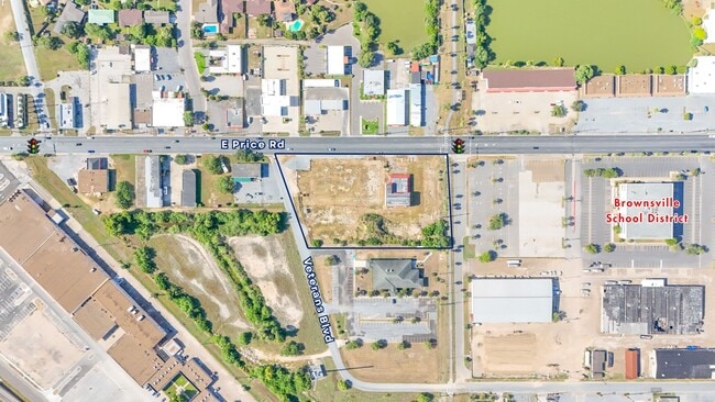
1774 E Price Rd, Brownsville, TX 78521


This Property Is For Sale
Property Detail
1774 E Price Rd
049200-0320-000000
LOS EBANOS PROPERTIES SUBDIVISION S PT BLK 32, 2.484 ACRES
Commercialnec
CAMERON
C
Texas
AH Areas with a 1% annual chance of shallow flooding, usually in the form of a pond, withan average depth ranging from 1 to 3 feet. These areas have a 26% chance of flooding over the life of a 30-year mortgage.
2.48 AC
2025
Greater Brownsville
2025
Brownsville/Harlingen
013002
Brownsville-Harlingen, TX
9,312 SF
NEARBY LISTINGS FOR SALE OR LEASE
DEMOGRAPHICS near 1774 E Price Rd
1 mile
3 mile
5 mile
2025 Total Population
13,489
111,973
183,532
2030 Population
13,624
113,857
187,181
Pop Growth 2025-2030
+ 1.00%
+ 1.68%
+ 1.99%
Average Age
37
37
36
2025 Total Households
4,992
36,321
56,816
HH Growth 2025-2030
+ 1.18%
+ 1.74%
+ 2.06%
Median Household Inc
$44,934
$47,915
$50,090
Avg Household Size
2.60
3.00
3.10
2025 Avg HH Vehicles
1.00
2.00
2.00
Median Home Value
$160,088
$140,550
$143,786
Median Year Built
1978
1988
1992
Nearby Places
Map Layers
Map Styles
 Street
 Aerial
Layers
 Traffic
 Biking
Places
Listings with unknown addresses are not visible on the map
- Restaurants
- Banks
- Shops
- Fitness
- Groceries
PUBLIC TRANSPORTATION
AIRPORT
Brownsville/South Padre Island International
Drive
Walk
Distance
Brownsville/South Padre Island International
11 min
5.1 mi
Valley International
Drive
Walk
Distance
Valley International
42 min
26.4 mi
Freight Ports
Port of Brownsville
Drive
Walk
Distance
Port of Brownsville
11 min
6.3 mi
Nearby Properties
Address
Land Use
TOTAL SIZE
Lot Size
Zoning
Address
Land Use
TOTAL SIZE
Lot Size
Zoning
591,279 SF
49.02 AC
Address
Land Use
TOTAL SIZE
Lot Size
Zoning
319,798 SF
46.28 AC
Address
Land Use
TOTAL SIZE
Lot Size
Zoning
452,559 SF
13.79 AC
C
Address
Land Use
TOTAL SIZE
Lot Size
Zoning
363,515 SF
34.39 AC
Address
Land Use
TOTAL SIZE
Lot Size
Zoning
302,902 SF
6.61 AC
C
Address
Land Use
TOTAL SIZE
Lot Size
Zoning
135,686 SF
19.05 AC
C
Address
Land Use
TOTAL SIZE
Lot Size
Zoning
196,847 SF
19.63 AC
Address
Land Use
TOTAL SIZE
Lot Size
Zoning
277,742 SF
31.28 AC
Address
Land Use
TOTAL SIZE
Lot Size
Zoning
72,436 SF
22.08 AC
Address
Land Use
TOTAL SIZE
Lot Size
Zoning
145,240 SF
17.49 AC
Address
Land Use
TOTAL SIZE
Lot Size
Zoning
100,491 SF
14 AC
C
Address
Land Use
TOTAL SIZE
Lot Size
Zoning
66,340 SF
3.85 AC
C
Address
Land Use
TOTAL SIZE
Lot Size
Zoning
167,653 SF
5.10 AC
Address
Land Use
TOTAL SIZE
Lot Size
Zoning
132,197 SF
10.70 AC
Address
Land Use
TOTAL SIZE
Lot Size
Zoning
56,804 SF
1.83 AC
Address
Land Use
TOTAL SIZE
Lot Size
Zoning
73,090 SF
3.08 AC
C
Address
Land Use
TOTAL SIZE
Lot Size
Zoning
148,781 SF
10.28 AC
B
Address
Land Use
TOTAL SIZE
Lot Size
Zoning
213,521 SF
38.75 AC
Address
Land Use
TOTAL SIZE
Lot Size
Zoning
60,747 SF
2.59 AC
C
Address
Land Use
TOTAL SIZE
Lot Size
Zoning
131,240 SF
9.94 AC
C
Address
Land Use
TOTAL SIZE
Lot Size
Zoning
188,446 SF
18.42 AC
Address
Land Use
TOTAL SIZE
Lot Size
Zoning
62,344 SF
2.92 AC
Address
Land Use
TOTAL SIZE
Lot Size
Zoning
133,476 SF
8.14 AC
Address
Land Use
TOTAL SIZE
Lot Size
Zoning
107,815 SF
10 AC
Address
Land Use
TOTAL SIZE
Lot Size
Zoning
52,668 SF
2.23 AC
Address
Land Use
TOTAL SIZE
Lot Size
Zoning
142,385 SF
0.50 AC
Address
Land Use
TOTAL SIZE
Lot Size
Zoning
120,166 SF
12.33 AC
Address
Land Use
TOTAL SIZE
Lot Size
Zoning
102,042 SF
8.68 AC
C
Address
Land Use
TOTAL SIZE
Lot Size
Zoning
176,990 SF
18.31 AC
C
The World's #1 Commercial Real Estate Marketplace
Connect with us
© 2026 CoStar Group
The information above has been obtained from sources believed reliable. While we do not doubt its accuracy we have not verified it and make no guarantee, warranty or representation about it. It is your responsibility to independently confirm its accuracy and completeness. Any projections, opinions, assumptions, or estimates used are for example only and do not represent the current or future performance of the property. The value of this transaction to you depends on tax and other factors which should be evaluated by your tax, financial, and legal advisors. You and your advisors should conduct a careful, independent investigation of the property to determine to your satisfaction the suitability of the property for your needs.