Property Record
1775 E 20Th St, San Bernardino, CA 92404


NEARBY LISTINGS FOR SALE OR LEASE
Property Detail
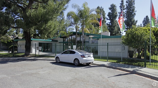
1775 E 20Th St
Riverside-San Bernardino-Ontario, CA
Orange Grove
0273-022-02
ORANGE GROVE TR PTN LOT 3 BLK 8 COM AT SE COR SD LOT BEING ALSO W LI TR NO 4019 TH ALG ELY LI SD LOT N 0 DEG 10 MIN 20 SECONDS W 654.63 FT TH N 89 DEG 59 MIN 10 SECONDS W 440.08 FT TO ELY LI TR NO 3879 BEING ALSO WLY LI SD LOT 3 TH S O DEG 08 MIN 20
Apartment
San Bernardino
X
California
06071C7963H
3
2024
6.55 AC
2025
Pacific
006304
Inland Empire (California)
64,152 SF
DEMOGRAPHICS near 1775 E 20Th St
1 Mile
3 Mile
5 Mile
2024 Total Population
27,074
152,583
255,762
2029 Population
27,752
155,277
259,882
Pop Growth 2024-2029
+ 2.50%
+ 1.77%
+ 1.61%
Average Age
33
34
35
2024 Total Households
7,494
43,805
74,045
HH Growth 2024-2029
+ 2.63%
+ 1.84%
+ 1.72%
Median Household Inc
$53,776
$55,405
$60,429
Avg Household Size
3.50
3.30
3.30
2024 Avg HH Vehicles
2.00
2.00
2.00
Median Home Value
$308,301
$332,179
$346,308
Median Year Built
1968
1966
1968
Nearby Places
Map Layers
Map Styles
 Street
 Aerial
- Restaurants
- Banks
- Shops
- Fitness
- Groceries
PUBLIC TRANSPORTATION
COMMUTER RAIL
DRIVE
WALK
Distance
10 min
4.9 mi
DRIVE
WALK
Distance
11 min
5.2 mi
AIRPORT
Ontario International
DRIVE
WALK
Distance
Ontario International
35 min
24.9 mi
SALE & LEASE HISTORY
LISTING DATE
SALE/LEASE

Apr 18, 2017
For Sale
Nearby Properties
Address
Land Use
TOTAL SIZE
Lot Size
Zoning
Address
Land Use
TOTAL SIZE
Lot Size
Zoning
2,134,798 SF
153.92 AC
Address
Land Use
TOTAL SIZE
Lot Size
Zoning
1,079,470 SF
46.39 AC
Address
Land Use
TOTAL SIZE
Lot Size
Zoning
708,500 SF
97.74 AC
Address
Land Use
TOTAL SIZE
Lot Size
Zoning
778,653 SF
19.31 AC
Address
Land Use
TOTAL SIZE
Lot Size
Zoning
497,664 SF
56.39 AC
Address
Land Use
TOTAL SIZE
Lot Size
Zoning
1,139,976 SF
49.56 AC
Address
Land Use
TOTAL SIZE
Lot Size
Zoning
406,710 SF
20.10 AC
Address
Land Use
TOTAL SIZE
Lot Size
Zoning
1,205,400 SF
58.05 AC
Address
Land Use
TOTAL SIZE
Lot Size
Zoning
472,962 SF
23.28 AC
Address
Land Use
TOTAL SIZE
Lot Size
Zoning
178,926 SF
9.12 AC
IC
Address
Land Use
TOTAL SIZE
Lot Size
Zoning
335,000 SF
8.44 AC
Address
Land Use
TOTAL SIZE
Lot Size
Zoning
415,405 SF
18.43 AC
IC
Address
Land Use
TOTAL SIZE
Lot Size
Zoning
599,690 SF
17.08 AC
IC
Address
Land Use
TOTAL SIZE
Lot Size
Zoning
159,956 SF
9.20 AC
Address
Land Use
TOTAL SIZE
Lot Size
Zoning
350,939 SF
6.29 AC
Address
Land Use
TOTAL SIZE
Lot Size
Zoning
150,308 SF
6.75 AC
Address
Land Use
TOTAL SIZE
Lot Size
Zoning
155,309 SF
5.56 AC
Address
Land Use
TOTAL SIZE
Lot Size
Zoning
Address
Land Use
TOTAL SIZE
Lot Size
Zoning
8,200 SF
11.29 AC
Address
Land Use
TOTAL SIZE
Lot Size
Zoning
112,520 SF
8.80 AC
Address
Land Use
TOTAL SIZE
Lot Size
Zoning
156,367 SF
7.40 AC
Address
Land Use
TOTAL SIZE
Lot Size
Zoning
132,596 SF
7.35 AC
Address
Land Use
TOTAL SIZE
Lot Size
Zoning
70,386 SF
5.11 AC
Address
Land Use
TOTAL SIZE
Lot Size
Zoning
954 SF
9.34 AC
IC
Address
Land Use
TOTAL SIZE
Lot Size
Zoning
188,350 SF
10.22 AC
Address
Land Use
TOTAL SIZE
Lot Size
Zoning
148,639 SF
12.12 AC
Address
Land Use
TOTAL SIZE
Lot Size
Zoning
73,864 SF
5.44 AC
R1
Address
Land Use
TOTAL SIZE
Lot Size
Zoning
6.05 AC
Address
Land Use
TOTAL SIZE
Lot Size
Zoning
212,970 SF
11.05 AC
Address
Land Use
TOTAL SIZE
Lot Size
Zoning
177,347 SF
9.01 AC
The World's #1 Commercial Real Estate Marketplace
Connect with us
© 2026 CoStar Group
The information above has been obtained from sources believed reliable. While we do not doubt its accuracy we have not verified it and make no guarantee, warranty or representation about it. It is your responsibility to independently confirm its accuracy and completeness. Any projections, opinions, assumptions, or estimates used are for example only and do not represent the current or future performance of the property. The value of this transaction to you depends on tax and other factors which should be evaluated by your tax, financial, and legal advisors. You and your advisors should conduct a careful, independent investigation of the property to determine to your satisfaction the suitability of the property for your needs.