Property Record
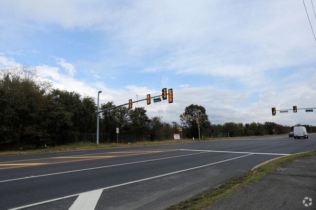
1775 Route 38, Lumberton, NJ 08048


NEARBY LISTINGS FOR SALE OR LEASE
Property Detail
1775 Route 38
Philadelphia-Camden-Wilmington, PA-NJ-DE-MD
ADDITIONAL LOTS: L-7&10
17-00023-0000-00003
Burlington
Vacantlandnec
New Jersey
X
3.2
34005C0257F
40.50 AC
2024
South Burlington County
2025
Philadelphia
703103
DEMOGRAPHICS near 1775 Route 38
1 Mile
3 Mile
5 Mile
2024 Total Population
4,937
34,114
54,250
2029 Population
5,166
34,930
55,394
Pop Growth 2024-2029
+ 4.64%
+ 2.39%
+ 2.11%
Average Age
37
40
41
2024 Total Households
2,101
13,119
20,602
HH Growth 2024-2029
+ 5.05%
+ 2.61%
+ 2.27%
Median Household Inc
$59,200
$85,123
$91,845
Avg Household Size
2.30
2.50
2.60
2024 Avg HH Vehicles
2.00
2.00
2.00
Median Home Value
$239,891
$276,086
$305,750
Median Year Built
1985
1978
1979
Nearby Places
Map Layers
Map Styles
 Street
 Aerial
- Restaurants
- Banks
- Shops
- Fitness
- Groceries
PUBLIC TRANSPORTATION
AIRPORT
Trenton Mercer
DRIVE
WALK
Distance
Trenton Mercer
42 min
27.1 mi
Philadelphia International
DRIVE
WALK
Distance
Philadelphia International
50 min
34.0 mi
Freight Ports
South Jersey Port
DRIVE
WALK
Distance
South Jersey Port
33 min
20.9 mi
Nearby Properties
Address
Land Use
TOTAL SIZE
Lot Size
Zoning
Address
Land Use
TOTAL SIZE
Lot Size
Zoning
3.03 AC
OB
Address
Land Use
TOTAL SIZE
Lot Size
Zoning
Address
Land Use
TOTAL SIZE
Lot Size
Zoning
27.64 AC
Address
Land Use
TOTAL SIZE
Lot Size
Zoning
53.05 AC
I2
Address
Land Use
TOTAL SIZE
Lot Size
Zoning
19.38 AC
R1
Address
Land Use
TOTAL SIZE
Lot Size
Zoning
478,715 SF
35.19 AC
Address
Land Use
TOTAL SIZE
Lot Size
Zoning
6.59 AC
GS
Address
Land Use
TOTAL SIZE
Lot Size
Zoning
0.52 AC
GS
Address
Land Use
TOTAL SIZE
Lot Size
Zoning
Address
Land Use
TOTAL SIZE
Lot Size
Zoning
12.31 AC
Address
Land Use
TOTAL SIZE
Lot Size
Zoning
5.29 AC
TC
Address
Land Use
TOTAL SIZE
Lot Size
Zoning
12.90 AC
Address
Land Use
TOTAL SIZE
Lot Size
Zoning
20.52 AC
RH
Address
Land Use
TOTAL SIZE
Lot Size
Zoning
28 AC
B3
Address
Land Use
TOTAL SIZE
Lot Size
Zoning
16.79 AC
R12
Address
Land Use
TOTAL SIZE
Lot Size
Zoning
10.12 AC
Address
Land Use
TOTAL SIZE
Lot Size
Zoning
23.33 AC
B2
Address
Land Use
TOTAL SIZE
Lot Size
Zoning
Address
Land Use
TOTAL SIZE
Lot Size
Zoning
15.60 AC
RH
Address
Land Use
TOTAL SIZE
Lot Size
Zoning
4.11 AC
Address
Land Use
TOTAL SIZE
Lot Size
Zoning
15 AC
R2
Address
Land Use
TOTAL SIZE
Lot Size
Zoning
15.64 AC
I2
Address
Land Use
TOTAL SIZE
Lot Size
Zoning
24.36 AC
Address
Land Use
TOTAL SIZE
Lot Size
Zoning
88.50 AC
MR
Address
Land Use
TOTAL SIZE
Lot Size
Zoning
Address
Land Use
TOTAL SIZE
Lot Size
Zoning
4.51 AC
PA
Address
Land Use
TOTAL SIZE
Lot Size
Zoning
19.21 AC
R1
Address
Land Use
TOTAL SIZE
Lot Size
Zoning
20 AC
R12
Address
Land Use
TOTAL SIZE
Lot Size
Zoning
3.95 AC
RED
Address
Land Use
TOTAL SIZE
Lot Size
Zoning
3.85 AC
R75
The World's #1 Commercial Real Estate Marketplace
Connect with us
© 2026 CoStar Group
The information above has been obtained from sources believed reliable. While we do not doubt its accuracy we have not verified it and make no guarantee, warranty or representation about it. It is your responsibility to independently confirm its accuracy and completeness. Any projections, opinions, assumptions, or estimates used are for example only and do not represent the current or future performance of the property. The value of this transaction to you depends on tax and other factors which should be evaluated by your tax, financial, and legal advisors. You and your advisors should conduct a careful, independent investigation of the property to determine to your satisfaction the suitability of the property for your needs.