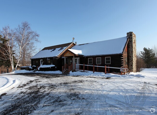
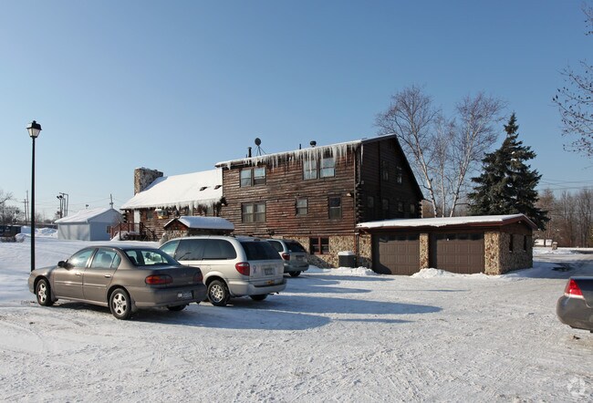
Property Record
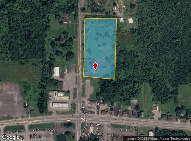
1776 Hilton Parma Corners Rd, Spencerport, NY 14559
NEARBY LISTINGS FOR SALE OR LEASE
Property Detail
1776 Hilton Parma Corners Rd
264089-072-010-0002-010-200
L12 T4 R1 GORE TRACT
Commercialofficeresidentialmixeduse
Monroe
X
New York
36055C0156G
10.200
2025
3.60 AC
2024
Northwest
014802
Rochester
2,724 SF
Rochester, NY
DEMOGRAPHICS near 1776 Hilton Parma Corners Rd
1 Mile
3 Mile
5 Mile
2024 Total Population
700
14,391
55,704
2029 Population
693
14,145
54,689
Pop Growth 2024-2029
(1.00%)
(1.71%)
(1.82%)
Average Age
45
42
44
2024 Total Households
284
5,759
22,916
HH Growth 2024-2029
(1.06%)
(1.82%)
(1.93%)
Median Household Inc
$114,062
$81,637
$77,997
Avg Household Size
2.40
2.50
2.40
2024 Avg HH Vehicles
2.00
2.00
2.00
Median Home Value
$258,450
$195,745
$185,492
Median Year Built
1977
1977
1981
Nearby Places
- Restaurants
- Banks
- Shops
- Fitness
- Groceries
PUBLIC TRANSPORTATION
AIRPORT
Frederick Douglass/Greater Rochester International
DRIVE
WALK
Distance
Frederick Douglass/Greater Rochester International
21 min
13.6 mi
Freight Ports
Albany, NY Port
DRIVE
WALK
Distance
Albany, NY Port
284 min
239.5 mi
Nearby Properties
Address
Land Use
TOTAL SIZE
Lot Size
Zoning
Address
Land Use
TOTAL SIZE
Lot Size
Zoning
279,852 SF
78.40 AC
R-1
Address
Land Use
TOTAL SIZE
Lot Size
Zoning
149,427 SF
10.90 AC
R-1
Address
Land Use
TOTAL SIZE
Lot Size
Zoning
180,566 SF
13.30 AC
R-1
Address
Land Use
TOTAL SIZE
Lot Size
Zoning
60,509 SF
29.40 AC
R-1
Address
Land Use
TOTAL SIZE
Lot Size
Zoning
1.70 AC
Address
Land Use
TOTAL SIZE
Lot Size
Zoning
44,643 SF
5.80 AC
05 - COMME
Address
Land Use
TOTAL SIZE
Lot Size
Zoning
8,386 SF
15.50 AC
MFR
Address
Land Use
TOTAL SIZE
Lot Size
Zoning
65,962 SF
19.71 AC
Address
Land Use
TOTAL SIZE
Lot Size
Zoning
49,100 SF
10.83 AC
05 - COMME
Address
Land Use
TOTAL SIZE
Lot Size
Zoning
86,432 SF
34.86 AC
R-1
Address
Land Use
TOTAL SIZE
Lot Size
Zoning
36,320 SF
9.97 AC
05 - COMME
Address
Land Use
TOTAL SIZE
Lot Size
Zoning
32,415 SF
9.18 AC
Address
Land Use
TOTAL SIZE
Lot Size
Zoning
42,944 SF
8.04 AC
05 - COMME
Address
Land Use
TOTAL SIZE
Lot Size
Zoning
30,650 SF
8.08 AC
02 - SINGL
Address
Land Use
TOTAL SIZE
Lot Size
Zoning
41,255 SF
9.03 AC
05 - COMME
Address
Land Use
TOTAL SIZE
Lot Size
Zoning
13,764 SF
10.90 AC
MFR
Address
Land Use
TOTAL SIZE
Lot Size
Zoning
71,344 SF
29.90 AC
R-1
Address
Land Use
TOTAL SIZE
Lot Size
Zoning
19,280 SF
1.15 AC
B2
Address
Land Use
TOTAL SIZE
Lot Size
Zoning
14,671 SF
33.82 AC
GC
Address
Land Use
TOTAL SIZE
Lot Size
Zoning
86,965 SF
8.25 AC
Address
Land Use
TOTAL SIZE
Lot Size
Zoning
5,260 SF
5.63 AC
SC
Address
Land Use
TOTAL SIZE
Lot Size
Zoning
20,845 SF
2.87 AC
RB
Address
Land Use
TOTAL SIZE
Lot Size
Zoning
13,718 SF
4.85 AC
MFR
Address
Land Use
TOTAL SIZE
Lot Size
Zoning
15,190 SF
10.44 AC
05 - COMME
Address
Land Use
TOTAL SIZE
Lot Size
Zoning
2,234 SF
4.52 AC
05 - COMME
Address
Land Use
TOTAL SIZE
Lot Size
Zoning
3,904 SF
5.19 AC
R3
Address
Land Use
TOTAL SIZE
Lot Size
Zoning
35,044 SF
10.90 AC
R-1
Address
Land Use
TOTAL SIZE
Lot Size
Zoning
16,379 SF
2.06 AC
05 - COMME
Address
Land Use
TOTAL SIZE
Lot Size
Zoning
37,000 SF
15.80 AC
R2
Address
Land Use
TOTAL SIZE
Lot Size
Zoning
2,226 SF
5.61 AC
SC
The World's #1 Commercial Real Estate Marketplace
Connect with us
© 2025 CoStar Group
The information above has been obtained from sources believed reliable. While we do not doubt its accuracy we have not verified it and make no guarantee, warranty or representation about it. It is your responsibility to independently confirm its accuracy and completeness. Any projections, opinions, assumptions, or estimates used are for example only and do not represent the current or future performance of the property. The value of this transaction to you depends on tax and other factors which should be evaluated by your tax, financial, and legal advisors. You and your advisors should conduct a careful, independent investigation of the property to determine to your satisfaction the suitability of the property for your needs.