Property Record
1776 N Ok Corral Way, Star, ID 83669

NEARBY LISTINGS FOR SALE OR LEASE
-
-
View all Star listings for sale on LoopNet.com
Property Detail
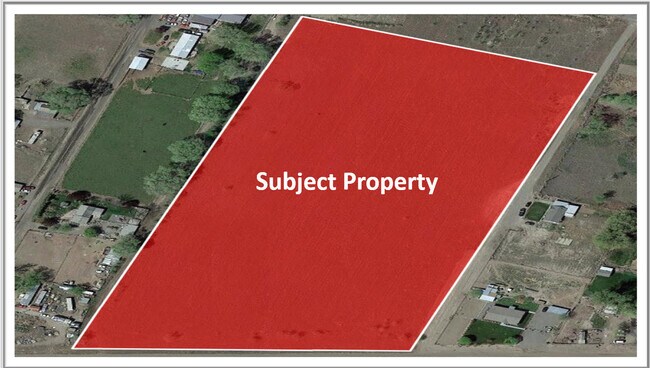
1776 N Ok Corral Way
Yakima, WA
Mab Twnsite Cos 2Nd Add & Mab Garden Trt
220801-41421
SECTION 01 TOWNSHIP 08 RANGE 22 QUARTER SE PLAT MAB TWNSITE CO'S 2ND ADD & MAB GARDEN TRTS (A-101 & RE-RECORD J-45) BLOCK 49 LOT 1 EXCEPT THE NOTHEASTERLY 5 FEET DEED TO CITY OF SECTION 01 TOWNSHIP 08 RANGE 22 QUARTER SE PLAT MAB TWNSITE CO'S 2ND ADD
Recreationalacreage
Yakima
X
Washington
53077C2280D
1
2025
1 AC
2025
Outlying Yakima County
002701
Yakima
DEMOGRAPHICS near 1776 N Ok Corral Way
1 Mile
3 Mile
5 Mile
2024 Total Population
1,820
2,351
9,468
2029 Population
1,734
2,252
9,397
Pop Growth 2024-2029
(4.73%)
(4.21%)
(0.75%)
Average Age
33
34
35
2024 Total Households
485
643
2,734
HH Growth 2024-2029
(4.95%)
(4.35%)
(0.80%)
Median Household Inc
$65,583
$67,380
$65,171
Avg Household Size
3.80
3.70
3.40
2024 Avg HH Vehicles
3.00
3.00
3.00
Median Home Value
$159,473
$172,692
$205,986
Median Year Built
1983
1982
1977
Nearby Places
Map Layers
Map Styles
 Street
 Aerial
- Restaurants
- Banks
- Shops
- Fitness
- Groceries
SALE & LEASE HISTORY
LISTING DATE
SALE/LEASE

Mar 28, 2022
For Sale
Nearby Properties
Address
Land Use
TOTAL SIZE
Lot Size
Zoning
Address
Land Use
TOTAL SIZE
Lot Size
Zoning
556,730 SF
45.97 AC
M1
Address
Land Use
TOTAL SIZE
Lot Size
Zoning
79,632 SF
8.94 AC
R1
Address
Land Use
TOTAL SIZE
Lot Size
Zoning
73,696 SF
68.44 AC
AG
Address
Land Use
TOTAL SIZE
Lot Size
Zoning
58,421 SF
10 AC
AG
Address
Land Use
TOTAL SIZE
Lot Size
Zoning
53,600 SF
51.47 AC
AG
Address
Land Use
TOTAL SIZE
Lot Size
Zoning
58,303 SF
3.60 AC
R1
Address
Land Use
TOTAL SIZE
Lot Size
Zoning
9,016 SF
0.96 AC
C1
Address
Land Use
TOTAL SIZE
Lot Size
Zoning
2,260 SF
69.95 AC
AG
Address
Land Use
TOTAL SIZE
Lot Size
Zoning
224.70 AC
AG
Address
Land Use
TOTAL SIZE
Lot Size
Zoning
30,820 SF
5.37 AC
AG
Address
Land Use
TOTAL SIZE
Lot Size
Zoning
10,718 SF
43.89 AC
AG
Address
Land Use
TOTAL SIZE
Lot Size
Zoning
9,054 SF
1.44 AC
R2
Address
Land Use
TOTAL SIZE
Lot Size
Zoning
5,800 SF
10.44 AC
R1
Address
Land Use
TOTAL SIZE
Lot Size
Zoning
4,800 SF
4.48 AC
AG
Address
Land Use
TOTAL SIZE
Lot Size
Zoning
10,409 SF
0.30 AC
M1
Address
Land Use
TOTAL SIZE
Lot Size
Zoning
1,112 SF
113.22 AC
AG
Address
Land Use
TOTAL SIZE
Lot Size
Zoning
35,112 SF
4.70 AC
R2
Address
Land Use
TOTAL SIZE
Lot Size
Zoning
20,762 SF
23.23 AC
AG
Address
Land Use
TOTAL SIZE
Lot Size
Zoning
2,233 SF
81.70 AC
AG
Address
Land Use
TOTAL SIZE
Lot Size
Zoning
10,108 SF
0.60 AC
M1
Address
Land Use
TOTAL SIZE
Lot Size
Zoning
39.69 AC
AG
Address
Land Use
TOTAL SIZE
Lot Size
Zoning
5,928 SF
80 AC
AG
Address
Land Use
TOTAL SIZE
Lot Size
Zoning
3,920 SF
0.09 AC
C1
Address
Land Use
TOTAL SIZE
Lot Size
Zoning
2,304 SF
39.38 AC
AG
Address
Land Use
TOTAL SIZE
Lot Size
Zoning
4,446 SF
20.71 AC
AG
Address
Land Use
TOTAL SIZE
Lot Size
Zoning
1,792 SF
4.47 AC
M1
Address
Land Use
TOTAL SIZE
Lot Size
Zoning
3,345 SF
25.34 AC
AG
Address
Land Use
TOTAL SIZE
Lot Size
Zoning
3,036 SF
117.01 AC
AG
Address
Land Use
TOTAL SIZE
Lot Size
Zoning
2,338 SF
0.38 AC
M1
Address
Land Use
TOTAL SIZE
Lot Size
Zoning
154.69 AC
RLDP
The World's #1 Commercial Real Estate Marketplace
Connect with us
© 2025 CoStar Group
The information above has been obtained from sources believed reliable. While we do not doubt its accuracy we have not verified it and make no guarantee, warranty or representation about it. It is your responsibility to independently confirm its accuracy and completeness. Any projections, opinions, assumptions, or estimates used are for example only and do not represent the current or future performance of the property. The value of this transaction to you depends on tax and other factors which should be evaluated by your tax, financial, and legal advisors. You and your advisors should conduct a careful, independent investigation of the property to determine to your satisfaction the suitability of the property for your needs.