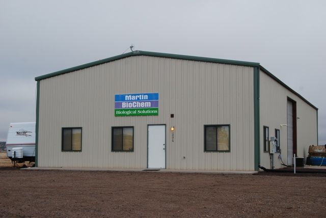
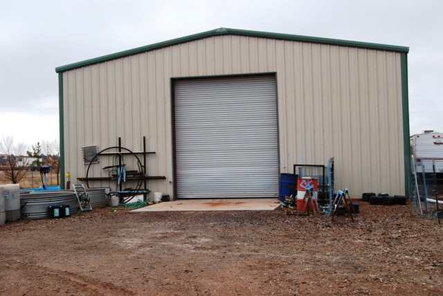
Property Record
1776 W Rutledge Dr, Snowflake, AZ 85937


Property Detail
1776 W Rutledge Dr
Commercialnec
SECTION 15,T13N,R21E: COM SW COR; TH N72*27'30 E 1852.36'; TH S89*33'37 W 255.15' POB; TH S89*33'37 W 235'; TH N00*34'01 W 370.71'; TH N89*35'33 E 235'; TH S00*34'01 E 370.57' TPOB. OUT OF 202-05-030Z FOR2003ROLL
MUNICIPAL
NAVAJO
B and X Area of moderate flood hazard, usually the area between the limits of the 100-year and 500-year floods.
Arizona
2024
2 AC
2026
Other Market Areas
963300
Show Low, AZ
3,200 SF
202-05-058
NEARBY LISTINGS FOR SALE OR LEASE
-
-
View all Snowflake listings for sale on LoopNet.com
DEMOGRAPHICS near 1776 W Rutledge Dr
1 mile
3 mile
5 mile
2025 Total Population
816
5,475
8,971
2030 Population
829
5,587
9,046
Pop Growth 2025-2030
+ 1.59%
+ 2.05%
+ 0.84%
Average Age
38
37
37
2025 Total Households
257
1,732
2,851
HH Growth 2025-2030
+ 1.56%
+ 2.02%
+ 0.46%
Median Household Inc
$65,147
$65,110
$66,288
Avg Household Size
3.10
3.10
3.10
2025 Avg HH Vehicles
3.00
2.00
2.00
Median Home Value
$321,428
$292,471
$307,749
Median Year Built
1994
1986
1992
Nearby Places
Map Layers
Map Styles
 Street
 Aerial
Layers
 Traffic
 Biking
Places
Listings with unknown addresses are not visible on the map
- Restaurants
- Banks
- Shops
- Fitness
- Groceries
Nearby Properties
Address
Land Use
TOTAL SIZE
Lot Size
Zoning
Address
Land Use
TOTAL SIZE
Lot Size
Zoning
4,116,428 SF
79.60 AC
MUNICIPAL
Address
Land Use
TOTAL SIZE
Lot Size
Zoning
63,917 SF
5.90 AC
MUNICIPAL
Address
Land Use
TOTAL SIZE
Lot Size
Zoning
16,267 SF
3.85 AC
MUNICIPAL
Address
Land Use
TOTAL SIZE
Lot Size
Zoning
47,830 SF
17.99 AC
MUNICIPAL
Address
Land Use
TOTAL SIZE
Lot Size
Zoning
28,911 SF
1.62 AC
MUNICIPAL
Address
Land Use
TOTAL SIZE
Lot Size
Zoning
52,140 SF
7.10 AC
MUNICIPAL
Address
Land Use
TOTAL SIZE
Lot Size
Zoning
20,769 SF
1.66 AC
MUNICIPAL
Address
Land Use
TOTAL SIZE
Lot Size
Zoning
9,294 SF
13.63 AC
MUNICIPAL
Address
Land Use
TOTAL SIZE
Lot Size
Zoning
18,300 SF
3.78 AC
MUNICIPAL
Address
Land Use
TOTAL SIZE
Lot Size
Zoning
31,598 SF
2 AC
MUNICIPAL
Address
Land Use
TOTAL SIZE
Lot Size
Zoning
23,257 SF
4.05 AC
MUNICIPAL
Address
Land Use
TOTAL SIZE
Lot Size
Zoning
43,000 SF
4.36 AC
MUNICIPAL
Address
Land Use
TOTAL SIZE
Lot Size
Zoning
8,813 SF
0.90 AC
Address
Land Use
TOTAL SIZE
Lot Size
Zoning
9,677 SF
4.49 AC
MUNICIPAL
Address
Land Use
TOTAL SIZE
Lot Size
Zoning
26,885 SF
4.07 AC
MUNICIPAL
Address
Land Use
TOTAL SIZE
Lot Size
Zoning
77,840 SF
9.62 AC
MUNICIPAL
Address
Land Use
TOTAL SIZE
Lot Size
Zoning
7,300 SF
1.69 AC
MUNICIPAL
Address
Land Use
TOTAL SIZE
Lot Size
Zoning
35,690 SF
3.05 AC
MUNICIPAL
Address
Land Use
TOTAL SIZE
Lot Size
Zoning
8,640 SF
2.09 AC
MUNICIPAL
Address
Land Use
TOTAL SIZE
Lot Size
Zoning
7,500 SF
18.50 AC
MUNICIPAL
Address
Land Use
TOTAL SIZE
Lot Size
Zoning
9,600 SF
1.48 AC
MUNICIPAL
Address
Land Use
TOTAL SIZE
Lot Size
Zoning
19,324 SF
1.64 AC
MUNICIPAL
Address
Land Use
TOTAL SIZE
Lot Size
Zoning
17,083 SF
2.23 AC
MUNICIPAL
Address
Land Use
TOTAL SIZE
Lot Size
Zoning
2,868 SF
1.63 AC
MUNICIPAL
Address
Land Use
TOTAL SIZE
Lot Size
Zoning
5,598 SF
0.45 AC
MUNICIPAL
Address
Land Use
TOTAL SIZE
Lot Size
Zoning
13,144 SF
0.81 AC
MUNICIPAL
Address
Land Use
TOTAL SIZE
Lot Size
Zoning
8,320 SF
0.90 AC
MUNICIPAL
Address
Land Use
TOTAL SIZE
Lot Size
Zoning
15,560 SF
1.07 AC
MUNICIPAL
Address
Land Use
TOTAL SIZE
Lot Size
Zoning
7,252 SF
6.20 AC
MUNICIPAL
Address
Land Use
TOTAL SIZE
Lot Size
Zoning
5,356 SF
0.64 AC
MUNICIPAL
The World's #1 Commercial Real Estate Marketplace
Connect with us
© 2026 CoStar Group
The information above has been obtained from sources believed reliable. While we do not doubt its accuracy we have not verified it and make no guarantee, warranty or representation about it. It is your responsibility to independently confirm its accuracy and completeness. Any projections, opinions, assumptions, or estimates used are for example only and do not represent the current or future performance of the property. The value of this transaction to you depends on tax and other factors which should be evaluated by your tax, financial, and legal advisors. You and your advisors should conduct a careful, independent investigation of the property to determine to your satisfaction the suitability of the property for your needs.