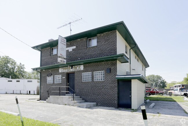
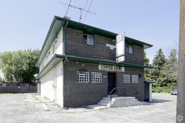
Property Record
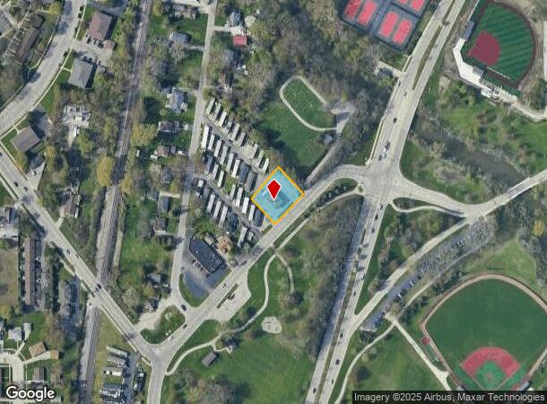
1778 Sheridan Rd, Kenosha, WI 53140
NEARBY LISTINGS FOR SALE OR LEASE
Property Detail
1778 Sheridan Rd
Chicago-Naperville-Elgin, IL-IN-WI
Riverview Subdv
83-4-223-184-1007
1923-H PARCEL 2 CSM 1791 SEC 18 & 19 T2 R23 A RE DIV OF LOTS 7,8 & 9 RIVERVIEW SUB (1995 SPILT FROM 81-4-223-184-1005) DOC#98
Commercialnec
Kenosha
X
Wisconsin
55059C0202E
7-9
2024
0.34 AC
2024
Kenosha East
000101
Chicago
3,415 SF
DEMOGRAPHICS near 1778 Sheridan Rd
1 Mile
3 Mile
5 Mile
2024 Total Population
8,612
43,372
99,760
2029 Population
8,608
42,913
98,548
Pop Growth 2024-2029
(0.05%)
(1.06%)
(1.21%)
Average Age
42
39
40
2024 Total Households
3,977
17,766
39,963
HH Growth 2024-2029
+ 0.30%
(0.91%)
(1.20%)
Median Household Inc
$62,363
$58,001
$63,877
Avg Household Size
2.00
2.20
2.30
2024 Avg HH Vehicles
2.00
2.00
2.00
Median Home Value
$199,831
$203,576
$190,563
Median Year Built
1974
1973
1967
Nearby Places
Map Layers
Map Styles
 Street
 Aerial
- Restaurants
- Banks
- Shops
- Fitness
- Groceries
PUBLIC TRANSPORTATION
COMMUTER RAIL
Kenosha Station (Union Pacific North Line - Northeast Illinois Regional Commuter Railroad (Metra))
DRIVE
WALK
Distance
Kenosha Station (Union Pacific North Line - Northeast Illinois Regional Commuter Railroad (Metra))
7 min
2.9 mi
AIRPORT
General Mitchell International
DRIVE
WALK
Distance
General Mitchell International
42 min
30.3 mi
Freight Ports
Port Milwaukee
DRIVE
WALK
Distance
Port Milwaukee
47 min
34.1 mi
SALE & LEASE HISTORY
LISTING DATE
SALE/LEASE

Jul 24, 2017
For Lease
Nearby Properties
Address
Land Use
TOTAL SIZE
Lot Size
Zoning
Address
Land Use
TOTAL SIZE
Lot Size
Zoning
30.04 AC
Address
Land Use
TOTAL SIZE
Lot Size
Zoning
183,173 SF
9.73 AC
RM3
Address
Land Use
TOTAL SIZE
Lot Size
Zoning
16,466 SF
19.09 AC
RM2
Address
Land Use
TOTAL SIZE
Lot Size
Zoning
32,245 SF
22 AC
RM2
Address
Land Use
TOTAL SIZE
Lot Size
Zoning
21,072 SF
24.33 AC
RM2
Address
Land Use
TOTAL SIZE
Lot Size
Zoning
26,016 SF
14.02 AC
FW
Address
Land Use
TOTAL SIZE
Lot Size
Zoning
26,500 SF
17.79 AC
RM2
Address
Land Use
TOTAL SIZE
Lot Size
Zoning
85,469 SF
11.30 AC
Address
Land Use
TOTAL SIZE
Lot Size
Zoning
88,473 SF
8.98 AC
B2
Address
Land Use
TOTAL SIZE
Lot Size
Zoning
15,084 SF
34.20 AC
Address
Land Use
TOTAL SIZE
Lot Size
Zoning
25,775 SF
3.43 AC
Address
Land Use
TOTAL SIZE
Lot Size
Zoning
28,815 SF
1.04 AC
B3
Address
Land Use
TOTAL SIZE
Lot Size
Zoning
0.62 AC
Address
Land Use
TOTAL SIZE
Lot Size
Zoning
26.05 AC
Address
Land Use
TOTAL SIZE
Lot Size
Zoning
63,500 SF
5.81 AC
RM2
Address
Land Use
TOTAL SIZE
Lot Size
Zoning
147,040 SF
2.50 AC
RM2
Address
Land Use
TOTAL SIZE
Lot Size
Zoning
59,660 SF
1.22 AC
RM3
Address
Land Use
TOTAL SIZE
Lot Size
Zoning
84,950 SF
8.11 AC
Address
Land Use
TOTAL SIZE
Lot Size
Zoning
31,650 SF
7.62 AC
FW
Address
Land Use
TOTAL SIZE
Lot Size
Zoning
319,640 SF
19.20 AC
M1
Address
Land Use
TOTAL SIZE
Lot Size
Zoning
9,860 SF
14.55 AC
RM2
Address
Land Use
TOTAL SIZE
Lot Size
Zoning
32,000 SF
3.97 AC
IP
Address
Land Use
TOTAL SIZE
Lot Size
Zoning
3.72 AC
Address
Land Use
TOTAL SIZE
Lot Size
Zoning
3,348 SF
3.21 AC
Address
Land Use
TOTAL SIZE
Lot Size
Zoning
49,528 SF
4.73 AC
B2
Address
Land Use
TOTAL SIZE
Lot Size
Zoning
13,224 SF
8.88 AC
Address
Land Use
TOTAL SIZE
Lot Size
Zoning
45,608 SF
1.31 AC
IP
Address
Land Use
TOTAL SIZE
Lot Size
Zoning
75,932 SF
4.10 AC
RM2
Address
Land Use
TOTAL SIZE
Lot Size
Zoning
1.30 AC
B3
Address
Land Use
TOTAL SIZE
Lot Size
Zoning
0.41 AC
B4
The World's #1 Commercial Real Estate Marketplace
Connect with us
© 2025 CoStar Group
The information above has been obtained from sources believed reliable. While we do not doubt its accuracy we have not verified it and make no guarantee, warranty or representation about it. It is your responsibility to independently confirm its accuracy and completeness. Any projections, opinions, assumptions, or estimates used are for example only and do not represent the current or future performance of the property. The value of this transaction to you depends on tax and other factors which should be evaluated by your tax, financial, and legal advisors. You and your advisors should conduct a careful, independent investigation of the property to determine to your satisfaction the suitability of the property for your needs.