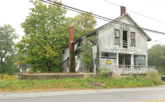
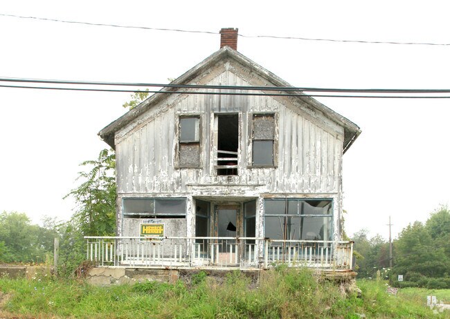
Property Record
17780 Claridon Troy Rd, Hiram, OH 44234
NEARBY LISTINGS FOR SALE OR LEASE
-
-
View all Hiram listings for sale on LoopNet.com
Property Detail
17780 Claridon Troy Rd
32-017550
SEC 13
Appliancestorebestbuyhhgregg
Geauga
X
Ohio
39155C0100D
3 AC
2024
Geauga County
2024
Cleveland
312000
Cleveland-Elyria, OH
9,157 SF
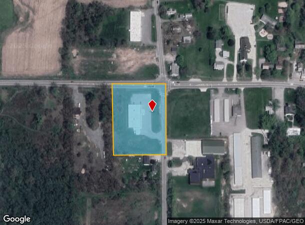
DEMOGRAPHICS near 17780 Claridon Troy Rd
1 Mile
3 Mile
5 Mile
2024 Total Population
386
2,737
9,653
2029 Population
377
2,687
9,512
Pop Growth 2024-2029
(2.33%)
(1.83%)
(1.46%)
Average Age
36
40
38
2024 Total Households
114
937
3,144
HH Growth 2024-2029
(2.63%)
(1.81%)
(1.43%)
Median Household Inc
$85,119
$80,184
$90,056
Avg Household Size
3.20
2.80
2.90
2024 Avg HH Vehicles
2.00
2.00
2.00
Median Home Value
$228,000
$204,812
$244,469
Median Year Built
1969
1976
1977
Nearby Places
Map Layers
Map Styles
 Street
 Aerial
- Restaurants
- Banks
- Shops
- Fitness
- Groceries
SALE & LEASE HISTORY
LISTING DATE
SALE/LEASE

Sep 24, 2016
For Sale
Jun 07, 2017
For Sale
Nearby Properties
Address
Land Use
TOTAL SIZE
Lot Size
Zoning
Address
Land Use
TOTAL SIZE
Lot Size
Zoning
334,594 SF
73.32 AC
M1
Address
Land Use
TOTAL SIZE
Lot Size
Zoning
56,278 SF
17.43 AC
M1
Address
Land Use
TOTAL SIZE
Lot Size
Zoning
82,352 SF
12.19 AC
M1
Address
Land Use
TOTAL SIZE
Lot Size
Zoning
68,148 SF
12.98 AC
M1
Address
Land Use
TOTAL SIZE
Lot Size
Zoning
41.07 AC
MHP
Address
Land Use
TOTAL SIZE
Lot Size
Zoning
28,628 SF
5.02 AC
R5
Address
Land Use
TOTAL SIZE
Lot Size
Zoning
40,590 SF
6.16 AC
M1
Address
Land Use
TOTAL SIZE
Lot Size
Zoning
15,403 SF
5.24 AC
M1
Address
Land Use
TOTAL SIZE
Lot Size
Zoning
8.99 AC
B1
Address
Land Use
TOTAL SIZE
Lot Size
Zoning
28,537 SF
5.75 AC
B1
Address
Land Use
TOTAL SIZE
Lot Size
Zoning
0.59 AC
R5
Address
Land Use
TOTAL SIZE
Lot Size
Zoning
1,452 SF
53.50 AC
R3
Address
Land Use
TOTAL SIZE
Lot Size
Zoning
6,385 SF
5.16 AC
M1
Address
Land Use
TOTAL SIZE
Lot Size
Zoning
5,677 SF
60.39 AC
R3
Address
Land Use
TOTAL SIZE
Lot Size
Zoning
2,568 SF
10.93 AC
M1
Address
Land Use
TOTAL SIZE
Lot Size
Zoning
1,166 SF
145.18 AC
R3
Address
Land Use
TOTAL SIZE
Lot Size
Zoning
8,400 SF
183.95 AC
R5
Address
Land Use
TOTAL SIZE
Lot Size
Zoning
222.50 AC
OS1
Address
Land Use
TOTAL SIZE
Lot Size
Zoning
11,006 SF
16.56 AC
B1
Address
Land Use
TOTAL SIZE
Lot Size
Zoning
4,628 SF
122.90 AC
Address
Land Use
TOTAL SIZE
Lot Size
Zoning
2,572 SF
100.54 AC
R3
Address
Land Use
TOTAL SIZE
Lot Size
Zoning
3,296 SF
48 AC
R5
Address
Land Use
TOTAL SIZE
Lot Size
Zoning
1,792 SF
52.85 AC
R5
Address
Land Use
TOTAL SIZE
Lot Size
Zoning
2,908 SF
74.06 AC
R3
Address
Land Use
TOTAL SIZE
Lot Size
Zoning
6,096 SF
5.01 AC
R5
Address
Land Use
TOTAL SIZE
Lot Size
Zoning
2,136 SF
72.29 AC
R3
Address
Land Use
TOTAL SIZE
Lot Size
Zoning
1,588 SF
111.56 AC
Address
Land Use
TOTAL SIZE
Lot Size
Zoning
3,428 SF
48.77 AC
R5
Address
Land Use
TOTAL SIZE
Lot Size
Zoning
4,824 SF
81.98 AC
R3
The World's #1 Commercial Real Estate Marketplace
Connect with us
© 2025 CoStar Group
The information above has been obtained from sources believed reliable. While we do not doubt its accuracy we have not verified it and make no guarantee, warranty or representation about it. It is your responsibility to independently confirm its accuracy and completeness. Any projections, opinions, assumptions, or estimates used are for example only and do not represent the current or future performance of the property. The value of this transaction to you depends on tax and other factors which should be evaluated by your tax, financial, and legal advisors. You and your advisors should conduct a careful, independent investigation of the property to determine to your satisfaction the suitability of the property for your needs.