Property Record
17781 Grand Island Rd, Walnut Grove, CA 95690

NEARBY LISTINGS FOR SALE OR LEASE
-
-
View all Walnut Grove listings for sale on LoopNet.com
Property Detail
17781 Grand Island Rd
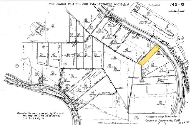
142-0120-042
POR OF S L S 511 AND 512 IN SEC 24, T 4N, R 3E,M D B &M, BEG AT S W COR OF S L S 511, TH FROM PO B N 27%39'41E 408.4 FT, TH S 46%21'33E 2607.82 FT, TH S 29%17'12W 83.93 FT, TH S 59%11'06E 128FT TO A PT ON THE R BANK OF SACTO RIVER, THS 37%1
Multifamilydwelling
Sacramento
AE
California
06067C0561H
33.49 AC
2024
Outer Sacramento County
2025
Sacramento
009900
Sacramento--Roseville--Arden-Arcade, CA
4,292 SF
DEMOGRAPHICS near 17781 Grand Island Rd
1 Mile
3 Mile
5 Mile
2024 Total Population
397
1,412
3,074
2029 Population
378
1,361
3,009
Pop Growth 2024-2029
(4.79%)
(3.61%)
(2.11%)
Average Age
45
44
45
2024 Total Households
157
548
1,272
HH Growth 2024-2029
(5.10%)
(3.83%)
(2.36%)
Median Household Inc
$85,937
$73,905
$64,104
Avg Household Size
2.50
2.50
2.40
2024 Avg HH Vehicles
2.00
2.00
2.00
Median Home Value
$609,649
$571,823
$508,086
Median Year Built
1973
1973
1976
Nearby Places
Map Layers
Map Styles
 Street
 Aerial
- Restaurants
- Banks
- Shops
- Fitness
- Groceries
PUBLIC TRANSPORTATION
AIRPORT
Stockton Metro
DRIVE
WALK
Distance
Stockton Metro
51 min
36.4 mi
Freight Ports
Port of Stockton
DRIVE
WALK
Distance
Port of Stockton
41 min
28.8 mi
SALE & LEASE HISTORY
LISTING DATE
SALE/LEASE

Aug 30, 2018
For Sale
Nearby Properties
Address
Land Use
TOTAL SIZE
Lot Size
Zoning
Address
Land Use
TOTAL SIZE
Lot Size
Zoning
153,371 SF
15.46 AC
C-O
Address
Land Use
TOTAL SIZE
Lot Size
Zoning
530.29 AC
AG-80
Address
Land Use
TOTAL SIZE
Lot Size
Zoning
AG80 F
Address
Land Use
TOTAL SIZE
Lot Size
Zoning
4,606 SF
720.08 AC
DW-S AG-80
Address
Land Use
TOTAL SIZE
Lot Size
Zoning
Address
Land Use
TOTAL SIZE
Lot Size
Zoning
288.37 AC
AG-80
Address
Land Use
TOTAL SIZE
Lot Size
Zoning
420.96 AC
Address
Land Use
TOTAL SIZE
Lot Size
Zoning
Address
Land Use
TOTAL SIZE
Lot Size
Zoning
804 SF
10.12 AC
Address
Land Use
TOTAL SIZE
Lot Size
Zoning
Address
Land Use
TOTAL SIZE
Lot Size
Zoning
109.82 AC
AG-80 DW-S
Address
Land Use
TOTAL SIZE
Lot Size
Zoning
Address
Land Use
TOTAL SIZE
Lot Size
Zoning
146 AC
AG-80
Address
Land Use
TOTAL SIZE
Lot Size
Zoning
1,694 SF
34.57 AC
DW
Address
Land Use
TOTAL SIZE
Lot Size
Zoning
Address
Land Use
TOTAL SIZE
Lot Size
Zoning
2,438 SF
25.10 AC
DW AG-80
Address
Land Use
TOTAL SIZE
Lot Size
Zoning
206.31 AC
AG-80
Address
Land Use
TOTAL SIZE
Lot Size
Zoning
Address
Land Use
TOTAL SIZE
Lot Size
Zoning
Address
Land Use
TOTAL SIZE
Lot Size
Zoning
6.90 AC
DW-R
Address
Land Use
TOTAL SIZE
Lot Size
Zoning
2,642 SF
534.50 AC
AG-80
Address
Land Use
TOTAL SIZE
Lot Size
Zoning
116.27 AC
AG-80
Address
Land Use
TOTAL SIZE
Lot Size
Zoning
3.06 AC
PDI
Address
Land Use
TOTAL SIZE
Lot Size
Zoning
190.74 AC
A 80
Address
Land Use
TOTAL SIZE
Lot Size
Zoning
6,048 SF
0.36 AC
CC
Address
Land Use
TOTAL SIZE
Lot Size
Zoning
Address
Land Use
TOTAL SIZE
Lot Size
Zoning
127.78 AC
AG-80
Address
Land Use
TOTAL SIZE
Lot Size
Zoning
Address
Land Use
TOTAL SIZE
Lot Size
Zoning
17,268 SF
4.01 AC
RCO PDI
Address
Land Use
TOTAL SIZE
Lot Size
Zoning
89.36 AC
AG-80 DW-S
The World's #1 Commercial Real Estate Marketplace
Connect with us
© 2026 CoStar Group
The information above has been obtained from sources believed reliable. While we do not doubt its accuracy we have not verified it and make no guarantee, warranty or representation about it. It is your responsibility to independently confirm its accuracy and completeness. Any projections, opinions, assumptions, or estimates used are for example only and do not represent the current or future performance of the property. The value of this transaction to you depends on tax and other factors which should be evaluated by your tax, financial, and legal advisors. You and your advisors should conduct a careful, independent investigation of the property to determine to your satisfaction the suitability of the property for your needs.