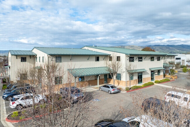
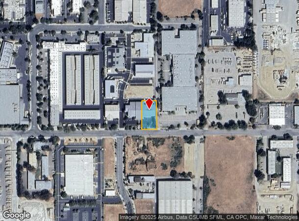
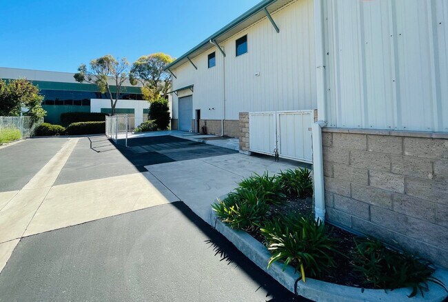
Property Record
178 Suburban Rd, San Luis Obispo, CA 93401
Current Lease Availabilities
NEARBY LISTINGS FOR SALE OR LEASE
Property Detail
178 Suburban Rd
San Luis Obispo-Paso Robles-Arroyo Grande, CA
Parcel Map Slo 4-0119
053-257-034
CY SLO PM 65/89-90 PAR 5
Storebuilding
San Luis Obispo
X
California
06079C1331H
5
2024
0.41 AC
2025
South SLO
011505
San Luis Obispo/Paso Robles
8,627 SF
DEMOGRAPHICS near 178 Suburban Rd
1 Mile
3 Mile
5 Mile
2024 Total Population
3,319
35,564
60,710
2029 Population
3,285
35,701
60,923
Pop Growth 2024-2029
(1.02%)
+ 0.39%
+ 0.35%
Average Age
44
40
36
2024 Total Households
1,513
15,049
22,838
HH Growth 2024-2029
(1.32%)
+ 0.05%
+ 0.24%
Median Household Inc
$68,249
$85,406
$71,320
Avg Household Size
2.20
2.30
2.30
2024 Avg HH Vehicles
2.00
2.00
2.00
Median Home Value
$480,768
$793,314
$824,995
Median Year Built
1983
1980
1979
Nearby Places
Map Layers
Map Styles
 Street
 Aerial
- Restaurants
- Banks
- Shops
- Fitness
- Groceries
PUBLIC TRANSPORTATION
COMMUTER RAIL
DRIVE
WALK
Distance
8 min
3.7 mi
AIRPORT
San Luis County Regional
DRIVE
WALK
Distance
San Luis County Regional
10 min
4.1 mi
Nearby Properties
Address
Land Use
TOTAL SIZE
Lot Size
Zoning
Address
Land Use
TOTAL SIZE
Lot Size
Zoning
99,866 SF
14.05 AC
O
Address
Land Use
TOTAL SIZE
Lot Size
Zoning
92,330 SF
3.69 AC
R4
Address
Land Use
TOTAL SIZE
Lot Size
Zoning
191,653 SF
6.70 AC
CR
Address
Land Use
TOTAL SIZE
Lot Size
Zoning
69,146 SF
0.93 AC
CR
Address
Land Use
TOTAL SIZE
Lot Size
Zoning
139,675 SF
14.88 AC
CR
Address
Land Use
TOTAL SIZE
Lot Size
Zoning
110,984 SF
1.19 AC
CD
Address
Land Use
TOTAL SIZE
Lot Size
Zoning
137,893 SF
10.08 AC
CS
Address
Land Use
TOTAL SIZE
Lot Size
Zoning
83,000 SF
4.90 AC
CT
Address
Land Use
TOTAL SIZE
Lot Size
Zoning
3.65 AC
CN
Address
Land Use
TOTAL SIZE
Lot Size
Zoning
100,759 SF
21.52 AC
CR
Address
Land Use
TOTAL SIZE
Lot Size
Zoning
61,720 SF
0.83 AC
CD
Address
Land Use
TOTAL SIZE
Lot Size
Zoning
116,351 SF
4.59 AC
R3
Address
Land Use
TOTAL SIZE
Lot Size
Zoning
Address
Land Use
TOTAL SIZE
Lot Size
Zoning
69,091 SF
20.41 AC
AG
Address
Land Use
TOTAL SIZE
Lot Size
Zoning
54,577 SF
0.95 AC
CC
Address
Land Use
TOTAL SIZE
Lot Size
Zoning
91,389 SF
4.65 AC
R4
Address
Land Use
TOTAL SIZE
Lot Size
Zoning
201,280 SF
8.66 AC
M
Address
Land Use
TOTAL SIZE
Lot Size
Zoning
92.20 AC
R1
Address
Land Use
TOTAL SIZE
Lot Size
Zoning
72,475 SF
8.12 AC
CR
Address
Land Use
TOTAL SIZE
Lot Size
Zoning
66,348 SF
2.83 AC
CT
Address
Land Use
TOTAL SIZE
Lot Size
Zoning
85,863 SF
7.70 AC
R3
Address
Land Use
TOTAL SIZE
Lot Size
Zoning
66,022 SF
3.26 AC
R4
Address
Land Use
TOTAL SIZE
Lot Size
Zoning
1.48 AC
CD
Address
Land Use
TOTAL SIZE
Lot Size
Zoning
73,223 SF
8.67 AC
CR
Address
Land Use
TOTAL SIZE
Lot Size
Zoning
30,889 SF
3.89 AC
R3
Address
Land Use
TOTAL SIZE
Lot Size
Zoning
30,986 SF
2.84 AC
CT
Address
Land Use
TOTAL SIZE
Lot Size
Zoning
59,358 SF
2 AC
M
Address
Land Use
TOTAL SIZE
Lot Size
Zoning
37,842 SF
1.36 AC
CS
Address
Land Use
TOTAL SIZE
Lot Size
Zoning
129,802 SF
10.73 AC
CR
Address
Land Use
TOTAL SIZE
Lot Size
Zoning
67,560 SF
10.07 AC
CC
The World's #1 Commercial Real Estate Marketplace
Connect with us
© 2025 CoStar Group
The information above has been obtained from sources believed reliable. While we do not doubt its accuracy we have not verified it and make no guarantee, warranty or representation about it. It is your responsibility to independently confirm its accuracy and completeness. Any projections, opinions, assumptions, or estimates used are for example only and do not represent the current or future performance of the property. The value of this transaction to you depends on tax and other factors which should be evaluated by your tax, financial, and legal advisors. You and your advisors should conduct a careful, independent investigation of the property to determine to your satisfaction the suitability of the property for your needs.