Property Record
1780 Bakertown Rd, Buchanan, MI 49107


NEARBY LISTINGS FOR SALE OR LEASE
-
-
View all Buchanan listings for sale on LoopNet.com
Property Detail
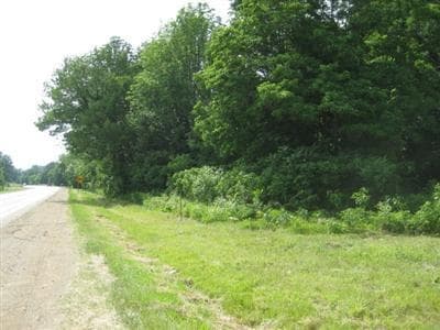
1780 Bakertown Rd
Niles, MI
Berrien
11-05-0003-0008-00-4
Michigan
Sfr
27.52 AC
X
Michigan Southwest Area
18141C0045D
Other Market Areas
2,114 SF
DEMOGRAPHICS near 1780 Bakertown Rd
1 Mile
3 Mile
5 Mile
2024 Total Population
259
6,584
11,037
2029 Population
252
6,444
10,832
Pop Growth 2024-2029
(2.70%)
(2.13%)
(1.86%)
Average Age
42
42
42
2024 Total Households
102
2,794
4,495
HH Growth 2024-2029
(2.94%)
(2.43%)
(2.11%)
Median Household Inc
$59,999
$55,568
$60,317
Avg Household Size
2.40
2.30
2.30
2024 Avg HH Vehicles
2.00
2.00
2.00
Median Home Value
$207,692
$173,786
$192,406
Median Year Built
1962
1963
1967
Nearby Places
Map Layers
Map Styles
 Street
 Aerial
- Restaurants
- Banks
- Shops
- Fitness
- Groceries
PUBLIC TRANSPORTATION
COMMUTER RAIL
DRIVE
WALK
Distance
14 min
8.5 mi
AIRPORT
South Bend International
DRIVE
WALK
Distance
South Bend International
26 min
13.9 mi
Nearby Properties
Address
Land Use
TOTAL SIZE
Lot Size
Zoning
Address
Land Use
TOTAL SIZE
Lot Size
Zoning
7.50 AC
R-1 SIN
Address
Land Use
TOTAL SIZE
Lot Size
Zoning
91,484 SF
14 AC
R-1 SIN
Address
Land Use
TOTAL SIZE
Lot Size
Zoning
207,400 SF
10.08 AC
R-1 SIN
Address
Land Use
TOTAL SIZE
Lot Size
Zoning
106,635 SF
7.74 AC
R-3 MUL
Address
Land Use
TOTAL SIZE
Lot Size
Zoning
269,301 SF
13.71 AC
R-1 SIN
Address
Land Use
TOTAL SIZE
Lot Size
Zoning
127,210 SF
16.71 AC
R-1 SIN
Address
Land Use
TOTAL SIZE
Lot Size
Zoning
47,520 SF
11.40 AC
R-1 SIN
Address
Land Use
TOTAL SIZE
Lot Size
Zoning
2,600 SF
6.46 AC
Address
Land Use
TOTAL SIZE
Lot Size
Zoning
12,540 SF
1.53 AC
R-1 SIN
Address
Land Use
TOTAL SIZE
Lot Size
Zoning
3,453 SF
100 AC
AG
Address
Land Use
TOTAL SIZE
Lot Size
Zoning
243.31 AC
AG AGRICUL
Address
Land Use
TOTAL SIZE
Lot Size
Zoning
1,403 SF
231.41 AC
AG AGRICUL
Address
Land Use
TOTAL SIZE
Lot Size
Zoning
23,294 SF
1.55 AC
R-1 SIN
Address
Land Use
TOTAL SIZE
Lot Size
Zoning
28,753 SF
5.33 AC
R-1 SIN
Address
Land Use
TOTAL SIZE
Lot Size
Zoning
1,750 SF
154.85 AC
AG AGRICUL
Address
Land Use
TOTAL SIZE
Lot Size
Zoning
43,744 SF
5.85 AC
C
Address
Land Use
TOTAL SIZE
Lot Size
Zoning
1,947 SF
160 AC
AG AGRICUL
Address
Land Use
TOTAL SIZE
Lot Size
Zoning
3,584 SF
160 AC
AG
Address
Land Use
TOTAL SIZE
Lot Size
Zoning
53,461 SF
8.39 AC
R-1 SIN
Address
Land Use
TOTAL SIZE
Lot Size
Zoning
160 AC
AG AGRICUL
Address
Land Use
TOTAL SIZE
Lot Size
Zoning
34,038 SF
2.50 AC
R-1 SIN
Address
Land Use
TOTAL SIZE
Lot Size
Zoning
3,978 SF
80 AC
AG AGRICUL
Address
Land Use
TOTAL SIZE
Lot Size
Zoning
1,908 SF
107.50 AC
AG AGRICUL
Address
Land Use
TOTAL SIZE
Lot Size
Zoning
10,600 SF
2.22 AC
M-1 LIG
Address
Land Use
TOTAL SIZE
Lot Size
Zoning
53,238 SF
3.94 AC
M-1 LIG
Address
Land Use
TOTAL SIZE
Lot Size
Zoning
137.07 AC
AG AGRICUL
Address
Land Use
TOTAL SIZE
Lot Size
Zoning
137.17 AC
AG AGRICUL
Address
Land Use
TOTAL SIZE
Lot Size
Zoning
1,536 SF
98 AC
AG AGRICUL
Address
Land Use
TOTAL SIZE
Lot Size
Zoning
42,053 SF
27.29 AC
I
Address
Land Use
TOTAL SIZE
Lot Size
Zoning
143.82 AC
AG AGRICUL
The World's #1 Commercial Real Estate Marketplace
Connect with us
© 2026 CoStar Group
The information above has been obtained from sources believed reliable. While we do not doubt its accuracy we have not verified it and make no guarantee, warranty or representation about it. It is your responsibility to independently confirm its accuracy and completeness. Any projections, opinions, assumptions, or estimates used are for example only and do not represent the current or future performance of the property. The value of this transaction to you depends on tax and other factors which should be evaluated by your tax, financial, and legal advisors. You and your advisors should conduct a careful, independent investigation of the property to determine to your satisfaction the suitability of the property for your needs.