Property Record
1780 Rohrerstown Rd, Lancaster, PA 17601
NEARBY LISTINGS FOR SALE OR LEASE
Property Detail
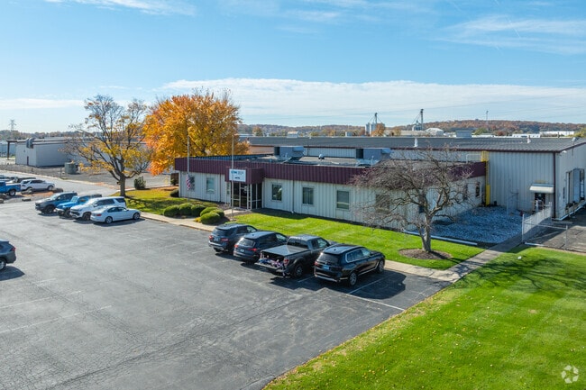
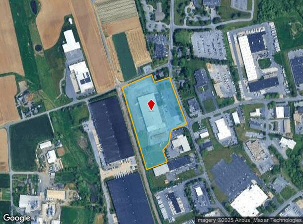
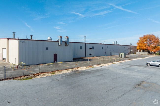
1780 Rohrerstown Rd
Lancaster, PA
Blackford Development
290-32324-0-0000
1780 ROHRERSTOWN RD
Lightindustrial
Lancaster
X
Pennsylvania
42071C0353F
1
2024
11.78 AC
2025
Lancaster County
011600
Philadelphia
93,550 SF
DEMOGRAPHICS near 1780 Rohrerstown Rd
1 Mile
3 Mile
5 Mile
2024 Total Population
3,400
44,612
166,482
2029 Population
3,409
44,940
168,060
Pop Growth 2024-2029
+ 0.26%
+ 0.74%
+ 0.95%
Average Age
44
42
41
2024 Total Households
1,409
16,977
64,381
HH Growth 2024-2029
(0.14%)
+ 0.62%
+ 0.93%
Median Household Inc
$78,548
$95,163
$77,549
Avg Household Size
2.30
2.50
2.40
2024 Avg HH Vehicles
2.00
2.00
2.00
Median Home Value
$238,951
$292,975
$255,385
Median Year Built
1978
1984
1969
Nearby Places
Map Layers
Map Styles
 Street
 Aerial
- Restaurants
- Banks
- Shops
- Fitness
- Groceries
PUBLIC TRANSPORTATION
COMMUTER RAIL
DRIVE
WALK
Distance
8 min
4.7 mi
DRIVE
WALK
Distance
14 min
9.2 mi
AIRPORT
Harrisburg International
DRIVE
WALK
Distance
Harrisburg International
37 min
28.7 mi
Freight Ports
Port Newark Container Terminal
DRIVE
WALK
Distance
Port Newark Container Terminal
85 min
52.0 mi
Nearby Properties
Address
Land Use
TOTAL SIZE
Lot Size
Zoning
Address
Land Use
TOTAL SIZE
Lot Size
Zoning
822,920 SF
97.54 AC
HCD
Address
Land Use
TOTAL SIZE
Lot Size
Zoning
1,603,151 SF
104.89 AC
C3
Address
Land Use
TOTAL SIZE
Lot Size
Zoning
526,898 SF
26.10 AC
AH
Address
Land Use
TOTAL SIZE
Lot Size
Zoning
1,003,686 SF
127.66 AC
HR
Address
Land Use
TOTAL SIZE
Lot Size
Zoning
905,200 SF
68.60 AC
Address
Land Use
TOTAL SIZE
Lot Size
Zoning
308,727 SF
11.37 AC
Address
Land Use
TOTAL SIZE
Lot Size
Zoning
193,864 SF
9 AC
Address
Land Use
TOTAL SIZE
Lot Size
Zoning
99,894 SF
21.88 AC
Address
Land Use
TOTAL SIZE
Lot Size
Zoning
269,890 SF
57.10 AC
SR
Address
Land Use
TOTAL SIZE
Lot Size
Zoning
135,998 SF
28.64 AC
HR
Address
Land Use
TOTAL SIZE
Lot Size
Zoning
223,327 SF
21.80 AC
B-4
Address
Land Use
TOTAL SIZE
Lot Size
Zoning
621,413 SF
79.20 AC
I-1
Address
Land Use
TOTAL SIZE
Lot Size
Zoning
691,290 SF
3 AC
Address
Land Use
TOTAL SIZE
Lot Size
Zoning
372,708 SF
50.40 AC
HR
Address
Land Use
TOTAL SIZE
Lot Size
Zoning
101,558 SF
28.14 AC
AH
Address
Land Use
TOTAL SIZE
Lot Size
Zoning
385,561 SF
27.20 AC
Address
Land Use
TOTAL SIZE
Lot Size
Zoning
299,600 SF
63 AC
HR
Address
Land Use
TOTAL SIZE
Lot Size
Zoning
244,568 SF
8.30 AC
IN
Address
Land Use
TOTAL SIZE
Lot Size
Zoning
1,382,541 SF
106.20 AC
Address
Land Use
TOTAL SIZE
Lot Size
Zoning
113,967 SF
13.32 AC
Address
Land Use
TOTAL SIZE
Lot Size
Zoning
75,766 SF
9.07 AC
Address
Land Use
TOTAL SIZE
Lot Size
Zoning
826,042 SF
57.40 AC
CM
Address
Land Use
TOTAL SIZE
Lot Size
Zoning
98,000 SF
18.30 AC
R-1
Address
Land Use
TOTAL SIZE
Lot Size
Zoning
158,689 SF
25.40 AC
B-4
Address
Land Use
TOTAL SIZE
Lot Size
Zoning
205,692 SF
19.79 AC
R-3
Address
Land Use
TOTAL SIZE
Lot Size
Zoning
137,650 SF
22.30 AC
I-1
Address
Land Use
TOTAL SIZE
Lot Size
Zoning
79,715 SF
11.61 AC
Address
Land Use
TOTAL SIZE
Lot Size
Zoning
123,564 SF
11.68 AC
Address
Land Use
TOTAL SIZE
Lot Size
Zoning
221,971 SF
29.66 AC
HR
Address
Land Use
TOTAL SIZE
Lot Size
Zoning
300,000 SF
10 AC
I-2
The World's #1 Commercial Real Estate Marketplace
Connect with us
© 2025 CoStar Group
The information above has been obtained from sources believed reliable. While we do not doubt its accuracy we have not verified it and make no guarantee, warranty or representation about it. It is your responsibility to independently confirm its accuracy and completeness. Any projections, opinions, assumptions, or estimates used are for example only and do not represent the current or future performance of the property. The value of this transaction to you depends on tax and other factors which should be evaluated by your tax, financial, and legal advisors. You and your advisors should conduct a careful, independent investigation of the property to determine to your satisfaction the suitability of the property for your needs.