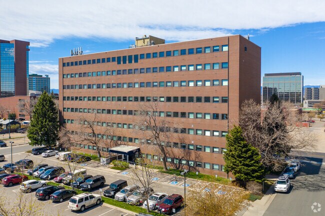
Property Record
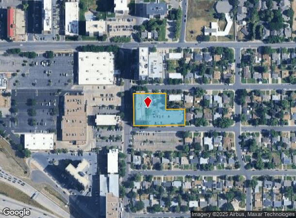
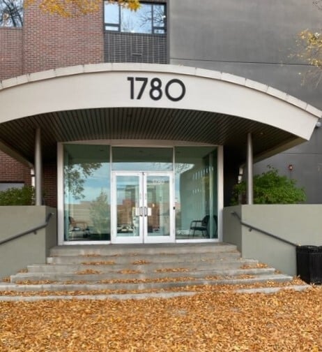
1780 S Bellaire St, Denver, CO 80222

Current Lease Availabilities
NEARBY LISTINGS FOR SALE OR LEASE
Property Detail
1780 S Bellaire St
Denver-Aurora-Lakewood, CO
Sunset Terrace
6193-17-028
SUNSET TERRACE B3 L5 TO 8 & L21 TO 26 EXC W 36.69FT OF L5 & EXC W 36.69FT OF L26
Officebuilding
Denver
X
Colorado
0800460216H
5
2024
1.21 AC
2024
Glendale
005104
Denver
87,675 SF
DEMOGRAPHICS near 1780 S Bellaire St
1 Mile
3 Mile
5 Mile
2024 Total Population
20,378
181,129
484,642
2029 Population
20,541
183,673
490,510
Pop Growth 2024-2029
+ 0.80%
+ 1.40%
+ 1.21%
Average Age
39
40
39
2024 Total Households
9,732
85,024
229,694
HH Growth 2024-2029
+ 0.65%
+ 1.37%
+ 1.22%
Median Household Inc
$75,635
$89,680
$77,583
Avg Household Size
2.00
2.10
2.00
2024 Avg HH Vehicles
2.00
2.00
2.00
Median Home Value
$664,753
$748,518
$624,504
Median Year Built
1966
1974
1973
Nearby Places
- Restaurants
- Banks
- Shops
- Fitness
- Groceries
PUBLIC TRANSPORTATION
TRANSIT/SUBWAY
Colorado (E Line - Denver Regional Transportation District Light Rail (TheRide), F Line - Denver Regional Transportation District Light Rail (TheRide), H Line - Denver Regional Transportation District Light Rail (TheRide))
DRIVE
WALK
Distance
Colorado (E Line - Denver Regional Transportation District Light Rail (TheRide), F Line - Denver Regional Transportation District Light Rail (TheRide), H Line - Denver Regional Transportation District Light Rail (TheRide))
3 min
13 min
0.7 mi
COMMUTER RAIL
Union Station: Lodo-Coors Field-16Th Street Mall (C Line - Denver Regional Transportation District Light Rail (TheRide), E Line - Denver Regional Transportation District Light Rail (TheRide), W Line - Denver Regional Transportation District Light Rail (TheRide))
DRIVE
WALK
Distance
Union Station: Lodo-Coors Field-16Th Street Mall (C Line - Denver Regional Transportation District Light Rail (TheRide), E Line - Denver Regional Transportation District Light Rail (TheRide), W Line - Denver Regional Transportation District Light Rail (TheRide))
13 min
7.9 mi
Denver (California Zephyr - Amtrak)
DRIVE
WALK
Distance
Denver (California Zephyr - Amtrak)
13 min
8.1 mi
AIRPORT
Denver International
DRIVE
WALK
Distance
Denver International
37 min
30.0 mi
Freight Ports
Tulsa Port Of Catoosa
DRIVE
WALK
Distance
Tulsa Port Of Catoosa
734 min
712.7 mi
Nearby Properties
Address
Land Use
TOTAL SIZE
Lot Size
Zoning
Address
Land Use
TOTAL SIZE
Lot Size
Zoning
856,519 SF
10.04 AC
B-3
Address
Land Use
TOTAL SIZE
Lot Size
Zoning
1,137,044 SF
35.49 AC
CMP-EI
Address
Land Use
TOTAL SIZE
Lot Size
Zoning
441,643 SF
9.79 AC
H-1-B
Address
Land Use
TOTAL SIZE
Lot Size
Zoning
252,992 SF
11.76 AC
B-3
Address
Land Use
TOTAL SIZE
Lot Size
Zoning
550,760 SF
13.25 AC
CMP-EI
Address
Land Use
TOTAL SIZE
Lot Size
Zoning
197,212 SF
0.56 AC
C-CCN-5
Address
Land Use
TOTAL SIZE
Lot Size
Zoning
543,122 SF
13.43 AC
CMP-EI
Address
Land Use
TOTAL SIZE
Lot Size
Zoning
152,415 SF
1.09 AC
C-CCN
Address
Land Use
TOTAL SIZE
Lot Size
Zoning
453,280 SF
5.45 AC
B-4
Address
Land Use
TOTAL SIZE
Lot Size
Zoning
416,096 SF
5.20 AC
C-MX-20
Address
Land Use
TOTAL SIZE
Lot Size
Zoning
240,545 SF
2.35 AC
C-MX-20
Address
Land Use
TOTAL SIZE
Lot Size
Zoning
505,731 SF
2.46 AC
G-MU-20
Address
Land Use
TOTAL SIZE
Lot Size
Zoning
281,456 SF
36.55 AC
R-5
Address
Land Use
TOTAL SIZE
Lot Size
Zoning
97,530 SF
0.43 AC
C-CCN-7
Address
Land Use
TOTAL SIZE
Lot Size
Zoning
185,689 SF
2.50 AC
C-CCN-8
Address
Land Use
TOTAL SIZE
Lot Size
Zoning
83,591 SF
0.42 AC
C-CCN-7
Address
Land Use
TOTAL SIZE
Lot Size
Zoning
174,244 SF
17.26 AC
E-SU-DX
Address
Land Use
TOTAL SIZE
Lot Size
Zoning
362,988 SF
4.71 AC
T-MU-30
Address
Land Use
TOTAL SIZE
Lot Size
Zoning
169,311 SF
0.47 AC
C-CCN-8
Address
Land Use
TOTAL SIZE
Lot Size
Zoning
178,107 SF
2.28 AC
C-CCN-8
Address
Land Use
TOTAL SIZE
Lot Size
Zoning
191,192 SF
10.16 AC
E-SU-D
Address
Land Use
TOTAL SIZE
Lot Size
Zoning
1,054,198 SF
6.62 AC
PUD
Address
Land Use
TOTAL SIZE
Lot Size
Zoning
379,927 SF
8.06 AC
PUD
Address
Land Use
TOTAL SIZE
Lot Size
Zoning
157,800 SF
2.12 AC
C-CCN-8
Address
Land Use
TOTAL SIZE
Lot Size
Zoning
160,631 SF
2.76 AC
C-CCN-8
Address
Land Use
TOTAL SIZE
Lot Size
Zoning
320,589 SF
33.33 AC
S-SU-F
Address
Land Use
TOTAL SIZE
Lot Size
Zoning
134,297 SF
1.54 AC
C-MX-5
Address
Land Use
TOTAL SIZE
Lot Size
Zoning
167,621 SF
6.59 AC
E-SU-D
Address
Land Use
TOTAL SIZE
Lot Size
Zoning
124,658 SF
2.13 AC
CMP-EI
Address
Land Use
TOTAL SIZE
Lot Size
Zoning
77,811 SF
0.28 AC
C-CCN-8
The World's #1 Commercial Real Estate Marketplace
Connect with us
© 2025 CoStar Group
The information above has been obtained from sources believed reliable. While we do not doubt its accuracy we have not verified it and make no guarantee, warranty or representation about it. It is your responsibility to independently confirm its accuracy and completeness. Any projections, opinions, assumptions, or estimates used are for example only and do not represent the current or future performance of the property. The value of this transaction to you depends on tax and other factors which should be evaluated by your tax, financial, and legal advisors. You and your advisors should conduct a careful, independent investigation of the property to determine to your satisfaction the suitability of the property for your needs.