Property Record
1780 W 49Th St, Hialeah, FL 33012
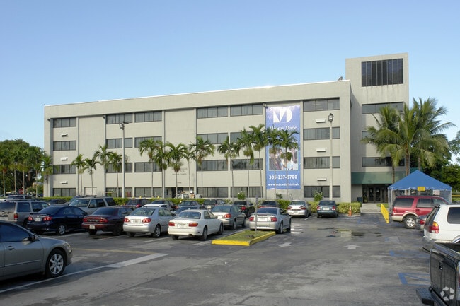
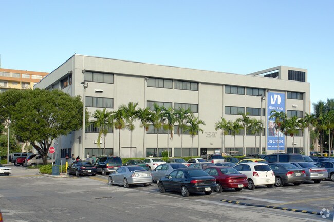
Property Detail
1780 W 49Th St
04-3002-069-0010
WESTLAND EXECUTIVE TRACT PB 115-51 TR A LOT SIZE 75010 SQ FT OR 18562-4193 0399 5
Governmentalpublicusegeneral
Miami-Dade
6600
Florida
AH Areas with a 1% annual chance of shallow flooding, usually in the form of a pond, withan average depth ranging from 1 to 3 feet. These areas have a 26% chance of flooding over the life of a 30-year mortgage.
1.72 AC
0
Hialeah
2025
South Florida
000705
Miami-Miami Beach-Kendall, FL
478,031 SF
NEARBY LISTINGS FOR SALE OR LEASE
-
-
View all Hialeah listings for sale on LoopNet.com
DEMOGRAPHICS near 1780 W 49Th St
1 mile
3 mile
5 mile
2025 Total Population
43,408
199,424
434,738
2030 Population
46,286
211,781
463,816
Pop Growth 2025-2030
+ 6.63%
+ 6.20%
+ 6.69%
Average Age
45
44
42
2025 Total Households
16,041
66,106
144,427
HH Growth 2025-2030
+ 6.63%
+ 6.14%
+ 6.63%
Median Household Inc
$43,309
$56,874
$68,877
Avg Household Size
2.70
2.90
2.90
2025 Avg HH Vehicles
1.00
2.00
2.00
Median Home Value
$280,645
$402,869
$451,851
Median Year Built
1977
1977
1982
Nearby Places
Map Layers
Map Styles
 Street
 Aerial
Layers
 Traffic
 Biking
Places
Listings with unknown addresses are not visible on the map
- Restaurants
- Banks
- Shops
- Fitness
- Groceries
PUBLIC TRANSPORTATION
COMMUTER RAIL
Okeechobee (Metrorail Green Line - Miami-Dade Transit (Metrorail/Metromover))
Drive
Walk
Distance
Okeechobee (Metrorail Green Line - Miami-Dade Transit (Metrorail/Metromover))
7 min
2.6 mi
Palmetto (Metrorail Green Line - Miami-Dade Transit (Metrorail/Metromover))
Drive
Walk
Distance
Palmetto (Metrorail Green Line - Miami-Dade Transit (Metrorail/Metromover))
7 min
2.7 mi
AIRPORT
Miami International
Drive
Walk
Distance
Miami International
16 min
6.8 mi
Fort Lauderdale/Hollywood International
Drive
Walk
Distance
Fort Lauderdale/Hollywood International
36 min
24.1 mi
Freight Ports
Port of Miami
Drive
Walk
Distance
Port of Miami
27 min
13.7 mi
Nearby Properties
Address
Land Use
TOTAL SIZE
Lot Size
Zoning
Address
Land Use
TOTAL SIZE
Lot Size
Zoning
614,708 SF
22.54 AC
4400
Address
Land Use
TOTAL SIZE
Lot Size
Zoning
636,721 SF
52.61 AC
2800
Address
Land Use
TOTAL SIZE
Lot Size
Zoning
777,714 SF
7.59 AC
9450
Address
Land Use
TOTAL SIZE
Lot Size
Zoning
7.62 AC
7200
Address
Land Use
TOTAL SIZE
Lot Size
Zoning
439,520 SF
20.20 AC
9400
Address
Land Use
TOTAL SIZE
Lot Size
Zoning
725,624 SF
34.80 AC
7300
Address
Land Use
TOTAL SIZE
Lot Size
Zoning
301,593 SF
16 AC
7100
Address
Land Use
TOTAL SIZE
Lot Size
Zoning
538,715 SF
24.72 AC
7100
Address
Land Use
TOTAL SIZE
Lot Size
Zoning
322,084 SF
6.60 AC
7100
Address
Land Use
TOTAL SIZE
Lot Size
Zoning
344,465 SF
5.03 AC
6400
Address
Land Use
TOTAL SIZE
Lot Size
Zoning
648,867 SF
33.08 AC
7100
Address
Land Use
TOTAL SIZE
Lot Size
Zoning
382,421 SF
19.66 AC
3700
Address
Land Use
TOTAL SIZE
Lot Size
Zoning
225,137 SF
80.89 AC
7600
Address
Land Use
TOTAL SIZE
Lot Size
Zoning
419,656 SF
8.61 AC
6400
Address
Land Use
TOTAL SIZE
Lot Size
Zoning
445,429 SF
4.45 AC
6400
Address
Land Use
TOTAL SIZE
Lot Size
Zoning
177,893 SF
15.02 AC
7100
Address
Land Use
TOTAL SIZE
Lot Size
Zoning
313,129 SF
16.06 AC
7100
Address
Land Use
TOTAL SIZE
Lot Size
Zoning
252,698 SF
13.22 AC
7100
Address
Land Use
TOTAL SIZE
Lot Size
Zoning
293,962 SF
9.99 AC
4400
Address
Land Use
TOTAL SIZE
Lot Size
Zoning
249,486 SF
11.84 AC
7100
Address
Land Use
TOTAL SIZE
Lot Size
Zoning
196,118 SF
11.06 AC
7100
Address
Land Use
TOTAL SIZE
Lot Size
Zoning
221,731 SF
11.17 AC
7100
Address
Land Use
TOTAL SIZE
Lot Size
Zoning
260,794 SF
12.50 AC
7100
Address
Land Use
TOTAL SIZE
Lot Size
Zoning
314,441 SF
16.99 AC
7600
Address
Land Use
TOTAL SIZE
Lot Size
Zoning
330,082 SF
7.02 AC
8000
Address
Land Use
TOTAL SIZE
Lot Size
Zoning
268,232 SF
14.33 AC
7100
Address
Land Use
TOTAL SIZE
Lot Size
Zoning
335,221 SF
21.51 AC
6400
Address
Land Use
TOTAL SIZE
Lot Size
Zoning
223,723 SF
35.59 AC
0100
Address
Land Use
TOTAL SIZE
Lot Size
Zoning
325,380 SF
24.86 AC
7100
The World's #1 Commercial Real Estate Marketplace
Connect with us
© 2026 CoStar Group
The information above has been obtained from sources believed reliable. While we do not doubt its accuracy we have not verified it and make no guarantee, warranty or representation about it. It is your responsibility to independently confirm its accuracy and completeness. Any projections, opinions, assumptions, or estimates used are for example only and do not represent the current or future performance of the property. The value of this transaction to you depends on tax and other factors which should be evaluated by your tax, financial, and legal advisors. You and your advisors should conduct a careful, independent investigation of the property to determine to your satisfaction the suitability of the property for your needs.