Property Record
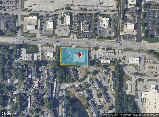
17801 E 39Th St S, Independence, MO 64055
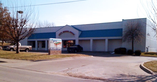
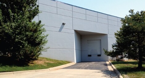
Property Detail
17801 E 39Th St S
34-340-01-06-03-0-00-000
RNG-31 TWP-49 SEC-19 PT OF E 20.5 AC OF NE 1/4 OF SE 1/4 DAF : BEG NE COR SD 1/4 1/4 TH S 50 TH N 89 DEG W ALG 39TH ST 3 47 TO TRU POB: TH CONT N 89 DEG W 337.11 TH S 200 TH S 89
Storebuilding
Jackson
X
Missouri
29095C0311G
1.54 AC
2024
East Jackson County
2025
Kansas City
014604
Kansas City, MO-KS
13,161 SF
NEARBY LISTINGS FOR SALE OR LEASE
DEMOGRAPHICS near 17801 E 39Th St S
1 mile
3 mile
5 mile
2024 Total Population
5,721
51,167
139,194
2029 Population
5,647
50,475
137,756
Pop Growth 2024-2029
(1.29%)
(1.35%)
(1.03%)
Average Age
43
43
41
2024 Total Households
2,527
22,032
56,848
HH Growth 2024-2029
(1.27%)
(1.47%)
(1.16%)
Median Household Inc
$69,442
$66,929
$65,641
Avg Household Size
2.20
2.20
2.40
2024 Avg HH Vehicles
2.00
2.00
2.00
Median Home Value
$188,315
$192,584
$185,368
Median Year Built
1987
1979
1973
Nearby Places
Map Layers
Map Styles
 Street
 Aerial
Transit
 Traffic
 Biking
Places
Listings with unknown addresses are not visible on the map
- Restaurants
- Banks
- Shops
- Fitness
- Groceries
PUBLIC TRANSPORTATION
COMMUTER RAIL
Drive
Walk
Distance
12 min
6.1 mi
AIRPORT
Kansas City International
Drive
Walk
Distance
Kansas City International
45 min
33.2 mi
Nearby Properties
Address
Land Use
TOTAL SIZE
Lot Size
Zoning
Address
Land Use
TOTAL SIZE
Lot Size
Zoning
398,212 SF
73.80 AC
Address
Land Use
TOTAL SIZE
Lot Size
Zoning
519,315 SF
28.47 AC
Address
Land Use
TOTAL SIZE
Lot Size
Zoning
158,369 SF
47.47 AC
Address
Land Use
TOTAL SIZE
Lot Size
Zoning
100,724 SF
1.65 AC
Address
Land Use
TOTAL SIZE
Lot Size
Zoning
250,196 SF
39.50 AC
Address
Land Use
TOTAL SIZE
Lot Size
Zoning
455,100 SF
42.02 AC
Address
Land Use
TOTAL SIZE
Lot Size
Zoning
385,487 SF
5.61 AC
Address
Land Use
TOTAL SIZE
Lot Size
Zoning
338,731 SF
29.59 AC
Address
Land Use
TOTAL SIZE
Lot Size
Zoning
171,513 SF
18.37 AC
Address
Land Use
TOTAL SIZE
Lot Size
Zoning
64,318 SF
32.40 AC
Address
Land Use
TOTAL SIZE
Lot Size
Zoning
96,348 SF
14.42 AC
Address
Land Use
TOTAL SIZE
Lot Size
Zoning
94,411 SF
4.99 AC
Address
Land Use
TOTAL SIZE
Lot Size
Zoning
39,638 SF
Address
Land Use
TOTAL SIZE
Lot Size
Zoning
179,962 SF
16.02 AC
Address
Land Use
TOTAL SIZE
Lot Size
Zoning
31,674 SF
11.45 AC
Address
Land Use
TOTAL SIZE
Lot Size
Zoning
287,132 SF
Address
Land Use
TOTAL SIZE
Lot Size
Zoning
193,191 SF
4.14 AC
Address
Land Use
TOTAL SIZE
Lot Size
Zoning
286,547 SF
Address
Land Use
TOTAL SIZE
Lot Size
Zoning
61,901 SF
15.11 AC
Address
Land Use
TOTAL SIZE
Lot Size
Zoning
36,396 SF
8.64 AC
Address
Land Use
TOTAL SIZE
Lot Size
Zoning
75,028 SF
16.11 AC
Address
Land Use
TOTAL SIZE
Lot Size
Zoning
129,570 SF
18.40 AC
Address
Land Use
TOTAL SIZE
Lot Size
Zoning
67,820 SF
11.94 AC
Address
Land Use
TOTAL SIZE
Lot Size
Zoning
20.97 AC
Address
Land Use
TOTAL SIZE
Lot Size
Zoning
178,652 SF
15.07 AC
Address
Land Use
TOTAL SIZE
Lot Size
Zoning
113,696 SF
28.25 AC
Address
Land Use
TOTAL SIZE
Lot Size
Zoning
68,921 SF
18.04 AC
Address
Land Use
TOTAL SIZE
Lot Size
Zoning
148,044 SF
17.85 AC
Address
Land Use
TOTAL SIZE
Lot Size
Zoning
157,429 SF
36.60 AC
Address
Land Use
TOTAL SIZE
Lot Size
Zoning
163,031 SF
17.33 AC
The World's #1 Commercial Real Estate Marketplace
Connect with us
© 2026 CoStar Group
The information above has been obtained from sources believed reliable. While we do not doubt its accuracy we have not verified it and make no guarantee, warranty or representation about it. It is your responsibility to independently confirm its accuracy and completeness. Any projections, opinions, assumptions, or estimates used are for example only and do not represent the current or future performance of the property. The value of this transaction to you depends on tax and other factors which should be evaluated by your tax, financial, and legal advisors. You and your advisors should conduct a careful, independent investigation of the property to determine to your satisfaction the suitability of the property for your needs.