Property Record
17810 S Main St, Carson, CA 90745
NEARBY LISTINGS FOR SALE OR LEASE
Property Detail
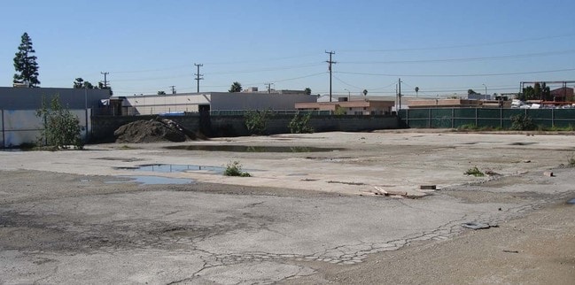
17810 S Main St
Los Angeles-Long Beach-Glendale, CA
South Gardena Tract
7339-002-013
SOUTH GARDENA TRACT N 130.75 FT OF S 261.50 FT OF W 118 FT OF E 656 FT OF LOT 8
Warehouse
Los Angeles
X
California
06037C1935F
8
2024
0.35 AC
2025
Mid-Cities
543804
Los Angeles
15,429 SF
DEMOGRAPHICS near 17810 S Main St
1 Mile
3 Mile
5 Mile
2024 Total Population
11,063
172,854
624,923
2029 Population
10,590
167,297
603,247
Pop Growth 2024-2029
(4.28%)
(3.21%)
(3.47%)
Average Age
42
41
39
2024 Total Households
3,211
53,637
188,825
HH Growth 2024-2029
(4.76%)
(3.46%)
(3.66%)
Median Household Inc
$72,296
$77,288
$72,555
Avg Household Size
3.10
3.00
3.20
2024 Avg HH Vehicles
2.00
2.00
2.00
Median Home Value
$670,165
$665,152
$657,183
Median Year Built
1966
1963
1962
Nearby Places
Map Layers
Map Styles
 Street
 Aerial
- Restaurants
- Banks
- Shops
- Fitness
- Groceries
PUBLIC TRANSPORTATION
AIRPORT
Long Beach (Daugherty Field)
DRIVE
WALK
Distance
Long Beach (Daugherty Field)
14 min
9.5 mi
Los Angeles International
DRIVE
WALK
Distance
Los Angeles International
19 min
12.8 mi
Bob Hope
DRIVE
WALK
Distance
Bob Hope
40 min
30.8 mi
Freight Ports
Port of Long Beach
DRIVE
WALK
Distance
Port of Long Beach
17 min
11.3 mi
Nearby Properties
Address
Land Use
TOTAL SIZE
Lot Size
Zoning
Address
Land Use
TOTAL SIZE
Lot Size
Zoning
64,456 SF
11.71 AC
CASP-10*
Address
Land Use
TOTAL SIZE
Lot Size
Zoning
10,152 SF
140.14 AC
TOMI-HVY
Address
Land Use
TOTAL SIZE
Lot Size
Zoning
422,640 SF
LAM3
Address
Land Use
TOTAL SIZE
Lot Size
Zoning
248,531 SF
13.30 AC
LCM11/2-B1
Address
Land Use
TOTAL SIZE
Lot Size
Zoning
291,731 SF
16.84 AC
CAML*
Address
Land Use
TOTAL SIZE
Lot Size
Zoning
604,106 SF
42.72 AC
TOMI-HVY
Address
Land Use
TOTAL SIZE
Lot Size
Zoning
506,189 SF
20.33 AC
LAM2
Address
Land Use
TOTAL SIZE
Lot Size
Zoning
3,585,714 SF
67.35 AC
LAM3
Address
Land Use
TOTAL SIZE
Lot Size
Zoning
409,522 SF
11.41 AC
LAM3
Address
Land Use
TOTAL SIZE
Lot Size
Zoning
184,300 SF
8.14 AC
LAM3
Address
Land Use
TOTAL SIZE
Lot Size
Zoning
214,782 SF
3.66 AC
GAR3
Address
Land Use
TOTAL SIZE
Lot Size
Zoning
260,766 SF
10.70 AC
LAM3
Address
Land Use
TOTAL SIZE
Lot Size
Zoning
282,280 SF
Address
Land Use
TOTAL SIZE
Lot Size
Zoning
670,305 SF
28.08 AC
TOMI-BP
Address
Land Use
TOTAL SIZE
Lot Size
Zoning
169,400 SF
8.11 AC
COMH*
Address
Land Use
TOTAL SIZE
Lot Size
Zoning
402,197 SF
27.29 AC
COMH*
Address
Land Use
TOTAL SIZE
Lot Size
Zoning
198,502 SF
LCM2 *
Address
Land Use
TOTAL SIZE
Lot Size
Zoning
515,047 SF
4.87 AC
COMH*
Address
Land Use
TOTAL SIZE
Lot Size
Zoning
1.27 AC
CACR&D*
Address
Land Use
TOTAL SIZE
Lot Size
Zoning
430,706 SF
18.95 AC
CASP-4*
Address
Land Use
TOTAL SIZE
Lot Size
Zoning
514,397 SF
24.34 AC
COMH-B*
Address
Land Use
TOTAL SIZE
Lot Size
Zoning
472,062 SF
24.39 AC
COMH-B*
Address
Land Use
TOTAL SIZE
Lot Size
Zoning
125,849 SF
6.08 AC
LAM2
Address
Land Use
TOTAL SIZE
Lot Size
Zoning
24,060 SF
LAM2
Address
Land Use
TOTAL SIZE
Lot Size
Zoning
178,323 SF
12.23 AC
CACR&D&MUR
Address
Land Use
TOTAL SIZE
Lot Size
Zoning
546,606 SF
17.58 AC
LAM3
Address
Land Use
TOTAL SIZE
Lot Size
Zoning
1,005,037 SF
23.98 AC
TOMI-LT
Address
Land Use
TOTAL SIZE
Lot Size
Zoning
155,099 SF
7.74 AC
TOMI-HVY
Address
Land Use
TOTAL SIZE
Lot Size
Zoning
230,694 SF
9.02 AC
COMH-B*
Address
Land Use
TOTAL SIZE
Lot Size
Zoning
499,562 SF
6.50 AC
LAM3
The World's #1 Commercial Real Estate Marketplace
Connect with us
© 2025 CoStar Group
The information above has been obtained from sources believed reliable. While we do not doubt its accuracy we have not verified it and make no guarantee, warranty or representation about it. It is your responsibility to independently confirm its accuracy and completeness. Any projections, opinions, assumptions, or estimates used are for example only and do not represent the current or future performance of the property. The value of this transaction to you depends on tax and other factors which should be evaluated by your tax, financial, and legal advisors. You and your advisors should conduct a careful, independent investigation of the property to determine to your satisfaction the suitability of the property for your needs.