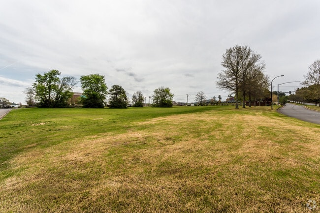
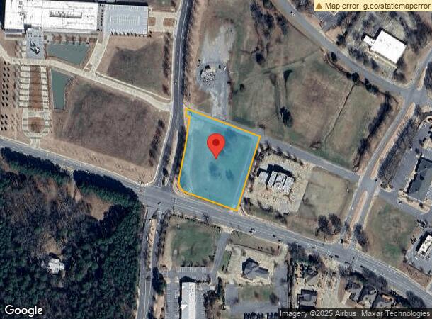
Property Record
17816 Ne Cantrell Rd, Little Rock, AR 72223

NEARBY LISTINGS FOR SALE OR LEASE
Property Detail
17816 Ne Cantrell Rd
Little Rock-North Little Rock-Conway, AR
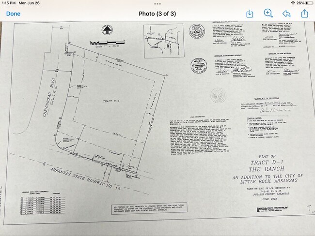
The Ranch Addn
53L-013-03-001-02
Pulaski
Commercialnec
Arkansas
X
d1
05119C0312G
2.51 AC
2025
West
2025
Little Rock/N Little Rock
004205
DEMOGRAPHICS near 17816 Ne Cantrell Rd
1 Mile
3 Mile
5 Mile
2024 Total Population
4,110
22,644
61,663
2029 Population
4,051
22,657
61,382
Pop Growth 2024-2029
(1.44%)
+ 0.06%
(0.46%)
Average Age
42
42
41
2024 Total Households
1,818
9,099
26,327
HH Growth 2024-2029
(1.49%)
+ 0.01%
(0.49%)
Median Household Inc
$126,741
$131,504
$91,529
Avg Household Size
2.20
2.40
2.30
2024 Avg HH Vehicles
2.00
2.00
2.00
Median Home Value
$365,526
$375,826
$318,457
Median Year Built
2003
2001
1995
Nearby Places
Map Layers
Map Styles
 Street
 Aerial
- Restaurants
- Banks
- Shops
- Fitness
- Groceries
PUBLIC TRANSPORTATION
AIRPORT
Bill and Hillary Clinton Ntl/Adams Field
DRIVE
WALK
Distance
Bill and Hillary Clinton Ntl/Adams Field
29 min
18.8 mi
Freight Ports
Port of Shreveport
DRIVE
WALK
Distance
Port of Shreveport
255 min
236.2 mi
SALE & LEASE HISTORY
LISTING DATE
SALE/LEASE

May 13, 2021
For Sale
Jul 16, 2018
For Lease
Apr 20, 2017
For Sale
Apr 18, 2023
For Sale
Nearby Properties
Address
Land Use
TOTAL SIZE
Lot Size
Zoning
Address
Land Use
TOTAL SIZE
Lot Size
Zoning
361,360 SF
20.01 AC
Address
Land Use
TOTAL SIZE
Lot Size
Zoning
286,440 SF
10.79 AC
Address
Land Use
TOTAL SIZE
Lot Size
Zoning
126,536 SF
25.98 AC
Address
Land Use
TOTAL SIZE
Lot Size
Zoning
267,343 SF
52.19 AC
Address
Land Use
TOTAL SIZE
Lot Size
Zoning
54,594 SF
16.79 AC
Address
Land Use
TOTAL SIZE
Lot Size
Zoning
82,176 SF
14.83 AC
Address
Land Use
TOTAL SIZE
Lot Size
Zoning
43,928 SF
26.72 AC
Address
Land Use
TOTAL SIZE
Lot Size
Zoning
102,600 SF
17.29 AC
Address
Land Use
TOTAL SIZE
Lot Size
Zoning
125,107 SF
22.09 AC
Address
Land Use
TOTAL SIZE
Lot Size
Zoning
168,221 SF
12.02 AC
Address
Land Use
TOTAL SIZE
Lot Size
Zoning
32,562 SF
13.40 AC
Address
Land Use
TOTAL SIZE
Lot Size
Zoning
58,828 SF
15.22 AC
Address
Land Use
TOTAL SIZE
Lot Size
Zoning
115,062 SF
10.04 AC
Address
Land Use
TOTAL SIZE
Lot Size
Zoning
86,186 SF
13.24 AC
Address
Land Use
TOTAL SIZE
Lot Size
Zoning
160,068 SF
18.91 AC
Address
Land Use
TOTAL SIZE
Lot Size
Zoning
114,269 SF
12.85 AC
Address
Land Use
TOTAL SIZE
Lot Size
Zoning
217,088 SF
26.89 AC
Address
Land Use
TOTAL SIZE
Lot Size
Zoning
40,803 SF
18.48 AC
Address
Land Use
TOTAL SIZE
Lot Size
Zoning
30,040 SF
10.80 AC
Address
Land Use
TOTAL SIZE
Lot Size
Zoning
93,175 SF
4.74 AC
Address
Land Use
TOTAL SIZE
Lot Size
Zoning
102,990 SF
10.43 AC
Address
Land Use
TOTAL SIZE
Lot Size
Zoning
42,686 SF
22.11 AC
Address
Land Use
TOTAL SIZE
Lot Size
Zoning
103,169 SF
8.32 AC
Address
Land Use
TOTAL SIZE
Lot Size
Zoning
85,980 SF
32.29 AC
Address
Land Use
TOTAL SIZE
Lot Size
Zoning
206,671 SF
26.16 AC
Address
Land Use
TOTAL SIZE
Lot Size
Zoning
91,822 SF
14 AC
Address
Land Use
TOTAL SIZE
Lot Size
Zoning
173,120 SF
67.23 AC
Address
Land Use
TOTAL SIZE
Lot Size
Zoning
99,581 SF
8.11 AC
Address
Land Use
TOTAL SIZE
Lot Size
Zoning
119,868 SF
12.91 AC
Address
Land Use
TOTAL SIZE
Lot Size
Zoning
3,470 SF
3.69 AC
The World's #1 Commercial Real Estate Marketplace
Connect with us
© 2026 CoStar Group
The information above has been obtained from sources believed reliable. While we do not doubt its accuracy we have not verified it and make no guarantee, warranty or representation about it. It is your responsibility to independently confirm its accuracy and completeness. Any projections, opinions, assumptions, or estimates used are for example only and do not represent the current or future performance of the property. The value of this transaction to you depends on tax and other factors which should be evaluated by your tax, financial, and legal advisors. You and your advisors should conduct a careful, independent investigation of the property to determine to your satisfaction the suitability of the property for your needs.