Property Record
17825 Libby Rd, Maple Heights, OH 44137
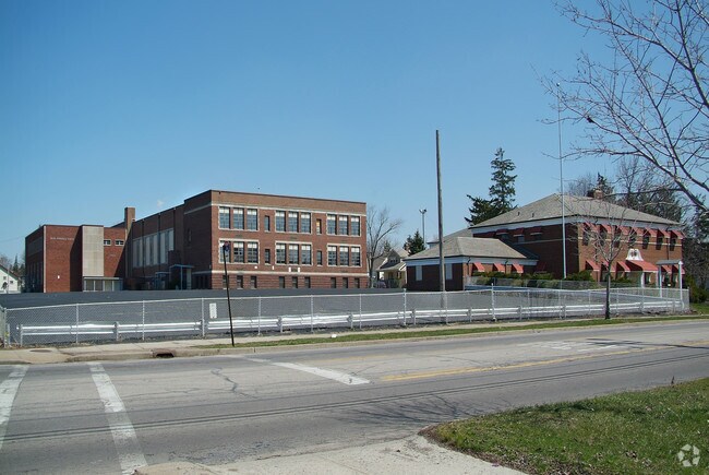


Property Detail
17825 Libby Rd
782-03-027
4 LLIBGAR#1 &S/L122 ALL 0121 ALL 78203028
Charitableorganization
Cuyahoga
RTF
Ohio
B and X Area of moderate flood hazard, usually the area between the limits of the 100-year and 500-year floods.
121
0
0.52 AC
2025
South
171103
Cleveland
10,446 SF
Cleveland-Elyria, OH
NEARBY LISTINGS FOR SALE OR LEASE
DEMOGRAPHICS near 17825 Libby Rd
1 mile
3 mile
5 mile
2025 Total Population
13,978
99,942
196,462
2030 Population
13,942
99,377
194,772
Pop Growth 2025-2030
(0.26%)
(0.57%)
(0.86%)
Average Age
40
42
42
2025 Total Households
5,691
43,944
85,429
HH Growth 2025-2030
(0.39%)
(0.67%)
(0.99%)
Median Household Inc
$54,689
$52,531
$55,229
Avg Household Size
2.40
2.20
2.20
2025 Avg HH Vehicles
1.00
1.00
1.00
Median Home Value
$76,344
$106,526
$134,529
Median Year Built
1952
1955
1953
Nearby Places
Map Layers
Map Styles
 Street
 Aerial
Layers
 Traffic
 Biking
Places
Listings with unknown addresses are not visible on the map
- Restaurants
- Banks
- Shops
- Fitness
- Groceries
PUBLIC TRANSPORTATION
COMMUTER RAIL
Canal Exploration Center (National Park Scenic Railway - Cuyahoga Valley Scenic Railroad)
Drive
Walk
Distance
Canal Exploration Center (National Park Scenic Railway - Cuyahoga Valley Scenic Railroad)
13 min
5.8 mi
Rockside (National Park Scenic Railway - Cuyahoga Valley Scenic Railroad)
Drive
Walk
Distance
Rockside (National Park Scenic Railway - Cuyahoga Valley Scenic Railroad)
11 min
5.9 mi
AIRPORT
Cleveland-Hopkins International
Drive
Walk
Distance
Cleveland-Hopkins International
27 min
16.9 mi
Freight Ports
Port of Toledo
Drive
Walk
Distance
Port of Toledo
141 min
117.8 mi
Nearby Properties
Address
Land Use
TOTAL SIZE
Lot Size
Zoning
Address
Land Use
TOTAL SIZE
Lot Size
Zoning
682,144 SF
99.58 AC
C-2
Address
Land Use
TOTAL SIZE
Lot Size
Zoning
32,400 SF
52.29 AC
U-4
Address
Land Use
TOTAL SIZE
Lot Size
Zoning
68.97 AC
C-1
Address
Land Use
TOTAL SIZE
Lot Size
Zoning
233,767 SF
36.30 AC
U-1A1
Address
Land Use
TOTAL SIZE
Lot Size
Zoning
186,275 SF
17.80 AC
U-8
Address
Land Use
TOTAL SIZE
Lot Size
Zoning
333,582 SF
3.67 AC
U-1A1
Address
Land Use
TOTAL SIZE
Lot Size
Zoning
129,112 SF
24.11 AC
U-8
Address
Land Use
TOTAL SIZE
Lot Size
Zoning
289,009 SF
25.27 AC
I/O
Address
Land Use
TOTAL SIZE
Lot Size
Zoning
227,141 SF
23.76 AC
U-4
Address
Land Use
TOTAL SIZE
Lot Size
Zoning
143,512 SF
16 AC
Address
Land Use
TOTAL SIZE
Lot Size
Zoning
11,808 SF
900.50 AC
1F-2
Address
Land Use
TOTAL SIZE
Lot Size
Zoning
235,921 SF
12.45 AC
SC
Address
Land Use
TOTAL SIZE
Lot Size
Zoning
18.38 AC
R2
Address
Land Use
TOTAL SIZE
Lot Size
Zoning
12.64 AC
U-4
Address
Land Use
TOTAL SIZE
Lot Size
Zoning
189,156 SF
24.49 AC
IG
Address
Land Use
TOTAL SIZE
Lot Size
Zoning
120,722 SF
20.55 AC
I/O
Address
Land Use
TOTAL SIZE
Lot Size
Zoning
838,521 SF
5.70 AC
I
Address
Land Use
TOTAL SIZE
Lot Size
Zoning
105,215 SF
5.42 AC
PF
Address
Land Use
TOTAL SIZE
Lot Size
Zoning
137,795 SF
37.09 AC
R-4
Address
Land Use
TOTAL SIZE
Lot Size
Zoning
155,896 SF
16.38 AC
Address
Land Use
TOTAL SIZE
Lot Size
Zoning
324,644 SF
15.13 AC
I
Address
Land Use
TOTAL SIZE
Lot Size
Zoning
347,218 SF
0.23 AC
O/I
Address
Land Use
TOTAL SIZE
Lot Size
Zoning
65,108 SF
24.93 AC
I/O
Address
Land Use
TOTAL SIZE
Lot Size
Zoning
69,033 SF
8.85 AC
R-3
Address
Land Use
TOTAL SIZE
Lot Size
Zoning
164,109 SF
8.89 AC
U-1A1
Address
Land Use
TOTAL SIZE
Lot Size
Zoning
191,322 SF
23.60 AC
1F
Address
Land Use
TOTAL SIZE
Lot Size
Zoning
8.60 AC
U-4
Address
Land Use
TOTAL SIZE
Lot Size
Zoning
15,154 SF
9.24 AC
SI
Address
Land Use
TOTAL SIZE
Lot Size
Zoning
350,592 SF
25.29 AC
O/I
Address
Land Use
TOTAL SIZE
Lot Size
Zoning
146,006 SF
8.38 AC
R-1
The World's #1 Commercial Real Estate Marketplace
Connect with us
© 2026 CoStar Group
The information above has been obtained from sources believed reliable. While we do not doubt its accuracy we have not verified it and make no guarantee, warranty or representation about it. It is your responsibility to independently confirm its accuracy and completeness. Any projections, opinions, assumptions, or estimates used are for example only and do not represent the current or future performance of the property. The value of this transaction to you depends on tax and other factors which should be evaluated by your tax, financial, and legal advisors. You and your advisors should conduct a careful, independent investigation of the property to determine to your satisfaction the suitability of the property for your needs.