Property Record
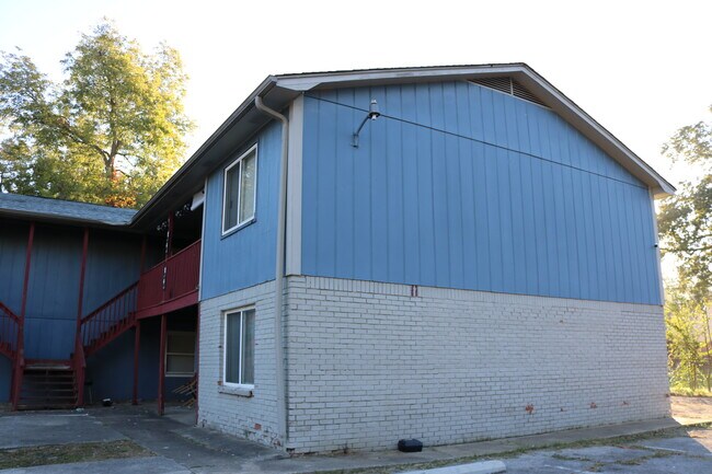
1785 Pearson Ave Sw, Birmingham, AL 35211


NEARBY LISTINGS FOR SALE OR LEASE
Property Detail
1785 Pearson Ave Sw
Birmingham-Hoover, AL
West End
29-00-09-3-015-005.000
LOT 1 BLK 74 WEST END
Apartment
Jefferson
X
Alabama
01073C0551G
1
2023
0.38 AC
2024
Oakwood Place
003803
Birmingham
7,700 SF
DEMOGRAPHICS near 1785 Pearson Ave Sw
1 Mile
3 Mile
5 Mile
2024 Total Population
11,827
77,291
167,116
2029 Population
12,175
78,673
168,561
Pop Growth 2024-2029
+ 2.94%
+ 1.79%
+ 0.86%
Average Age
43
41
39
2024 Total Households
5,112
33,990
72,168
HH Growth 2024-2029
+ 3.01%
+ 1.79%
+ 0.91%
Median Household Inc
$33,214
$34,145
$42,039
Avg Household Size
2.20
2.10
2.10
2024 Avg HH Vehicles
2.00
1.00
2.00
Median Home Value
$68,014
$78,907
$138,331
Median Year Built
1962
1961
1967
Nearby Places
Map Layers
Map Styles
 Street
 Aerial
- Restaurants
- Banks
- Shops
- Fitness
- Groceries
PUBLIC TRANSPORTATION
COMMUTER RAIL
DRIVE
WALK
Distance
9 min
4.1 mi
AIRPORT
Birmingham-Shuttlesworth International
DRIVE
WALK
Distance
Birmingham-Shuttlesworth International
18 min
9.2 mi
SALE & LEASE HISTORY
LISTING DATE
SALE/LEASE

Jan 14, 2025
For Sale
Nearby Properties
Address
Land Use
TOTAL SIZE
Lot Size
Zoning
Address
Land Use
TOTAL SIZE
Lot Size
Zoning
203,878 SF
12.58 AC
B6
Address
Land Use
TOTAL SIZE
Lot Size
Zoning
344,150 SF
42 AC
R5
Address
Land Use
TOTAL SIZE
Lot Size
Zoning
416,477 SF
80 AC
R5
Address
Land Use
TOTAL SIZE
Lot Size
Zoning
311,982 SF
30 AC
R6
Address
Land Use
TOTAL SIZE
Lot Size
Zoning
180,412 SF
14.89 AC
R6
Address
Land Use
TOTAL SIZE
Lot Size
Zoning
1.77 AC
QO&I
Address
Land Use
TOTAL SIZE
Lot Size
Zoning
267,289 SF
18.40 AC
L1
Address
Land Use
TOTAL SIZE
Lot Size
Zoning
136,184 SF
21 AC
B2-B
Address
Land Use
TOTAL SIZE
Lot Size
Zoning
229,230 SF
13.29 AC
R6
Address
Land Use
TOTAL SIZE
Lot Size
Zoning
146,358 SF
13.70 AC
R6
Address
Land Use
TOTAL SIZE
Lot Size
Zoning
127,240 SF
3.50 AC
R4
Address
Land Use
TOTAL SIZE
Lot Size
Zoning
200,650 SF
19.48 AC
R4
Address
Land Use
TOTAL SIZE
Lot Size
Zoning
198,732 SF
11.60 AC
L1
Address
Land Use
TOTAL SIZE
Lot Size
Zoning
336,653 SF
22.50 AC
CM1
Address
Land Use
TOTAL SIZE
Lot Size
Zoning
191,910 SF
13.88 AC
I3
Address
Land Use
TOTAL SIZE
Lot Size
Zoning
106,366 SF
8.70 AC
R3
Address
Land Use
TOTAL SIZE
Lot Size
Zoning
134,032 SF
4.13 AC
B5
Address
Land Use
TOTAL SIZE
Lot Size
Zoning
189,046 SF
14 AC
B1
Address
Land Use
TOTAL SIZE
Lot Size
Zoning
144,613 SF
11 AC
B5
Address
Land Use
TOTAL SIZE
Lot Size
Zoning
79,035 SF
8.43 AC
R5
Address
Land Use
TOTAL SIZE
Lot Size
Zoning
67,628 SF
5.46 AC
B5
Address
Land Use
TOTAL SIZE
Lot Size
Zoning
98,932 SF
11 AC
R5
Address
Land Use
TOTAL SIZE
Lot Size
Zoning
112,500 SF
8.30 AC
I-3
Address
Land Use
TOTAL SIZE
Lot Size
Zoning
68,046 SF
6 AC
B6
Address
Land Use
TOTAL SIZE
Lot Size
Zoning
83,583 SF
10.61 AC
R5
Address
Land Use
TOTAL SIZE
Lot Size
Zoning
64.50 AC
R5/C
Address
Land Use
TOTAL SIZE
Lot Size
Zoning
194,416 SF
13.20 AC
I3
Address
Land Use
TOTAL SIZE
Lot Size
Zoning
182,418 SF
8.30 AC
LI
Address
Land Use
TOTAL SIZE
Lot Size
Zoning
250,918 SF
10 AC
B-2
Address
Land Use
TOTAL SIZE
Lot Size
Zoning
65,299 SF
2 AC
B2
The World's #1 Commercial Real Estate Marketplace
Connect with us
© 2025 CoStar Group
The information above has been obtained from sources believed reliable. While we do not doubt its accuracy we have not verified it and make no guarantee, warranty or representation about it. It is your responsibility to independently confirm its accuracy and completeness. Any projections, opinions, assumptions, or estimates used are for example only and do not represent the current or future performance of the property. The value of this transaction to you depends on tax and other factors which should be evaluated by your tax, financial, and legal advisors. You and your advisors should conduct a careful, independent investigation of the property to determine to your satisfaction the suitability of the property for your needs.