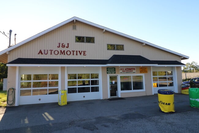
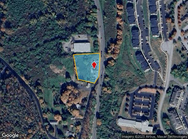
Property Record
1785 Route 22, Brewster, NY 10509

NEARBY LISTINGS FOR SALE OR LEASE
Property Detail
1785 Route 22
373089-046-000-0004-022-000-0000
Putnam
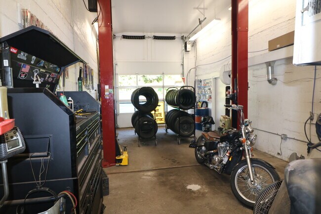
Vehiclerentalsvehiclesales
New York
X
22.00
36079C0154E
1.18 AC
2024
Brewster
2024
Westchester/So Connecticut
011802
Dutchess County-Putnam County, NY
2,240 SF
DEMOGRAPHICS near 1785 Route 22
1 Mile
3 Mile
5 Mile
2024 Total Population
2,058
14,895
49,897
2029 Population
2,066
14,947
49,982
Pop Growth 2024-2029
+ 0.39%
+ 0.35%
+ 0.17%
Average Age
47
43
43
2024 Total Households
753
5,376
18,337
HH Growth 2024-2029
+ 0.40%
+ 0.33%
+ 0.15%
Median Household Inc
$116,882
$107,987
$111,047
Avg Household Size
2.50
2.70
2.60
2024 Avg HH Vehicles
2.00
2.00
2.00
Median Home Value
$378,106
$373,030
$386,682
Median Year Built
1985
1973
1973
Nearby Places
- Restaurants
- Banks
- Shops
- Fitness
- Groceries
PUBLIC TRANSPORTATION
COMMUTER RAIL
Brewster Station (Harlem Line - Metro-North Commuter Railroad Company (Metro-North))
DRIVE
WALK
Distance
Brewster Station (Harlem Line - Metro-North Commuter Railroad Company (Metro-North))
8 min
5.0 mi
Southeast Station (Harlem Line - Metro-North Commuter Railroad Company (Metro-North))
DRIVE
WALK
Distance
Southeast Station (Harlem Line - Metro-North Commuter Railroad Company (Metro-North))
13 min
5.5 mi
AIRPORT
Westchester County
DRIVE
WALK
Distance
Westchester County
37 min
29.1 mi
New York Stewart International
DRIVE
WALK
Distance
New York Stewart International
52 min
36.7 mi
Freight Ports
Port of New Haven
DRIVE
WALK
Distance
Port of New Haven
72 min
48.8 mi
SALE & LEASE HISTORY
LISTING DATE
SALE/LEASE

Oct 05, 2021
For Sale
Nearby Properties
Address
Land Use
TOTAL SIZE
Lot Size
Zoning
Address
Land Use
TOTAL SIZE
Lot Size
Zoning
282,770 SF
50.83 AC
R160
Address
Land Use
TOTAL SIZE
Lot Size
Zoning
170,015 SF
70.32 AC
R160
Address
Land Use
TOTAL SIZE
Lot Size
Zoning
146,484 SF
23.06 AC
SR 22
Address
Land Use
TOTAL SIZE
Lot Size
Zoning
223,335 SF
27.56 AC
OP2
Address
Land Use
TOTAL SIZE
Lot Size
Zoning
116,000 SF
13.29 AC
SP Z
Address
Land Use
TOTAL SIZE
Lot Size
Zoning
Address
Land Use
TOTAL SIZE
Lot Size
Zoning
109,593 SF
16.65 AC
C1
Address
Land Use
TOTAL SIZE
Lot Size
Zoning
97,708 SF
11.42 AC
OP2
Address
Land Use
TOTAL SIZE
Lot Size
Zoning
48,811 SF
11.66 AC
OP2
Address
Land Use
TOTAL SIZE
Lot Size
Zoning
150,000 SF
10.40 AC
OP2
Address
Land Use
TOTAL SIZE
Lot Size
Zoning
118,990 SF
29.02 AC
MWFH
Address
Land Use
TOTAL SIZE
Lot Size
Zoning
3,060 SF
2.47 AC
R40
Address
Land Use
TOTAL SIZE
Lot Size
Zoning
131,719 SF
19.05 AC
OP2
Address
Land Use
TOTAL SIZE
Lot Size
Zoning
116,593 SF
11.23 AC
HC
Address
Land Use
TOTAL SIZE
Lot Size
Zoning
178,472 SF
2.74 AC
R4
Address
Land Use
TOTAL SIZE
Lot Size
Zoning
45,581 SF
10 AC
SP Z
Address
Land Use
TOTAL SIZE
Lot Size
Zoning
131,700 SF
7.82 AC
OP2
Address
Land Use
TOTAL SIZE
Lot Size
Zoning
29,369 SF
19.29 AC
SP Z
Address
Land Use
TOTAL SIZE
Lot Size
Zoning
61,114 SF
6.06 AC
OP2
Address
Land Use
TOTAL SIZE
Lot Size
Zoning
109,516 SF
12.84 AC
SR 22
Address
Land Use
TOTAL SIZE
Lot Size
Zoning
40,317 SF
20 AC
R160
Address
Land Use
TOTAL SIZE
Lot Size
Zoning
72,560 SF
11.25 AC
OP2
Address
Land Use
TOTAL SIZE
Lot Size
Zoning
Address
Land Use
TOTAL SIZE
Lot Size
Zoning
41,082 SF
21 AC
R4
Address
Land Use
TOTAL SIZE
Lot Size
Zoning
101,890 SF
6.02 AC
OP1
Address
Land Use
TOTAL SIZE
Lot Size
Zoning
61,854 SF
8.93 AC
SR 22
Address
Land Use
TOTAL SIZE
Lot Size
Zoning
Address
Land Use
TOTAL SIZE
Lot Size
Zoning
46.30 AC
SP Z
Address
Land Use
TOTAL SIZE
Lot Size
Zoning
34,621 SF
327.96 AC
R160
Address
Land Use
TOTAL SIZE
Lot Size
Zoning
The World's #1 Commercial Real Estate Marketplace
Connect with us
© 2025 CoStar Group
The information above has been obtained from sources believed reliable. While we do not doubt its accuracy we have not verified it and make no guarantee, warranty or representation about it. It is your responsibility to independently confirm its accuracy and completeness. Any projections, opinions, assumptions, or estimates used are for example only and do not represent the current or future performance of the property. The value of this transaction to you depends on tax and other factors which should be evaluated by your tax, financial, and legal advisors. You and your advisors should conduct a careful, independent investigation of the property to determine to your satisfaction the suitability of the property for your needs.