Property Record
17850 Kedzie Ave, Hazel Crest, IL 60429


Current Lease Availabilities
NEARBY LISTINGS FOR SALE OR LEASE
-
-
View all Hazel Crest listings for lease on LoopNet.com
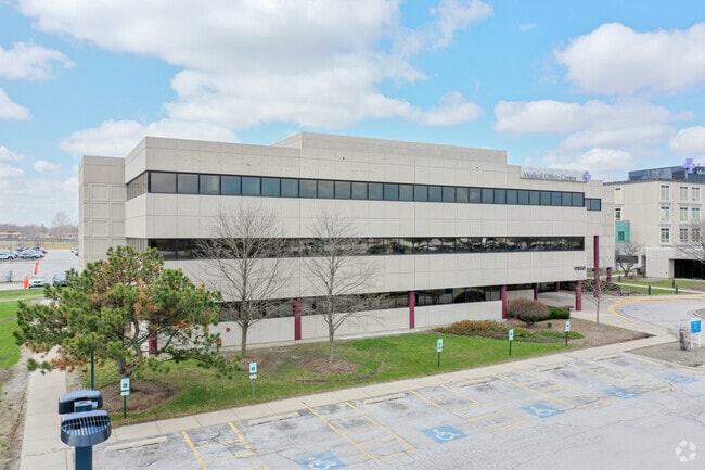
Property Detail
17850 Kedzie Ave
Storebuilding
Cook
X
Illinois
17031C0729J
0.38 AC
2023
Far South
2024
Chicago
825504
Chicago-Naperville-Elgin, IL-IN-WI
42,870 SF
28-35-202-009-0000
DEMOGRAPHICS near 17850 Kedzie Ave
1 Mile
3 Mile
5 Mile
2024 Total Population
14,375
75,935
215,561
2029 Population
14,005
74,092
211,276
Pop Growth 2024-2029
(2.57%)
(2.43%)
(1.99%)
Average Age
40
41
41
2024 Total Households
4,966
27,036
77,954
HH Growth 2024-2029
(2.86%)
(2.74%)
(2.30%)
Median Household Inc
$69,460
$71,393
$66,708
Avg Household Size
2.80
2.70
2.70
2024 Avg HH Vehicles
2.00
2.00
2.00
Median Home Value
$168,230
$176,744
$171,042
Median Year Built
1971
1967
1968
Nearby Places
Map Layers
Map Styles
 Street
 Aerial
- Restaurants
- Banks
- Shops
- Fitness
- Groceries
PUBLIC TRANSPORTATION
COMMUTER RAIL
Calumet Station (Metra Electric Line - Northeast Illinois Regional Commuter Railroad (Metra))
DRIVE
WALK
Distance
Calumet Station (Metra Electric Line - Northeast Illinois Regional Commuter Railroad (Metra))
5 min
2.3 mi
Homewood Station (Metra Electric Line - Northeast Illinois Regional Commuter Railroad (Metra))
DRIVE
WALK
Distance
Homewood Station (Metra Electric Line - Northeast Illinois Regional Commuter Railroad (Metra))
7 min
2.4 mi
AIRPORT
Chicago Midway International
DRIVE
WALK
Distance
Chicago Midway International
31 min
18.1 mi
Chicago O'Hare International
DRIVE
WALK
Distance
Chicago O'Hare International
56 min
39.9 mi
Nearby Properties
Address
Land Use
TOTAL SIZE
Lot Size
Zoning
Address
Land Use
TOTAL SIZE
Lot Size
Zoning
Address
Land Use
TOTAL SIZE
Lot Size
Zoning
194,292 SF
21.10 AC
Address
Land Use
TOTAL SIZE
Lot Size
Zoning
1,033,450 SF
Address
Land Use
TOTAL SIZE
Lot Size
Zoning
Address
Land Use
TOTAL SIZE
Lot Size
Zoning
203,995 SF
20.27 AC
Address
Land Use
TOTAL SIZE
Lot Size
Zoning
1,201 SF
3.65 AC
Address
Land Use
TOTAL SIZE
Lot Size
Zoning
2.94 AC
Address
Land Use
TOTAL SIZE
Lot Size
Zoning
196,125 SF
18.55 AC
Address
Land Use
TOTAL SIZE
Lot Size
Zoning
3.65 AC
Address
Land Use
TOTAL SIZE
Lot Size
Zoning
27,082 SF
0.69 AC
Address
Land Use
TOTAL SIZE
Lot Size
Zoning
52,220 SF
6 AC
Address
Land Use
TOTAL SIZE
Lot Size
Zoning
Address
Land Use
TOTAL SIZE
Lot Size
Zoning
62,380 SF
4.65 AC
Address
Land Use
TOTAL SIZE
Lot Size
Zoning
Address
Land Use
TOTAL SIZE
Lot Size
Zoning
0.34 AC
Address
Land Use
TOTAL SIZE
Lot Size
Zoning
48,727 SF
3.76 AC
Address
Land Use
TOTAL SIZE
Lot Size
Zoning
5.42 AC
Address
Land Use
TOTAL SIZE
Lot Size
Zoning
19,858 SF
2.59 AC
Address
Land Use
TOTAL SIZE
Lot Size
Zoning
185,463 SF
10.96 AC
Address
Land Use
TOTAL SIZE
Lot Size
Zoning
66,320 SF
12.11 AC
Address
Land Use
TOTAL SIZE
Lot Size
Zoning
90,220 SF
2.21 AC
Address
Land Use
TOTAL SIZE
Lot Size
Zoning
78,075 SF
5.47 AC
Address
Land Use
TOTAL SIZE
Lot Size
Zoning
Address
Land Use
TOTAL SIZE
Lot Size
Zoning
36,920 SF
14.86 AC
Address
Land Use
TOTAL SIZE
Lot Size
Zoning
28.54 AC
Address
Land Use
TOTAL SIZE
Lot Size
Zoning
Address
Land Use
TOTAL SIZE
Lot Size
Zoning
59,672 SF
5.62 AC
Address
Land Use
TOTAL SIZE
Lot Size
Zoning
10,995 SF
1.21 AC
Address
Land Use
TOTAL SIZE
Lot Size
Zoning
6,990 SF
0.68 AC
The World's #1 Commercial Real Estate Marketplace
Connect with us
© 2025 CoStar Group
The information above has been obtained from sources believed reliable. While we do not doubt its accuracy we have not verified it and make no guarantee, warranty or representation about it. It is your responsibility to independently confirm its accuracy and completeness. Any projections, opinions, assumptions, or estimates used are for example only and do not represent the current or future performance of the property. The value of this transaction to you depends on tax and other factors which should be evaluated by your tax, financial, and legal advisors. You and your advisors should conduct a careful, independent investigation of the property to determine to your satisfaction the suitability of the property for your needs.