Property Record
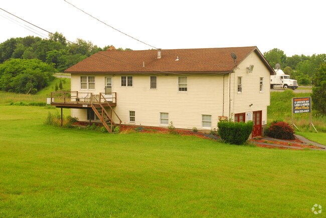
1787 Route 17M, Goshen, NY 10924


NEARBY LISTINGS FOR SALE OR LEASE
Property Detail
1787 Route 17M
333089-011-000-0001-020.220-0000
LT 2 KOLK MP4071
Officebuilding
Orange
AE
New York
36071C0293E
20.22
2024
2.30 AC
2024
Newburgh
012200
Northern New Jersey
2,388 SF
New York-Jersey City-White Plains, NY-NJ
DEMOGRAPHICS near 1787 Route 17M
1 Mile
3 Mile
5 Mile
2024 Total Population
1,884
16,347
30,236
2029 Population
1,956
16,661
30,766
Pop Growth 2024-2029
+ 3.82%
+ 1.92%
+ 1.75%
Average Age
43
42
42
2024 Total Households
634
6,098
10,415
HH Growth 2024-2029
+ 4.26%
+ 2.05%
+ 1.92%
Median Household Inc
$117,827
$104,537
$112,509
Avg Household Size
2.70
2.60
2.70
2024 Avg HH Vehicles
2.00
2.00
2.00
Median Home Value
$352,631
$340,365
$375,277
Median Year Built
1975
1974
1976
Nearby Places
- Restaurants
- Banks
- Shops
- Fitness
- Groceries
PUBLIC TRANSPORTATION
COMMUTER RAIL
Campbell Hall (Bergen County/Port Jervis Line - NJ Transit Commuter Rail (NJ Transit), Main/Port Jervis Line - NJ Transit Commuter Rail (NJ Transit))
DRIVE
WALK
Distance
Campbell Hall (Bergen County/Port Jervis Line - NJ Transit Commuter Rail (NJ Transit), Main/Port Jervis Line - NJ Transit Commuter Rail (NJ Transit))
13 min
7.5 mi
Middletown New York (Bergen County/Port Jervis Line - NJ Transit Commuter Rail (NJ Transit), Main/Port Jervis Line - NJ Transit Commuter Rail (NJ Transit))
DRIVE
WALK
Distance
Middletown New York (Bergen County/Port Jervis Line - NJ Transit Commuter Rail (NJ Transit), Main/Port Jervis Line - NJ Transit Commuter Rail (NJ Transit))
13 min
8.2 mi
AIRPORT
New York Stewart International
DRIVE
WALK
Distance
New York Stewart International
30 min
18.4 mi
Freight Ports
Port Newark Container Terminal
DRIVE
WALK
Distance
Port Newark Container Terminal
83 min
62.9 mi
SALE & LEASE HISTORY
LISTING DATE
SALE/LEASE

Apr 24, 2020
For Sale
Nearby Properties
Address
Land Use
TOTAL SIZE
Lot Size
Zoning
Address
Land Use
TOTAL SIZE
Lot Size
Zoning
389 AC
02092
Address
Land Use
TOTAL SIZE
Lot Size
Zoning
371,790 SF
169.40 AC
01092
Address
Land Use
TOTAL SIZE
Lot Size
Zoning
82 AC
04300
Address
Land Use
TOTAL SIZE
Lot Size
Zoning
878,010 SF
50.40 AC
Address
Land Use
TOTAL SIZE
Lot Size
Zoning
1,313,710 SF
34 AC
SR2*
Address
Land Use
TOTAL SIZE
Lot Size
Zoning
221,073 SF
35.40 AC
04023
Address
Land Use
TOTAL SIZE
Lot Size
Zoning
145,831 SF
15.30 AC
04023
Address
Land Use
TOTAL SIZE
Lot Size
Zoning
198,260 SF
27.60 AC
B2
Address
Land Use
TOTAL SIZE
Lot Size
Zoning
157,558 SF
37.40 AC
2034
Address
Land Use
TOTAL SIZE
Lot Size
Zoning
188,237 SF
9.60 AC
01092
Address
Land Use
TOTAL SIZE
Lot Size
Zoning
50.30 AC
I
Address
Land Use
TOTAL SIZE
Lot Size
Zoning
404,550 SF
35.90 AC
M1
Address
Land Use
TOTAL SIZE
Lot Size
Zoning
159,871 SF
23.20 AC
01092
Address
Land Use
TOTAL SIZE
Lot Size
Zoning
319,144 SF
47.80 AC
IP
Address
Land Use
TOTAL SIZE
Lot Size
Zoning
147,312 SF
10.60 AC
04023
Address
Land Use
TOTAL SIZE
Lot Size
Zoning
134,566 SF
60 AC
02092
Address
Land Use
TOTAL SIZE
Lot Size
Zoning
100,324 SF
0.66 AC
RS
Address
Land Use
TOTAL SIZE
Lot Size
Zoning
116,353 SF
22.50 AC
2034
Address
Land Use
TOTAL SIZE
Lot Size
Zoning
95,273 SF
31.60 AC
02069
Address
Land Use
TOTAL SIZE
Lot Size
Zoning
116,426 SF
9.10 AC
M1
Address
Land Use
TOTAL SIZE
Lot Size
Zoning
52,730 SF
13.70 AC
04092
Address
Land Use
TOTAL SIZE
Lot Size
Zoning
211,990 SF
13.10 AC
M1
Address
Land Use
TOTAL SIZE
Lot Size
Zoning
24.10 AC
04023
Address
Land Use
TOTAL SIZE
Lot Size
Zoning
64 AC
01092
Address
Land Use
TOTAL SIZE
Lot Size
Zoning
194,400 SF
28.10 AC
I
Address
Land Use
TOTAL SIZE
Lot Size
Zoning
92,969 SF
4.98 AC
M1
Address
Land Use
TOTAL SIZE
Lot Size
Zoning
282,147 SF
7.50 AC
M2
Address
Land Use
TOTAL SIZE
Lot Size
Zoning
142,425 SF
12.40 AC
04300
Address
Land Use
TOTAL SIZE
Lot Size
Zoning
42,944 SF
4.90 AC
04300
Address
Land Use
TOTAL SIZE
Lot Size
Zoning
40,918 SF
3.60 AC
04011
The World's #1 Commercial Real Estate Marketplace
Connect with us
© 2025 CoStar Group
The information above has been obtained from sources believed reliable. While we do not doubt its accuracy we have not verified it and make no guarantee, warranty or representation about it. It is your responsibility to independently confirm its accuracy and completeness. Any projections, opinions, assumptions, or estimates used are for example only and do not represent the current or future performance of the property. The value of this transaction to you depends on tax and other factors which should be evaluated by your tax, financial, and legal advisors. You and your advisors should conduct a careful, independent investigation of the property to determine to your satisfaction the suitability of the property for your needs.