Property Record
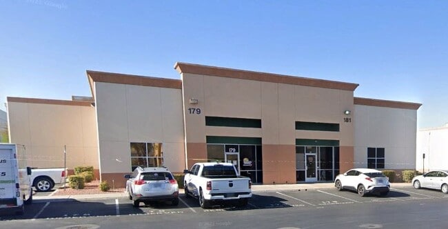
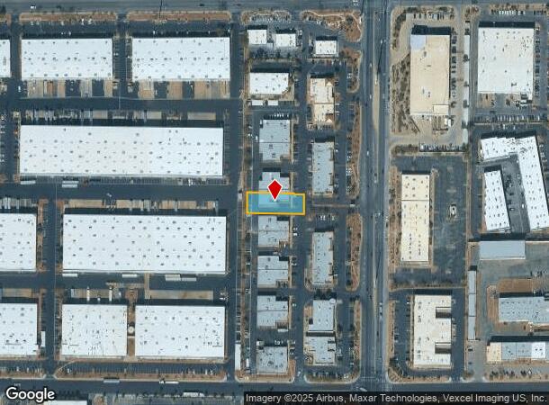
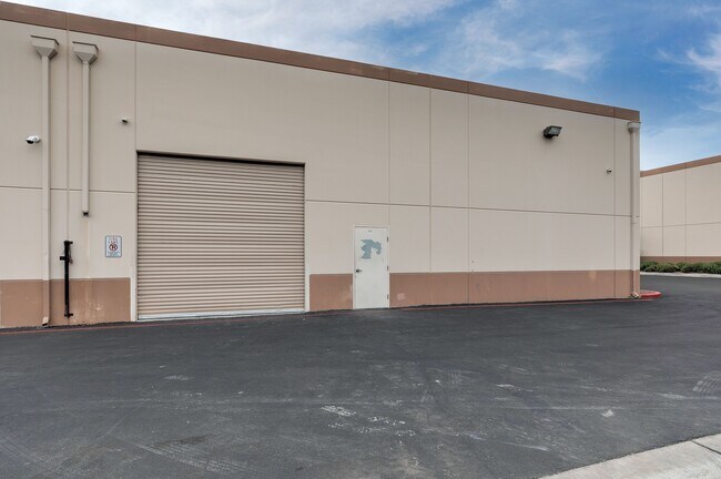
179 N Gibson Rd, Henderson, NV 89014

NEARBY LISTINGS FOR SALE OR LEASE
Property Detail
179 N Gibson Rd
Las Vegas-Henderson-Paradise, NV
Gibson Business Park 3
178-15-511-043
GIBSON BUSINESS PARK 3 PLAT BOOK 56 PAGE 36 PT LOT 1
Commercialnec
Clark
X
Nevada
32003C2595F
1
2025
0.33 AC
2025
SE LV/Henderson
005115
Las Vegas
7,691 SF
DEMOGRAPHICS near 179 N Gibson Rd
1 Mile
3 Mile
5 Mile
2024 Total Population
14,484
113,119
298,905
2029 Population
15,565
121,430
321,392
Pop Growth 2024-2029
+ 7.46%
+ 7.35%
+ 7.52%
Average Age
38
40
41
2024 Total Households
5,868
44,963
116,408
HH Growth 2024-2029
+ 7.52%
+ 7.29%
+ 7.52%
Median Household Inc
$75,112
$75,456
$71,504
Avg Household Size
2.40
2.40
2.50
2024 Avg HH Vehicles
2.00
2.00
2.00
Median Home Value
$408,610
$393,511
$382,143
Median Year Built
2002
1996
1996
Nearby Places
Map Layers
Map Styles
 Street
 Aerial
- Restaurants
- Banks
- Shops
- Fitness
- Groceries
PUBLIC TRANSPORTATION
AIRPORT
Harry Reid International
DRIVE
WALK
Distance
Harry Reid International
15 min
10.9 mi
Boulder City Municipal
DRIVE
WALK
Distance
Boulder City Municipal
21 min
14.1 mi
SALE & LEASE HISTORY
LISTING DATE
SALE/LEASE

Oct 13, 2021
For Lease
Mar 03, 2025
For Sale
Jul 17, 2024
For Sale
Feb 03, 2022
For Sale
Aug 30, 2021
For Sale
Apr 27, 2022
For Lease
Nearby Properties
Address
Land Use
TOTAL SIZE
Lot Size
Zoning
Address
Land Use
TOTAL SIZE
Lot Size
Zoning
678,168 SF
69.69 AC
Address
Land Use
TOTAL SIZE
Lot Size
Zoning
251,075 SF
24.28 AC
Address
Land Use
TOTAL SIZE
Lot Size
Zoning
62,258 SF
59.95 AC
Address
Land Use
TOTAL SIZE
Lot Size
Zoning
14,840 SF
38.54 AC
CC
Address
Land Use
TOTAL SIZE
Lot Size
Zoning
Address
Land Use
TOTAL SIZE
Lot Size
Zoning
31,463 SF
191.46 AC
PS
Address
Land Use
TOTAL SIZE
Lot Size
Zoning
8,536 SF
24.93 AC
Address
Land Use
TOTAL SIZE
Lot Size
Zoning
8,047 SF
17.42 AC
Address
Land Use
TOTAL SIZE
Lot Size
Zoning
7,825 SF
15.41 AC
Address
Land Use
TOTAL SIZE
Lot Size
Zoning
358,212 SF
9.06 AC
CC
Address
Land Use
TOTAL SIZE
Lot Size
Zoning
8,168 SF
15.22 AC
Address
Land Use
TOTAL SIZE
Lot Size
Zoning
10.50 AC
Address
Land Use
TOTAL SIZE
Lot Size
Zoning
5,658 SF
16.18 AC
RH24
Address
Land Use
TOTAL SIZE
Lot Size
Zoning
1,500 SF
25.08 AC
Address
Land Use
TOTAL SIZE
Lot Size
Zoning
4,446 SF
15.81 AC
CC
Address
Land Use
TOTAL SIZE
Lot Size
Zoning
3,289 SF
22.36 AC
R3
Address
Land Use
TOTAL SIZE
Lot Size
Zoning
383,889 SF
31.11 AC
Address
Land Use
TOTAL SIZE
Lot Size
Zoning
38.36 AC
Address
Land Use
TOTAL SIZE
Lot Size
Zoning
9,000 SF
96.81 AC
RE
Address
Land Use
TOTAL SIZE
Lot Size
Zoning
4,578 SF
13.23 AC
H:RH-24-MP
Address
Land Use
TOTAL SIZE
Lot Size
Zoning
40,031 SF
21.25 AC
Address
Land Use
TOTAL SIZE
Lot Size
Zoning
35.42 AC
PS
Address
Land Use
TOTAL SIZE
Lot Size
Zoning
314,454 SF
22.94 AC
CC
Address
Land Use
TOTAL SIZE
Lot Size
Zoning
222,167 SF
6.99 AC
Address
Land Use
TOTAL SIZE
Lot Size
Zoning
4,496 SF
15.59 AC
H:RH-24-MP
Address
Land Use
TOTAL SIZE
Lot Size
Zoning
239,288 SF
14.10 AC
Address
Land Use
TOTAL SIZE
Lot Size
Zoning
3,126 SF
17.69 AC
RM16
Address
Land Use
TOTAL SIZE
Lot Size
Zoning
250,076 SF
24.61 AC
Address
Land Use
TOTAL SIZE
Lot Size
Zoning
4,280 SF
18.25 AC
H:RM-16-MP
Address
Land Use
TOTAL SIZE
Lot Size
Zoning
237,955 SF
40 AC
IG
The World's #1 Commercial Real Estate Marketplace
Connect with us
© 2025 CoStar Group
The information above has been obtained from sources believed reliable. While we do not doubt its accuracy we have not verified it and make no guarantee, warranty or representation about it. It is your responsibility to independently confirm its accuracy and completeness. Any projections, opinions, assumptions, or estimates used are for example only and do not represent the current or future performance of the property. The value of this transaction to you depends on tax and other factors which should be evaluated by your tax, financial, and legal advisors. You and your advisors should conduct a careful, independent investigation of the property to determine to your satisfaction the suitability of the property for your needs.