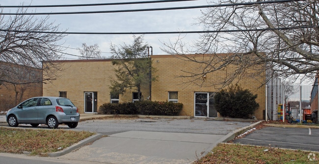
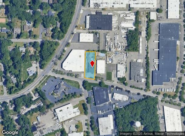
Property Record
179 Bridge Rd, Islandia, NY 11749

NEARBY LISTINGS FOR SALE OR LEASE
Property Detail
179 Bridge Rd
Nassau County-Suffolk County, NY
X2223189Y212347 N013N00000000
0504-011-00-01-00-003-000
Suffolk
Warehouse
New York
X
100
36103C0665H
0.58 AC
0
Hauppauge
2024
Long Island (New York)
145804
DEMOGRAPHICS near 179 Bridge Rd
1 Mile
3 Mile
5 Mile
2024 Total Population
11,969
91,479
243,273
2029 Population
11,810
89,231
237,434
Pop Growth 2024-2029
(1.33%)
(2.46%)
(2.40%)
Average Age
39
39
40
2024 Total Households
3,623
26,443
71,448
HH Growth 2024-2029
(1.55%)
(2.47%)
(2.48%)
Median Household Inc
$97,181
$110,204
$119,730
Avg Household Size
3.00
3.20
3.20
2024 Avg HH Vehicles
2.00
2.00
2.00
Median Home Value
$374,747
$448,988
$466,257
Median Year Built
1968
1968
1967
Nearby Places
- Restaurants
- Banks
- Shops
- Fitness
- Groceries
PUBLIC TRANSPORTATION
AIRPORT
Long Island MacArthur
DRIVE
WALK
Distance
Long Island MacArthur
12 min
6.3 mi
John F Kennedy International
DRIVE
WALK
Distance
John F Kennedy International
54 min
40.4 mi
Freight Ports
NY - Red Hook Container Terminal
DRIVE
WALK
Distance
NY - Red Hook Container Terminal
69 min
47.9 mi
Nearby Properties
Address
Land Use
TOTAL SIZE
Lot Size
Zoning
Address
Land Use
TOTAL SIZE
Lot Size
Zoning
301 SF
3.70 AC
Address
Land Use
TOTAL SIZE
Lot Size
Zoning
97.50 AC
AAA
Address
Land Use
TOTAL SIZE
Lot Size
Zoning
57.30 AC
AAA
Address
Land Use
TOTAL SIZE
Lot Size
Zoning
22.22 AC
AA
Address
Land Use
TOTAL SIZE
Lot Size
Zoning
8.05 AC
NULL
Address
Land Use
TOTAL SIZE
Lot Size
Zoning
170.87 AC
AAA
Address
Land Use
TOTAL SIZE
Lot Size
Zoning
24.10 AC
A
Address
Land Use
TOTAL SIZE
Lot Size
Zoning
83.41 AC
Address
Land Use
TOTAL SIZE
Lot Size
Zoning
27.38 AC
Address
Land Use
TOTAL SIZE
Lot Size
Zoning
2.79 AC
Address
Land Use
TOTAL SIZE
Lot Size
Zoning
36.66 AC
NULL
Address
Land Use
TOTAL SIZE
Lot Size
Zoning
24.96 AC
Address
Land Use
TOTAL SIZE
Lot Size
Zoning
24.70 AC
AAA
Address
Land Use
TOTAL SIZE
Lot Size
Zoning
360.60 AC
AAA
Address
Land Use
TOTAL SIZE
Lot Size
Zoning
13.06 AC
BUS3
Address
Land Use
TOTAL SIZE
Lot Size
Zoning
5,140 SF
23.39 AC
CA
Address
Land Use
TOTAL SIZE
Lot Size
Zoning
97.24 AC
AAA
Address
Land Use
TOTAL SIZE
Lot Size
Zoning
21.20 AC
AA
Address
Land Use
TOTAL SIZE
Lot Size
Zoning
15 AC
AA
Address
Land Use
TOTAL SIZE
Lot Size
Zoning
45.56 AC
Address
Land Use
TOTAL SIZE
Lot Size
Zoning
12.84 AC
NULL
Address
Land Use
TOTAL SIZE
Lot Size
Zoning
8.02 AC
NULL
Address
Land Use
TOTAL SIZE
Lot Size
Zoning
23.08 AC
AA
Address
Land Use
TOTAL SIZE
Lot Size
Zoning
10.90 AC
AAA
Address
Land Use
TOTAL SIZE
Lot Size
Zoning
22.84 AC
IND1
Address
Land Use
TOTAL SIZE
Lot Size
Zoning
45.71 AC
NULL
Address
Land Use
TOTAL SIZE
Lot Size
Zoning
200.70 AC
AAA
Address
Land Use
TOTAL SIZE
Lot Size
Zoning
5.53 AC
ICD
Address
Land Use
TOTAL SIZE
Lot Size
Zoning
10.50 AC
NULL
Address
Land Use
TOTAL SIZE
Lot Size
Zoning
5.32 AC
BUS3
The World's #1 Commercial Real Estate Marketplace
Connect with us
© 2025 CoStar Group
The information above has been obtained from sources believed reliable. While we do not doubt its accuracy we have not verified it and make no guarantee, warranty or representation about it. It is your responsibility to independently confirm its accuracy and completeness. Any projections, opinions, assumptions, or estimates used are for example only and do not represent the current or future performance of the property. The value of this transaction to you depends on tax and other factors which should be evaluated by your tax, financial, and legal advisors. You and your advisors should conduct a careful, independent investigation of the property to determine to your satisfaction the suitability of the property for your needs.