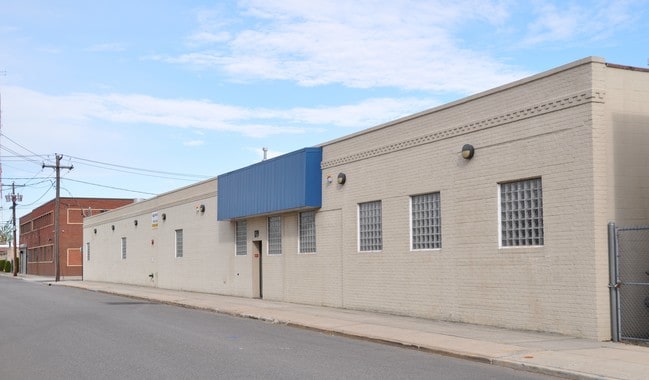
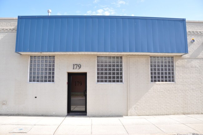
Property Record
179 Liberty Ave, Mineola, NY 11501

NEARBY LISTINGS FOR SALE OR LEASE
Property Detail
179 Liberty Ave
Nassau County-Suffolk County, NY
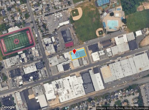
Map Of Mineola Manor
2223-09-300-00-0014-0
14-22
Warehouse
Nassau
X
New York
36059C0210G
14-22
2025
0.43 AC
2025
Central Nassau
303700
Long Island (New York)
12,400 SF
DEMOGRAPHICS near 179 Liberty Ave
1 Mile
3 Mile
5 Mile
2024 Total Population
23,366
168,911
478,907
2029 Population
23,020
166,206
468,520
Pop Growth 2024-2029
(1.48%)
(1.60%)
(2.17%)
Average Age
42
41
42
2024 Total Households
9,240
54,538
149,205
HH Growth 2024-2029
(1.41%)
(1.59%)
(2.27%)
Median Household Inc
$119,238
$119,557
$122,520
Avg Household Size
2.50
2.90
3.00
2024 Avg HH Vehicles
2.00
2.00
2.00
Median Home Value
$713,465
$729,705
$693,437
Median Year Built
1954
1954
1953
Nearby Places
- Restaurants
- Banks
- Shops
- Fitness
- Groceries
PUBLIC TRANSPORTATION
TRANSIT/SUBWAY
Mineola Station (Oyster Bay Branch - Long Island Rail Road, Port Jefferson Branch - Long Island Rail Road, Ronkonkoma Branch - Long Island Rail Road)
DRIVE
WALK
Distance
Mineola Station (Oyster Bay Branch - Long Island Rail Road, Port Jefferson Branch - Long Island Rail Road, Ronkonkoma Branch - Long Island Rail Road)
3 min
17 min
0.9 mi
COMMUTER RAIL
Mineola Station (Oyster Bay Branch - Long Island Rail Road, Port Jefferson Branch - Long Island Rail Road, Ronkonkoma Branch - Long Island Rail Road)
DRIVE
WALK
Distance
Mineola Station (Oyster Bay Branch - Long Island Rail Road, Port Jefferson Branch - Long Island Rail Road, Ronkonkoma Branch - Long Island Rail Road)
3 min
17 min
0.9 mi
East Williston Station (Oyster Bay Branch - Long Island Rail Road)
DRIVE
WALK
Distance
East Williston Station (Oyster Bay Branch - Long Island Rail Road)
4 min
1.5 mi
AIRPORT
John F Kennedy International
DRIVE
WALK
Distance
John F Kennedy International
27 min
15.2 mi
LaGuardia
DRIVE
WALK
Distance
LaGuardia
29 min
17.0 mi
Westchester County
DRIVE
WALK
Distance
Westchester County
59 min
38.3 mi
Freight Ports
NY - Red Hook Container Terminal
DRIVE
WALK
Distance
NY - Red Hook Container Terminal
41 min
25.1 mi
SALE & LEASE HISTORY
LISTING DATE
SALE/LEASE

Sep 24, 2016
For Lease
Sep 23, 2016
For Sale
Nearby Properties
Address
Land Use
TOTAL SIZE
Lot Size
Zoning
Address
Land Use
TOTAL SIZE
Lot Size
Zoning
5,322,666 SF
86.10 AC
Address
Land Use
TOTAL SIZE
Lot Size
Zoning
419,282 SF
57.46 AC
Address
Land Use
TOTAL SIZE
Lot Size
Zoning
187,225 SF
15.35 AC
Address
Land Use
TOTAL SIZE
Lot Size
Zoning
1,188,742 SF
11.93 AC
Address
Land Use
TOTAL SIZE
Lot Size
Zoning
181,472 SF
168.80 AC
Address
Land Use
TOTAL SIZE
Lot Size
Zoning
1,197,283 SF
64.50 AC
Address
Land Use
TOTAL SIZE
Lot Size
Zoning
574,353 SF
65 AC
Address
Land Use
TOTAL SIZE
Lot Size
Zoning
2,835 SF
239 AC
Address
Land Use
TOTAL SIZE
Lot Size
Zoning
186 AC
Address
Land Use
TOTAL SIZE
Lot Size
Zoning
556,575 SF
11.46 AC
Address
Land Use
TOTAL SIZE
Lot Size
Zoning
Address
Land Use
TOTAL SIZE
Lot Size
Zoning
822,113 SF
26 AC
Address
Land Use
TOTAL SIZE
Lot Size
Zoning
962,971 SF
18.90 AC
Address
Land Use
TOTAL SIZE
Lot Size
Zoning
493,535 SF
5.88 AC
Address
Land Use
TOTAL SIZE
Lot Size
Zoning
352,730 SF
41.04 AC
Address
Land Use
TOTAL SIZE
Lot Size
Zoning
29,224 SF
1.33 AC
Address
Land Use
TOTAL SIZE
Lot Size
Zoning
152,926 SF
30 AC
Address
Land Use
TOTAL SIZE
Lot Size
Zoning
277,200 SF
21.03 AC
Address
Land Use
TOTAL SIZE
Lot Size
Zoning
130,720 SF
48.60 AC
Address
Land Use
TOTAL SIZE
Lot Size
Zoning
111,756 SF
21.24 AC
Address
Land Use
TOTAL SIZE
Lot Size
Zoning
63,600 SF
2 AC
Address
Land Use
TOTAL SIZE
Lot Size
Zoning
182,129 SF
1.51 AC
Address
Land Use
TOTAL SIZE
Lot Size
Zoning
92,466 SF
8 AC
Address
Land Use
TOTAL SIZE
Lot Size
Zoning
152,783 SF
51.20 AC
Address
Land Use
TOTAL SIZE
Lot Size
Zoning
254,845 SF
22.28 AC
Address
Land Use
TOTAL SIZE
Lot Size
Zoning
399,955 SF
13.63 AC
Address
Land Use
TOTAL SIZE
Lot Size
Zoning
76.10 AC
Address
Land Use
TOTAL SIZE
Lot Size
Zoning
83.42 AC
Address
Land Use
TOTAL SIZE
Lot Size
Zoning
126,558 SF
12.76 AC
Address
Land Use
TOTAL SIZE
Lot Size
Zoning
35,718 SF
22.15 AC
The World's #1 Commercial Real Estate Marketplace
Connect with us
© 2025 CoStar Group
The information above has been obtained from sources believed reliable. While we do not doubt its accuracy we have not verified it and make no guarantee, warranty or representation about it. It is your responsibility to independently confirm its accuracy and completeness. Any projections, opinions, assumptions, or estimates used are for example only and do not represent the current or future performance of the property. The value of this transaction to you depends on tax and other factors which should be evaluated by your tax, financial, and legal advisors. You and your advisors should conduct a careful, independent investigation of the property to determine to your satisfaction the suitability of the property for your needs.