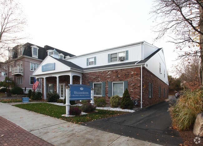
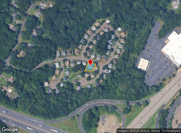
Property Record
179 Broad St, Milford, CT 06460
Current Lease Availabilities
NEARBY LISTINGS FOR SALE OR LEASE
Property Detail
179 Broad St
MILF-000054-000394-000008
New Haven
Commercialbuilding
Connecticut
X
8
09009C0531K
0.48 AC
2025
Milford
2025
Westchester/So Connecticut
150100
New Haven-Milford, CT
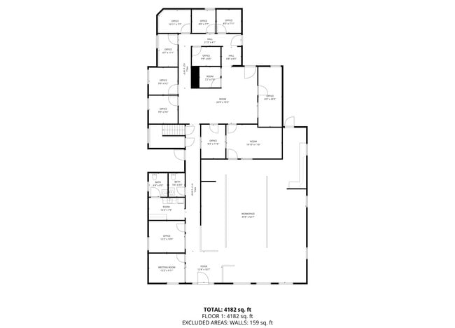
7,819 SF
DEMOGRAPHICS near 179 Broad St
1 Mile
3 Mile
5 Mile
2024 Total Population
11,340
49,956
118,808
2029 Population
11,482
50,311
119,331
Pop Growth 2024-2029
+ 1.25%
+ 0.71%
+ 0.44%
Average Age
43
44
44
2024 Total Households
5,123
21,304
48,573
HH Growth 2024-2029
+ 1.17%
+ 0.69%
+ 0.46%
Median Household Inc
$89,835
$101,008
$98,237
Avg Household Size
2.20
2.30
2.40
2024 Avg HH Vehicles
2.00
2.00
2.00
Median Home Value
$358,988
$349,557
$326,406
Median Year Built
1956
1964
1962
Nearby Places
Map Layers
Map Styles
 Street
 Aerial
- Restaurants
- Banks
- Shops
- Fitness
- Groceries
PUBLIC TRANSPORTATION
COMMUTER RAIL
Milford Station (New Haven Line - Metro-North Commuter Railroad Company (Metro-North))
DRIVE
WALK
Distance
Milford Station (New Haven Line - Metro-North Commuter Railroad Company (Metro-North))
3 min
1.6 mi
West Haven (New Haven - Metro-North Railroad)
DRIVE
WALK
Distance
West Haven (New Haven - Metro-North Railroad)
10 min
6.2 mi
AIRPORT
Tweed/New Haven
DRIVE
WALK
Distance
Tweed/New Haven
24 min
13.6 mi
Freight Ports
Port of New Haven
DRIVE
WALK
Distance
Port of New Haven
18 min
10.8 mi
Nearby Properties
Address
Land Use
TOTAL SIZE
Lot Size
Zoning
Address
Land Use
TOTAL SIZE
Lot Size
Zoning
187,983 SF
254.30 AC
H-3
Address
Land Use
TOTAL SIZE
Lot Size
Zoning
74.86 AC
SCD
Address
Land Use
TOTAL SIZE
Lot Size
Zoning
9.05 AC
MCDD
Address
Land Use
TOTAL SIZE
Lot Size
Zoning
35.05 AC
LI-2
Address
Land Use
TOTAL SIZE
Lot Size
Zoning
1,628 SF
22.65 AC
OSAH
Address
Land Use
TOTAL SIZE
Lot Size
Zoning
34.40 AC
SCD
Address
Land Use
TOTAL SIZE
Lot Size
Zoning
214,516 SF
35.88 AC
RA
Address
Land Use
TOTAL SIZE
Lot Size
Zoning
287.63 AC
OS
Address
Land Use
TOTAL SIZE
Lot Size
Zoning
125,676 SF
22.12 AC
BOP
Address
Land Use
TOTAL SIZE
Lot Size
Zoning
1,110 SF
6.76 AC
CDD1
Address
Land Use
TOTAL SIZE
Lot Size
Zoning
3,864 SF
26.06 AC
DO25
Address
Land Use
TOTAL SIZE
Lot Size
Zoning
6.86 AC
RA
Address
Land Use
TOTAL SIZE
Lot Size
Zoning
26,736 SF
10.86 AC
CDD1
Address
Land Use
TOTAL SIZE
Lot Size
Zoning
9 AC
LI-4
Address
Land Use
TOTAL SIZE
Lot Size
Zoning
162,464 SF
7.51 AC
SLD
Address
Land Use
TOTAL SIZE
Lot Size
Zoning
145,145 SF
22.60 AC
MCDD
Address
Land Use
TOTAL SIZE
Lot Size
Zoning
181,277 SF
4.58 AC
CDD5
Address
Land Use
TOTAL SIZE
Lot Size
Zoning
20.33 AC
LI-3
Address
Land Use
TOTAL SIZE
Lot Size
Zoning
14.69 AC
WDD
Address
Land Use
TOTAL SIZE
Lot Size
Zoning
2.91 AC
MCDD
Address
Land Use
TOTAL SIZE
Lot Size
Zoning
7.54 AC
CDD5
Address
Land Use
TOTAL SIZE
Lot Size
Zoning
55,894 SF
8.25 AC
LI-2
Address
Land Use
TOTAL SIZE
Lot Size
Zoning
18.14 AC
ID
Address
Land Use
TOTAL SIZE
Lot Size
Zoning
15.51 AC
C-2
Address
Land Use
TOTAL SIZE
Lot Size
Zoning
138,970 SF
14.34 AC
CDD5
Address
Land Use
TOTAL SIZE
Lot Size
Zoning
14,183 SF
16.40 AC
R18
Address
Land Use
TOTAL SIZE
Lot Size
Zoning
47,225 SF
41.33 AC
LI-2
Address
Land Use
TOTAL SIZE
Lot Size
Zoning
97,527 SF
3.70 AC
LI-2
Address
Land Use
TOTAL SIZE
Lot Size
Zoning
21.50 AC
LI
Address
Land Use
TOTAL SIZE
Lot Size
Zoning
29.18 AC
MCDD
The World's #1 Commercial Real Estate Marketplace
Connect with us
© 2025 CoStar Group
The information above has been obtained from sources believed reliable. While we do not doubt its accuracy we have not verified it and make no guarantee, warranty or representation about it. It is your responsibility to independently confirm its accuracy and completeness. Any projections, opinions, assumptions, or estimates used are for example only and do not represent the current or future performance of the property. The value of this transaction to you depends on tax and other factors which should be evaluated by your tax, financial, and legal advisors. You and your advisors should conduct a careful, independent investigation of the property to determine to your satisfaction the suitability of the property for your needs.