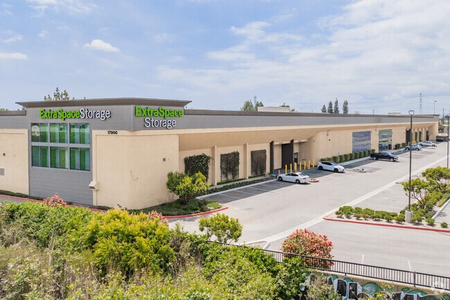
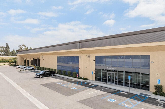
Property Record
17900 Crusader Ave, Cerritos, CA 90703

NEARBY LISTINGS FOR SALE OR LEASE
Property Detail
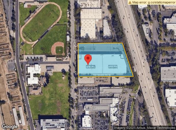
17900 Crusader Ave
Los Angeles-Long Beach-Glendale, CA
Parcel Map 16834
7034-017-032
P M 223-52-53 LOT 1
Publicstorage
Los Angeles
X
California
06037C1980F
1
2024
4.81 AC
2025
Mid-Cities
554521
Los Angeles
353,001 SF
DEMOGRAPHICS near 17900 Crusader Ave
1 Mile
3 Mile
5 Mile
2024 Total Population
18,902
254,890
614,859
2029 Population
18,281
246,293
594,202
Pop Growth 2024-2029
(3.29%)
(3.37%)
(3.36%)
Average Age
43
40
39
2024 Total Households
6,104
77,732
186,809
HH Growth 2024-2029
(3.56%)
(3.62%)
(3.59%)
Median Household Inc
$93,148
$88,514
$87,794
Avg Household Size
3.00
3.20
3.20
2024 Avg HH Vehicles
2.00
2.00
2.00
Median Home Value
$756,053
$716,206
$710,946
Median Year Built
1966
1961
1960
Nearby Places
Map Layers
Map Styles
 Street
 Aerial
- Restaurants
- Banks
- Shops
- Fitness
- Groceries
PUBLIC TRANSPORTATION
COMMUTER RAIL
Norwalk/Santa Fe Springs (91 Line - Southern California Regional Rail Authority (Metrolink), Orange County Line - Southern California Regional Rail Authority (Metrolink))
DRIVE
WALK
Distance
Norwalk/Santa Fe Springs (91 Line - Southern California Regional Rail Authority (Metrolink), Orange County Line - Southern California Regional Rail Authority (Metrolink))
12 min
5.9 mi
Buena Park (91 Line - Southern California Regional Rail Authority (Metrolink), Orange County Line - Southern California Regional Rail Authority (Metrolink))
DRIVE
WALK
Distance
Buena Park (91 Line - Southern California Regional Rail Authority (Metrolink), Orange County Line - Southern California Regional Rail Authority (Metrolink))
15 min
9.6 mi
AIRPORT
Long Beach (Daugherty Field)
DRIVE
WALK
Distance
Long Beach (Daugherty Field)
14 min
7.8 mi
John Wayne/Orange County
DRIVE
WALK
Distance
John Wayne/Orange County
29 min
22.2 mi
Los Angeles International
DRIVE
WALK
Distance
Los Angeles International
32 min
23.4 mi
Freight Ports
Port of Long Beach
DRIVE
WALK
Distance
Port of Long Beach
22 min
10.5 mi
SALE & LEASE HISTORY
LISTING DATE
SALE/LEASE

Sep 14, 2017
For Lease
May 16, 2017
For Lease
Jun 05, 2024
For Sale
Jul 10, 2017
For Lease
Nearby Properties
Address
Land Use
TOTAL SIZE
Lot Size
Zoning
Address
Land Use
TOTAL SIZE
Lot Size
Zoning
324,400 SF
55.03 AC
CECR
Address
Land Use
TOTAL SIZE
Lot Size
Zoning
202,924 SF
99.50 AC
LKC4*
Address
Land Use
TOTAL SIZE
Lot Size
Zoning
235,971 SF
10.58 AC
HGC4*
Address
Land Use
TOTAL SIZE
Lot Size
Zoning
730,731 SF
14.89 AC
BFCG*
Address
Land Use
TOTAL SIZE
Lot Size
Zoning
266,337 SF
2.40 AC
CE-ADP-16
Address
Land Use
TOTAL SIZE
Lot Size
Zoning
203,371 SF
0.14 AC
HGC4*
Address
Land Use
TOTAL SIZE
Lot Size
Zoning
247,536 SF
5.79 AC
CECR
Address
Land Use
TOTAL SIZE
Lot Size
Zoning
161,650 SF
6 AC
CEM(D1)*
Address
Land Use
TOTAL SIZE
Lot Size
Zoning
145,520 SF
6.64 AC
CEADP1
Address
Land Use
TOTAL SIZE
Lot Size
Zoning
64,160 SF
6.62 AC
CEADP1
Address
Land Use
TOTAL SIZE
Lot Size
Zoning
140,624 SF
4.35 AC
ATMRV1200*
Address
Land Use
TOTAL SIZE
Lot Size
Zoning
80,114 SF
1.27 AC
LKC4*
Address
Land Use
TOTAL SIZE
Lot Size
Zoning
299,406 SF
1.72 AC
LKC4*
Address
Land Use
TOTAL SIZE
Lot Size
Zoning
1,004,620 SF
19.73 AC
CECR
Address
Land Use
TOTAL SIZE
Lot Size
Zoning
102,680 SF
4.43 AC
CEADP1
Address
Land Use
TOTAL SIZE
Lot Size
Zoning
132,019 SF
5.22 AC
LKMFR*
Address
Land Use
TOTAL SIZE
Lot Size
Zoning
290,000 SF
11.83 AC
CEADP1
Address
Land Use
TOTAL SIZE
Lot Size
Zoning
80,339 SF
5.88 AC
ATCPD*
Address
Land Use
TOTAL SIZE
Lot Size
Zoning
266,036 SF
6.13 AC
ATCS
Address
Land Use
TOTAL SIZE
Lot Size
Zoning
96,849 SF
7.56 AC
LKC3YY
Address
Land Use
TOTAL SIZE
Lot Size
Zoning
193,300 SF
4.22 AC
CECR
Address
Land Use
TOTAL SIZE
Lot Size
Zoning
131,914 SF
10.15 AC
CECR
Address
Land Use
TOTAL SIZE
Lot Size
Zoning
160,769 SF
5.90 AC
LKC4*
Address
Land Use
TOTAL SIZE
Lot Size
Zoning
175,482 SF
3.13 AC
HGC4*
Address
Land Use
TOTAL SIZE
Lot Size
Zoning
61,098 SF
4.98 AC
CEADP5
Address
Land Use
TOTAL SIZE
Lot Size
Zoning
166,006 SF
1.59 AC
LKC4*
Address
Land Use
TOTAL SIZE
Lot Size
Zoning
493,692 SF
13.35 AC
CECR
Address
Land Use
TOTAL SIZE
Lot Size
Zoning
340,346 SF
5.74 AC
CECR
Address
Land Use
TOTAL SIZE
Lot Size
Zoning
148,126 SF
0.69 AC
CEAD P2
The World's #1 Commercial Real Estate Marketplace
Connect with us
© 2025 CoStar Group
The information above has been obtained from sources believed reliable. While we do not doubt its accuracy we have not verified it and make no guarantee, warranty or representation about it. It is your responsibility to independently confirm its accuracy and completeness. Any projections, opinions, assumptions, or estimates used are for example only and do not represent the current or future performance of the property. The value of this transaction to you depends on tax and other factors which should be evaluated by your tax, financial, and legal advisors. You and your advisors should conduct a careful, independent investigation of the property to determine to your satisfaction the suitability of the property for your needs.