Property Record
1791 Olivet Rd, Santa Rosa, CA 95401
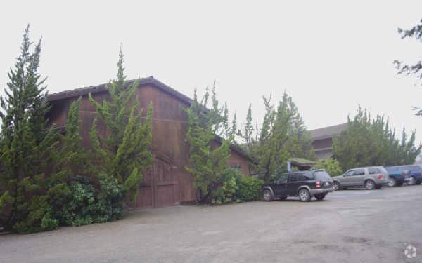

Property Detail
1791 Olivet Rd
057-022-018
86 FM 57-020-78 PER MD
Winery
Sonoma
LIA40
California
AE The base floodplain where base flood elevations are provided. AE Zones are now used on new format FIRMs instead of A1-A30 Zones.
12.17 AC
2025
Santa Rosa
2025
North Bay/Santa Rosa
152906
Santa Rosa-Petaluma, CA
13,800 SF
NEARBY LISTINGS FOR SALE OR LEASE
-
-
View all Santa Rosa listings for sale on LoopNet.com
DEMOGRAPHICS near 1791 Olivet Rd
1 mile
3 mile
5 mile
2025 Total Population
800
12,308
101,555
2030 Population
772
12,013
101,055
Pop Growth 2025-2030
(3.50%)
(2.40%)
(0.49%)
Average Age
46
44
42
2025 Total Households
303
4,608
37,048
HH Growth 2025-2030
(3.30%)
(2.58%)
(0.56%)
Median Household Inc
$111,805
$118,785
$99,319
Avg Household Size
2.60
2.60
2.60
2025 Avg HH Vehicles
3.00
2.00
2.00
Median Home Value
$796,428
$777,233
$730,938
Median Year Built
1977
1979
1981
Nearby Places
Map Layers
Map Styles
 Street
 Aerial
Layers
 Traffic
 Biking
Places
Listings with unknown addresses are not visible on the map
- Restaurants
- Banks
- Shops
- Fitness
- Groceries
PUBLIC TRANSPORTATION
COMMUTER RAIL
Smart Santa Rosa North (Main Line - Sonoma Marin Area Rail Transit)
Drive
Walk
Distance
Smart Santa Rosa North (Main Line - Sonoma Marin Area Rail Transit)
11 min
5.4 mi
Smart Santa Rosa Downtown (Main Line - Sonoma Marin Area Rail Transit)
Drive
Walk
Distance
Smart Santa Rosa Downtown (Main Line - Sonoma Marin Area Rail Transit)
14 min
7.0 mi
AIRPORT
Charles M Schulz - Sonoma County
Drive
Walk
Distance
Charles M Schulz - Sonoma County
16 min
5.9 mi
Freight Ports
Port of Richmond
Drive
Walk
Distance
Port of Richmond
75 min
55.1 mi
Nearby Properties
Address
Land Use
TOTAL SIZE
Lot Size
Zoning
Address
Land Use
TOTAL SIZE
Lot Size
Zoning
11,906 SF
0.12 AC
DA60
Address
Land Use
TOTAL SIZE
Lot Size
Zoning
71,800 SF
7.76 AC
CIPD
Address
Land Use
TOTAL SIZE
Lot Size
Zoning
100,704 SF
84.59 AC
Address
Land Use
TOTAL SIZE
Lot Size
Zoning
4,464 SF
19.16 AC
DA20
Address
Land Use
TOTAL SIZE
Lot Size
Zoning
14,962 SF
20.02 AC
Address
Land Use
TOTAL SIZE
Lot Size
Zoning
26,734 SF
9.55 AC
Address
Land Use
TOTAL SIZE
Lot Size
Zoning
64,235 SF
5.61 AC
CITYSR
Address
Land Use
TOTAL SIZE
Lot Size
Zoning
51,326 SF
3.51 AC
Address
Land Use
TOTAL SIZE
Lot Size
Zoning
3,515 SF
40.24 AC
Address
Land Use
TOTAL SIZE
Lot Size
Zoning
10,333 SF
96.67 AC
Address
Land Use
TOTAL SIZE
Lot Size
Zoning
2,029 SF
121.99 AC
Address
Land Use
TOTAL SIZE
Lot Size
Zoning
11,990 SF
9 AC
Address
Land Use
TOTAL SIZE
Lot Size
Zoning
1,630 SF
20 AC
Address
Land Use
TOTAL SIZE
Lot Size
Zoning
2,800 SF
262.94 AC
LEAB7FRZN
Address
Land Use
TOTAL SIZE
Lot Size
Zoning
6,082 SF
17.95 AC
Address
Land Use
TOTAL SIZE
Lot Size
Zoning
108.93 AC
LIA40
Address
Land Use
TOTAL SIZE
Lot Size
Zoning
25,036 SF
2.03 AC
PC
Address
Land Use
TOTAL SIZE
Lot Size
Zoning
13,883 SF
4 AC
Address
Land Use
TOTAL SIZE
Lot Size
Zoning
119.63 AC
LIA40
Address
Land Use
TOTAL SIZE
Lot Size
Zoning
18.05 AC
DA40
Address
Land Use
TOTAL SIZE
Lot Size
Zoning
1,972 SF
93.59 AC
Address
Land Use
TOTAL SIZE
Lot Size
Zoning
21,610 SF
69.97 AC
LEA60
Address
Land Use
TOTAL SIZE
Lot Size
Zoning
5,400 SF
56.30 AC
DA20
Address
Land Use
TOTAL SIZE
Lot Size
Zoning
1,440 SF
69 AC
LIA40
Address
Land Use
TOTAL SIZE
Lot Size
Zoning
43,968 SF
9.67 AC
Address
Land Use
TOTAL SIZE
Lot Size
Zoning
1,456 SF
0.14 AC
LIA40
Address
Land Use
TOTAL SIZE
Lot Size
Zoning
2,883 SF
17.42 AC
DA10
Address
Land Use
TOTAL SIZE
Lot Size
Zoning
4,100 SF
65.01 AC
LEA60
Address
Land Use
TOTAL SIZE
Lot Size
Zoning
46,285 SF
125.47 AC
The World's #1 Commercial Real Estate Marketplace
Connect with us
© 2026 CoStar Group
The information above has been obtained from sources believed reliable. While we do not doubt its accuracy we have not verified it and make no guarantee, warranty or representation about it. It is your responsibility to independently confirm its accuracy and completeness. Any projections, opinions, assumptions, or estimates used are for example only and do not represent the current or future performance of the property. The value of this transaction to you depends on tax and other factors which should be evaluated by your tax, financial, and legal advisors. You and your advisors should conduct a careful, independent investigation of the property to determine to your satisfaction the suitability of the property for your needs.