Property Record
1795 Old Highway 52, Moncks Corner, SC 29461


Property Detail
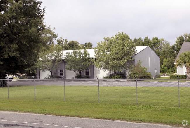
1795 Old Highway 52
181-02-02-004
ASSESSMENT DISTRICT: 960OFFICE BUILDING SMALL SEC15 PG18OWEN LOT
Distributionwarehouseregional
Berkeley
BERKELEY C
South Carolina
B and X Area of moderate flood hazard, usually the area between the limits of the 100-year and 500-year floods.
2.53 AC
2025
Outlying Berkeley County
2025
Charleston/N Charleston
020602
Charleston-North Charleston, SC
3,200 SF
NEARBY LISTINGS FOR SALE OR LEASE
-
-
View all Moncks Corner listings for sale on LoopNet.com
DEMOGRAPHICS near 1795 Old Highway 52
1 mile
3 mile
5 mile
2025 Total Population
2,173
13,902
44,450
2030 Population
2,448
15,710
50,602
Pop Growth 2025-2030
+ 12.66%
+ 13.01%
+ 13.84%
Average Age
37
37
38
2025 Total Households
757
4,802
15,775
HH Growth 2025-2030
+ 13.08%
+ 13.47%
+ 14.26%
Median Household Inc
$91,382
$87,787
$90,595
Avg Household Size
2.80
2.80
2.80
2025 Avg HH Vehicles
2.00
2.00
2.00
Median Home Value
$326,389
$319,174
$347,797
Median Year Built
2004
2005
2009
Nearby Places
Map Layers
Map Styles
 Street
 Aerial
Layers
 Traffic
 Biking
Places
Listings with unknown addresses are not visible on the map
- Restaurants
- Banks
- Shops
- Fitness
- Groceries
PUBLIC TRANSPORTATION
AIRPORT
Charleston AFB/International
Drive
Walk
Distance
Charleston AFB/International
33 min
22.2 mi
Freight Ports
North Charleston Terminal
Drive
Walk
Distance
North Charleston Terminal
27 min
20.6 mi
SALE & LEASE HISTORY
LISTING DATE
SALE/LEASE

Sep 23, 2016
For Sale
Nearby Properties
Address
Land Use
TOTAL SIZE
Lot Size
Zoning
Address
Land Use
TOTAL SIZE
Lot Size
Zoning
615,000 SF
85.05 AC
Address
Land Use
TOTAL SIZE
Lot Size
Zoning
96,375 SF
49.17 AC
MONCKS COR
Address
Land Use
TOTAL SIZE
Lot Size
Zoning
200,772 SF
30.94 AC
BERKELEY C
Address
Land Use
TOTAL SIZE
Lot Size
Zoning
93,800 SF
15 AC
BERKELEY C
Address
Land Use
TOTAL SIZE
Lot Size
Zoning
54,600 SF
21.23 AC
BERKELEY C
Address
Land Use
TOTAL SIZE
Lot Size
Zoning
3,000 SF
130.80 AC
Address
Land Use
TOTAL SIZE
Lot Size
Zoning
116,572 SF
12.37 AC
MONCKS COR
Address
Land Use
TOTAL SIZE
Lot Size
Zoning
4,000 SF
12.83 AC
BERKELEY C
Address
Land Use
TOTAL SIZE
Lot Size
Zoning
6,308 SF
6.14 AC
BERKELEY C
Address
Land Use
TOTAL SIZE
Lot Size
Zoning
37,921 SF
6.05 AC
MONCKS COR
Address
Land Use
TOTAL SIZE
Lot Size
Zoning
20,730 SF
12.58 AC
BERKELEY C
Address
Land Use
TOTAL SIZE
Lot Size
Zoning
1,131 SF
22 AC
Address
Land Use
TOTAL SIZE
Lot Size
Zoning
28.01 AC
MONCKS COR
Address
Land Use
TOTAL SIZE
Lot Size
Zoning
3,000 SF
154.36 AC
MONCKS COR
Address
Land Use
TOTAL SIZE
Lot Size
Zoning
31,920 SF
9.71 AC
BERKELEY C
Address
Land Use
TOTAL SIZE
Lot Size
Zoning
38,976 SF
18.29 AC
MONCKS COR
Address
Land Use
TOTAL SIZE
Lot Size
Zoning
20,528 SF
5.30 AC
MONCKS COR
Address
Land Use
TOTAL SIZE
Lot Size
Zoning
17.60 AC
MONCKS COR
Address
Land Use
TOTAL SIZE
Lot Size
Zoning
19,166 SF
177.36 AC
BERKELEY C
Address
Land Use
TOTAL SIZE
Lot Size
Zoning
17,536 SF
4.89 AC
BERKELEY C
Address
Land Use
TOTAL SIZE
Lot Size
Zoning
8,050 SF
154.50 AC
BERKELEY C
Address
Land Use
TOTAL SIZE
Lot Size
Zoning
16,605 SF
2.06 AC
BERKELEY C
Address
Land Use
TOTAL SIZE
Lot Size
Zoning
10.01 AC
BERKELEY C
Address
Land Use
TOTAL SIZE
Lot Size
Zoning
8,397 SF
4.58 AC
BERKELEY C
Address
Land Use
TOTAL SIZE
Lot Size
Zoning
57.59 AC
MONCKS COR
Address
Land Use
TOTAL SIZE
Lot Size
Zoning
9,040 SF
1.79 AC
BERKELEY C
Address
Land Use
TOTAL SIZE
Lot Size
Zoning
4,298 SF
29.08 AC
BERKELEY C
Address
Land Use
TOTAL SIZE
Lot Size
Zoning
11,250 SF
3.97 AC
BERKELEY C
Address
Land Use
TOTAL SIZE
Lot Size
Zoning
15,350 SF
12.70 AC
BERKELEY C
The World's #1 Commercial Real Estate Marketplace
Connect with us
© 2026 CoStar Group
The information above has been obtained from sources believed reliable. While we do not doubt its accuracy we have not verified it and make no guarantee, warranty or representation about it. It is your responsibility to independently confirm its accuracy and completeness. Any projections, opinions, assumptions, or estimates used are for example only and do not represent the current or future performance of the property. The value of this transaction to you depends on tax and other factors which should be evaluated by your tax, financial, and legal advisors. You and your advisors should conduct a careful, independent investigation of the property to determine to your satisfaction the suitability of the property for your needs.