Property Record
1796 Kernan Blvd S, Jacksonville, FL 32246


NEARBY LISTINGS FOR SALE OR LEASE
Property Detail
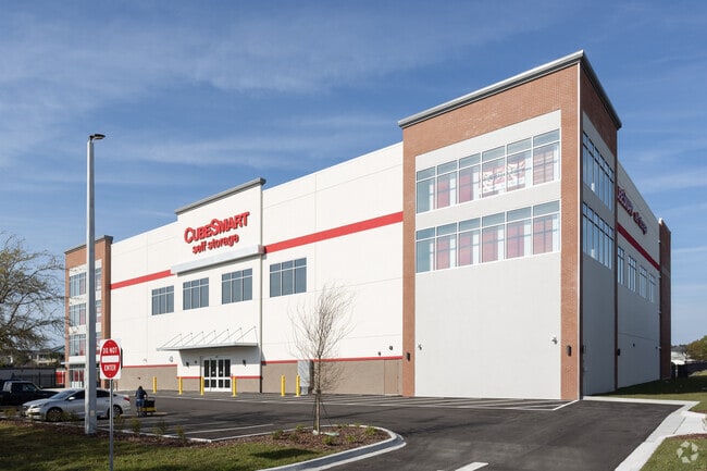
1796 Kernan Blvd S
Jacksonville, FL
Section Land
165264-0060
21-2S-28E 2.22 PT GOVT LOT 8 RECD O/R 18623-777
Warehouse
Duval
X
Florida
12031C0403J
8
2025
2.22 AC
2026
Southside
014344
Jacksonville (Florida)
58,261 SF
DEMOGRAPHICS near 1796 Kernan Blvd S
1 Mile
3 Mile
5 Mile
2024 Total Population
10,894
83,300
187,658
2029 Population
11,202
86,639
195,531
Pop Growth 2024-2029
+ 2.83%
+ 4.01%
+ 4.20%
Average Age
37
38
38
2024 Total Households
3,912
31,888
74,451
HH Growth 2024-2029
+ 2.86%
+ 4.11%
+ 4.30%
Median Household Inc
$88,115
$82,145
$73,059
Avg Household Size
2.70
2.50
2.40
2024 Avg HH Vehicles
2.00
2.00
2.00
Median Home Value
$307,180
$295,282
$291,281
Median Year Built
2000
1995
1993
Nearby Places
Map Layers
Map Styles
 Street
 Aerial
- Restaurants
- Banks
- Shops
- Fitness
- Groceries
PUBLIC TRANSPORTATION
AIRPORT
Jacksonville International
DRIVE
WALK
Distance
Jacksonville International
31 min
20.5 mi
Freight Ports
Jacksonville Port
DRIVE
WALK
Distance
Jacksonville Port
22 min
12.2 mi
Nearby Properties
Address
Land Use
TOTAL SIZE
Lot Size
Zoning
Address
Land Use
TOTAL SIZE
Lot Size
Zoning
461,453 SF
46.69 AC
PUD
Address
Land Use
TOTAL SIZE
Lot Size
Zoning
377,617 SF
23.38 AC
PUD
Address
Land Use
TOTAL SIZE
Lot Size
Zoning
375,307 SF
29.13 AC
PUD
Address
Land Use
TOTAL SIZE
Lot Size
Zoning
178,884 SF
12.54 AC
PUD
Address
Land Use
TOTAL SIZE
Lot Size
Zoning
364,605 SF
33.94 AC
PUD
Address
Land Use
TOTAL SIZE
Lot Size
Zoning
361,268 SF
15.27 AC
PUD
Address
Land Use
TOTAL SIZE
Lot Size
Zoning
194,953 SF
22.43 AC
PUD
Address
Land Use
TOTAL SIZE
Lot Size
Zoning
389,030 SF
26.39 AC
PUD
Address
Land Use
TOTAL SIZE
Lot Size
Zoning
404,896 SF
36.51 AC
PUD
Address
Land Use
TOTAL SIZE
Lot Size
Zoning
395,677 SF
45.86 AC
PUD
Address
Land Use
TOTAL SIZE
Lot Size
Zoning
304,922 SF
26.28 AC
PUD
Address
Land Use
TOTAL SIZE
Lot Size
Zoning
277,959 SF
14.39 AC
PUD
Address
Land Use
TOTAL SIZE
Lot Size
Zoning
176,465 SF
10.33 AC
PUD
Address
Land Use
TOTAL SIZE
Lot Size
Zoning
302,329 SF
28.90 AC
PUD
Address
Land Use
TOTAL SIZE
Lot Size
Zoning
266,120 SF
14.60 AC
PUD
Address
Land Use
TOTAL SIZE
Lot Size
Zoning
345,122 SF
19.85 AC
RMD-D
Address
Land Use
TOTAL SIZE
Lot Size
Zoning
107,297 SF
6.14 AC
PUD
Address
Land Use
TOTAL SIZE
Lot Size
Zoning
471,372 SF
1,071.38 AC
PUD
Address
Land Use
TOTAL SIZE
Lot Size
Zoning
184,563 SF
125.66 AC
PBF-1
Address
Land Use
TOTAL SIZE
Lot Size
Zoning
214,460 SF
19.77 AC
RMD-C
Address
Land Use
TOTAL SIZE
Lot Size
Zoning
135,141 SF
12.14 AC
PUD
Address
Land Use
TOTAL SIZE
Lot Size
Zoning
130,426 SF
18 AC
PUD
Address
Land Use
TOTAL SIZE
Lot Size
Zoning
284,164 SF
29.53 AC
PUD
Address
Land Use
TOTAL SIZE
Lot Size
Zoning
267,103 SF
17.31 AC
RMD-C
Address
Land Use
TOTAL SIZE
Lot Size
Zoning
125,088 SF
6.62 AC
RMD-D
Address
Land Use
TOTAL SIZE
Lot Size
Zoning
52,116 SF
15.05 AC
PUD
Address
Land Use
TOTAL SIZE
Lot Size
Zoning
80,308 SF
12.07 AC
PUD
Address
Land Use
TOTAL SIZE
Lot Size
Zoning
122,854 SF
12.25 AC
PUD
Address
Land Use
TOTAL SIZE
Lot Size
Zoning
171,731 SF
17.56 AC
RMD-D
Address
Land Use
TOTAL SIZE
Lot Size
Zoning
115,628 SF
6.26 AC
CRO
The World's #1 Commercial Real Estate Marketplace
Connect with us
© 2025 CoStar Group
The information above has been obtained from sources believed reliable. While we do not doubt its accuracy we have not verified it and make no guarantee, warranty or representation about it. It is your responsibility to independently confirm its accuracy and completeness. Any projections, opinions, assumptions, or estimates used are for example only and do not represent the current or future performance of the property. The value of this transaction to you depends on tax and other factors which should be evaluated by your tax, financial, and legal advisors. You and your advisors should conduct a careful, independent investigation of the property to determine to your satisfaction the suitability of the property for your needs.