Property Record
17991 Grange Hall Loop, Wimauma, FL 33598

Property Detail
17991 Grange Hall Loop
Tampa-St. Petersburg-Clearwater, FL
N 1/2 OF SW 1/4 NOW PREVATT PRESERVE PHASE 1 PB 141 PG 233 2022 SEE 088920-0170 PIN U-18-32-21-C7E-000000-00000.0
U-18-32-21-ZZZ-000004-52820.0
HILLSBOROUGH
Miscellaneous
Florida
A
52820
AE The base floodplain where base flood elevations are provided. AE Zones are now used on new format FIRMs instead of A1-A30 Zones.
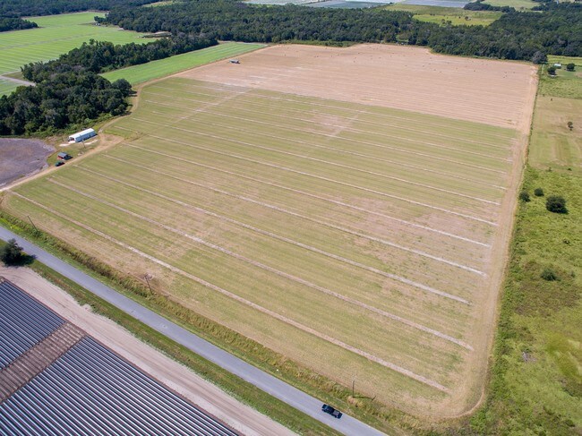
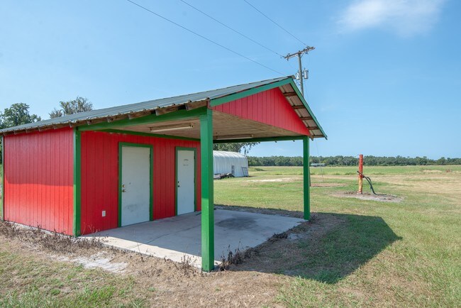
81.74 AC
0
Eastern Outlying
2025
Tampa/St Petersburg
013914
NEARBY LISTINGS FOR SALE OR LEASE
-
-
View all Wimauma listings for sale on LoopNet.com
DEMOGRAPHICS near 17991 Grange Hall Loop
1 mile
3 mile
5 mile
2025 Total Population
103
831
6,046
2030 Population
114
932
6,771
Pop Growth 2025-2030
+ 10.68%
+ 12.15%
+ 11.99%
Average Age
41
41
36
2025 Total Households
36
282
1,765
HH Growth 2025-2030
+ 11.11%
+ 12.41%
+ 12.35%
Median Household Inc
$34,999
$71,428
$69,170
Avg Household Size
2.80
2.80
3.20
2025 Avg HH Vehicles
2.00
3.00
2.00
Median Home Value
$583,333
$450,000
$407,905
Median Year Built
1987
1990
2009
Nearby Places
Map Layers
Map Styles
 Street
 Aerial
Transit
 Traffic
 Biking
Places
Listings with unknown addresses are not visible on the map
- Restaurants
- Banks
- Shops
- Fitness
- Groceries
PUBLIC TRANSPORTATION
AIRPORT
Tampa International
Drive
Walk
Distance
Tampa International
59 min
38.1 mi
Sarasota/Bradenton International
Drive
Walk
Distance
Sarasota/Bradenton International
59 min
38.2 mi
Freight Ports
Port Manatee
Drive
Walk
Distance
Port Manatee
37 min
22.7 mi
SALE & LEASE HISTORY
LISTING DATE
SALE/LEASE

Oct 11, 2019
For Sale
Nearby Properties
Address
Land Use
TOTAL SIZE
Lot Size
Zoning
Address
Land Use
TOTAL SIZE
Lot Size
Zoning
2,051.62 AC
AR
Address
Land Use
TOTAL SIZE
Lot Size
Zoning
737.49 AC
AM
Address
Land Use
TOTAL SIZE
Lot Size
Zoning
543.83 AC
AM
Address
Land Use
TOTAL SIZE
Lot Size
Zoning
675.65 AC
A
Address
Land Use
TOTAL SIZE
Lot Size
Zoning
3,010 SF
486.85 AC
AM
Address
Land Use
TOTAL SIZE
Lot Size
Zoning
3,072 SF
250.91 AC
AR
Address
Land Use
TOTAL SIZE
Lot Size
Zoning
2,686 SF
83.76 AC
AM
Address
Land Use
TOTAL SIZE
Lot Size
Zoning
77,067 SF
5 AC
AR
Address
Land Use
TOTAL SIZE
Lot Size
Zoning
1,152 SF
276.54 AC
AR
Address
Land Use
TOTAL SIZE
Lot Size
Zoning
155.18 AC
AR
Address
Land Use
TOTAL SIZE
Lot Size
Zoning
185.11 AC
A
Address
Land Use
TOTAL SIZE
Lot Size
Zoning
477.30 AC
AM
Address
Land Use
TOTAL SIZE
Lot Size
Zoning
1,152 SF
167.26 AC
AM
Address
Land Use
TOTAL SIZE
Lot Size
Zoning
157.43 AC
AM
Address
Land Use
TOTAL SIZE
Lot Size
Zoning
6,128 SF
39.17 AC
AM
Address
Land Use
TOTAL SIZE
Lot Size
Zoning
2,002 SF
368.53 AC
AM
Address
Land Use
TOTAL SIZE
Lot Size
Zoning
17,812 SF
27.25 AC
AR
Address
Land Use
TOTAL SIZE
Lot Size
Zoning
89,015 SF
202.73 AC
AR
Address
Land Use
TOTAL SIZE
Lot Size
Zoning
6,753 SF
40.76 AC
A
Address
Land Use
TOTAL SIZE
Lot Size
Zoning
81.59 AC
AM
Address
Land Use
TOTAL SIZE
Lot Size
Zoning
53.49 AC
A
Address
Land Use
TOTAL SIZE
Lot Size
Zoning
96.22 AC
AR
Address
Land Use
TOTAL SIZE
Lot Size
Zoning
48.37 AC
A
Address
Land Use
TOTAL SIZE
Lot Size
Zoning
4,800 SF
5.02 AC
AR
Address
Land Use
TOTAL SIZE
Lot Size
Zoning
5,828 SF
7.49 AC
AR
Address
Land Use
TOTAL SIZE
Lot Size
Zoning
29.93 AC
AR
Address
Land Use
TOTAL SIZE
Lot Size
Zoning
35.65 AC
A
Address
Land Use
TOTAL SIZE
Lot Size
Zoning
5,923 SF
19.03 AC
A
Address
Land Use
TOTAL SIZE
Lot Size
Zoning
521.23 AC
AR
Address
Land Use
TOTAL SIZE
Lot Size
Zoning
6,430 SF
22.14 AC
AR
The World's #1 Commercial Real Estate Marketplace
Connect with us
© 2026 CoStar Group
The information above has been obtained from sources believed reliable. While we do not doubt its accuracy we have not verified it and make no guarantee, warranty or representation about it. It is your responsibility to independently confirm its accuracy and completeness. Any projections, opinions, assumptions, or estimates used are for example only and do not represent the current or future performance of the property. The value of this transaction to you depends on tax and other factors which should be evaluated by your tax, financial, and legal advisors. You and your advisors should conduct a careful, independent investigation of the property to determine to your satisfaction the suitability of the property for your needs.