Property Record
18 Augusta Pines Dr, Spring, TX 77389
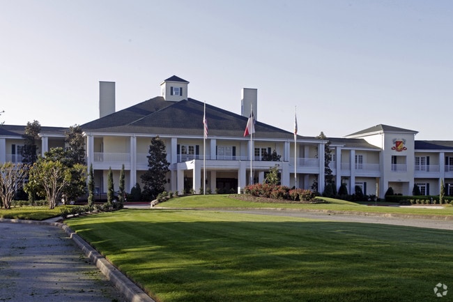

Property Detail
18 Augusta Pines Dr
1216710010001
RES A1 BLK 1 AUGUSTA PINES SEC 1
Countryclub
HARRIS
B and X Area of moderate flood hazard, usually the area between the limits of the 100-year and 500-year floods.
Texas
2024
10.25 AC
2025
The Woodlands
554902
Houston
60,425 SF
Houston-Pasadena-The Woodlands, TX
NEARBY LISTINGS FOR SALE OR LEASE
DEMOGRAPHICS near 18 Augusta Pines Dr
1 mile
3 mile
5 mile
2025 Total Population
13,497
67,853
184,081
2030 Population
14,621
73,999
205,092
Pop Growth 2025-2030
+ 8.33%
+ 9.06%
+ 11.41%
Average Age
38
37
38
2025 Total Households
4,458
23,152
65,226
HH Growth 2025-2030
+ 8.64%
+ 9.49%
+ 12.20%
Median Household Inc
$152,653
$123,496
$119,478
Avg Household Size
3.00
2.90
2.80
2025 Avg HH Vehicles
2.00
2.00
2.00
Median Home Value
$473,064
$404,996
$411,601
Median Year Built
2010
2010
2006
Nearby Places
Map Layers
Map Styles
 Street
 Aerial
Transit
 Traffic
 Biking
Places
Listings with unknown addresses are not visible on the map
- Restaurants
- Banks
- Shops
- Fitness
- Groceries
PUBLIC TRANSPORTATION
AIRPORT
George Bush Intcntl/Houston
Drive
Walk
Distance
George Bush Intcntl/Houston
37 min
25.9 mi
Freight Ports
Port of Houston
Drive
Walk
Distance
Port of Houston
60 min
41.7 mi
SALE & LEASE HISTORY
LISTING DATE
SALE/LEASE

Sep 26, 2016
For Lease
Oct 03, 2017
For Lease
Mar 01, 2022
For Lease
Dec 22, 2016
For Lease
Aug 03, 2021
For Lease
Nearby Properties
Address
Land Use
TOTAL SIZE
Lot Size
Zoning
Address
Land Use
TOTAL SIZE
Lot Size
Zoning
370,296 SF
14.05 AC
Address
Land Use
TOTAL SIZE
Lot Size
Zoning
454,599 SF
22.79 AC
Address
Land Use
TOTAL SIZE
Lot Size
Zoning
156,885 SF
26.24 AC
Address
Land Use
TOTAL SIZE
Lot Size
Zoning
289,737 SF
13.83 AC
Address
Land Use
TOTAL SIZE
Lot Size
Zoning
409,309 SF
20.47 AC
Address
Land Use
TOTAL SIZE
Lot Size
Zoning
323,119 SF
14.37 AC
Address
Land Use
TOTAL SIZE
Lot Size
Zoning
306,815 SF
14.88 AC
Address
Land Use
TOTAL SIZE
Lot Size
Zoning
296,117 SF
21.52 AC
Address
Land Use
TOTAL SIZE
Lot Size
Zoning
212,071 SF
7 AC
Address
Land Use
TOTAL SIZE
Lot Size
Zoning
163,392 SF
4.53 AC
Address
Land Use
TOTAL SIZE
Lot Size
Zoning
87,445 SF
6.45 AC
Address
Land Use
TOTAL SIZE
Lot Size
Zoning
800 SF
23.53 AC
Address
Land Use
TOTAL SIZE
Lot Size
Zoning
233,293 SF
13.20 AC
Address
Land Use
TOTAL SIZE
Lot Size
Zoning
106,857 SF
10.12 AC
Address
Land Use
TOTAL SIZE
Lot Size
Zoning
76,841 SF
12.17 AC
Address
Land Use
TOTAL SIZE
Lot Size
Zoning
120,220 SF
13.49 AC
Address
Land Use
TOTAL SIZE
Lot Size
Zoning
100,374 SF
11.24 AC
Address
Land Use
TOTAL SIZE
Lot Size
Zoning
182,115 SF
16.52 AC
Address
Land Use
TOTAL SIZE
Lot Size
Zoning
74,786 SF
5.90 AC
Address
Land Use
TOTAL SIZE
Lot Size
Zoning
35,560 SF
4 AC
Address
Land Use
TOTAL SIZE
Lot Size
Zoning
48,525 SF
4.68 AC
Address
Land Use
TOTAL SIZE
Lot Size
Zoning
66,946 SF
5.28 AC
Address
Land Use
TOTAL SIZE
Lot Size
Zoning
34,892 SF
2.99 AC
Address
Land Use
TOTAL SIZE
Lot Size
Zoning
110,280 SF
10.80 AC
Address
Land Use
TOTAL SIZE
Lot Size
Zoning
65,968 SF
8.29 AC
6
Address
Land Use
TOTAL SIZE
Lot Size
Zoning
29,611 SF
4.03 AC
Address
Land Use
TOTAL SIZE
Lot Size
Zoning
109,430 SF
3.12 AC
Address
Land Use
TOTAL SIZE
Lot Size
Zoning
77,441 SF
7.35 AC
Address
Land Use
TOTAL SIZE
Lot Size
Zoning
63,190 SF
7.47 AC
Address
Land Use
TOTAL SIZE
Lot Size
Zoning
48.36 AC
The World's #1 Commercial Real Estate Marketplace
Connect with us
© 2026 CoStar Group
The information above has been obtained from sources believed reliable. While we do not doubt its accuracy we have not verified it and make no guarantee, warranty or representation about it. It is your responsibility to independently confirm its accuracy and completeness. Any projections, opinions, assumptions, or estimates used are for example only and do not represent the current or future performance of the property. The value of this transaction to you depends on tax and other factors which should be evaluated by your tax, financial, and legal advisors. You and your advisors should conduct a careful, independent investigation of the property to determine to your satisfaction the suitability of the property for your needs.