Property Record
18 Chuck Dr, Dracut, MA 01826
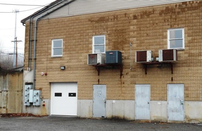

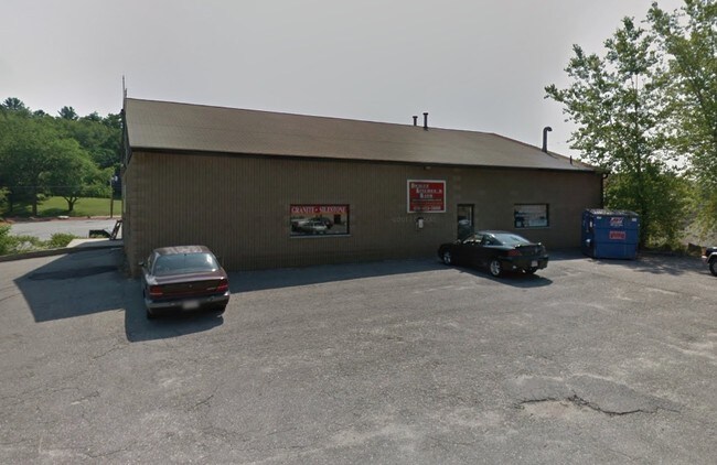
Property Detail
18 Chuck Dr
DRAC-000029-000003-000048
Middlesex
Commercialbuilding
Massachusetts
B4
48
AE The base floodplain where base flood elevations are provided. AE Zones are now used on new format FIRMs instead of A1-A30 Zones.
0.65 AC
2025
Groton/Townsend
2025
Boston
314200
Boston-Cambridge-Newton, MA-NH
4,500 SF
NEARBY LISTINGS FOR SALE OR LEASE
DEMOGRAPHICS near 18 Chuck Dr
1 mile
3 mile
5 mile
2025 Total Population
3,408
79,094
185,172
2030 Population
3,542
81,631
190,891
Pop Growth 2025-2030
+ 3.93%
+ 3.21%
+ 3.09%
Average Age
42
39
40
2025 Total Households
1,198
29,154
66,728
HH Growth 2025-2030
+ 4.01%
+ 3.40%
+ 3.25%
Median Household Inc
$103,750
$83,508
$94,648
Avg Household Size
2.80
2.50
2.60
2025 Avg HH Vehicles
2.00
2.00
2.00
Median Home Value
$516,899
$459,510
$482,577
Median Year Built
1973
1963
1965
Nearby Places
Map Layers
Map Styles
 Street
 Aerial
Transit
 Traffic
 Biking
Places
Listings with unknown addresses are not visible on the map
- Restaurants
- Banks
- Shops
- Fitness
- Groceries
PUBLIC TRANSPORTATION
COMMUTER RAIL
Lowell (Lowell Line - Massachusetts Bay Transportation Authority Commuter Rail (Purple Line))
Drive
Walk
Distance
Lowell (Lowell Line - Massachusetts Bay Transportation Authority Commuter Rail (Purple Line))
10 min
4.1 mi
North Billerica (Lowell Line - Massachusetts Bay Transportation Authority Commuter Rail (Purple Line))
Drive
Walk
Distance
North Billerica (Lowell Line - Massachusetts Bay Transportation Authority Commuter Rail (Purple Line))
18 min
7.6 mi
AIRPORT
Manchester Boston Regional
Drive
Walk
Distance
Manchester Boston Regional
48 min
26.4 mi
General Edward Lawrence Logan International
Drive
Walk
Distance
General Edward Lawrence Logan International
51 min
34.6 mi
SALE & LEASE HISTORY
LISTING DATE
SALE/LEASE

Feb 14, 2019
For Lease
Nearby Properties
Address
Land Use
TOTAL SIZE
Lot Size
Zoning
Address
Land Use
TOTAL SIZE
Lot Size
Zoning
70.20 AC
R3
Address
Land Use
TOTAL SIZE
Lot Size
Zoning
30,744 SF
31.28 AC
INST
Address
Land Use
TOTAL SIZE
Lot Size
Zoning
803 SF
3.29 AC
R1
Address
Land Use
TOTAL SIZE
Lot Size
Zoning
215,884 SF
1.55 AC
DMU
Address
Land Use
TOTAL SIZE
Lot Size
Zoning
134,439 SF
3.29 AC
DMU
Address
Land Use
TOTAL SIZE
Lot Size
Zoning
2.15 AC
INST
Address
Land Use
TOTAL SIZE
Lot Size
Zoning
6.27 AC
DMU
Address
Land Use
TOTAL SIZE
Lot Size
Zoning
225,252 SF
2.31 AC
DMU
Address
Land Use
TOTAL SIZE
Lot Size
Zoning
10.48 AC
INST
Address
Land Use
TOTAL SIZE
Lot Size
Zoning
168,114 SF
0.17 AC
UMU
Address
Land Use
TOTAL SIZE
Lot Size
Zoning
2.62 AC
INST
Address
Land Use
TOTAL SIZE
Lot Size
Zoning
7.25 AC
INST
Address
Land Use
TOTAL SIZE
Lot Size
Zoning
167,201 SF
6.31 AC
DMU
Address
Land Use
TOTAL SIZE
Lot Size
Zoning
20.88 AC
TSF
Address
Land Use
TOTAL SIZE
Lot Size
Zoning
185,172 SF
2.93 AC
DMU
Address
Land Use
TOTAL SIZE
Lot Size
Zoning
245,562 SF
1.44 AC
DMU
Address
Land Use
TOTAL SIZE
Lot Size
Zoning
33.01 AC
R3
Address
Land Use
TOTAL SIZE
Lot Size
Zoning
2.35 AC
DMU
Address
Land Use
TOTAL SIZE
Lot Size
Zoning
152,930 SF
3.44 AC
UMU
Address
Land Use
TOTAL SIZE
Lot Size
Zoning
122,533 SF
2.37 AC
DMU
Address
Land Use
TOTAL SIZE
Lot Size
Zoning
50 AC
R
Address
Land Use
TOTAL SIZE
Lot Size
Zoning
105,826 SF
2.27 AC
DMU
Address
Land Use
TOTAL SIZE
Lot Size
Zoning
1.41 AC
UMU
Address
Land Use
TOTAL SIZE
Lot Size
Zoning
8,528 SF
4.59 AC
UMF
Address
Land Use
TOTAL SIZE
Lot Size
Zoning
187,442 SF
1.43 AC
DMU
Address
Land Use
TOTAL SIZE
Lot Size
Zoning
119,372 SF
1.74 AC
INST
Address
Land Use
TOTAL SIZE
Lot Size
Zoning
3.59 AC
UMF
Address
Land Use
TOTAL SIZE
Lot Size
Zoning
73,965 SF
1.33 AC
TTF
Address
Land Use
TOTAL SIZE
Lot Size
Zoning
3,822 SF
1.88 AC
INST
Address
Land Use
TOTAL SIZE
Lot Size
Zoning
70,004 SF
9.32 AC
UMF
The World's #1 Commercial Real Estate Marketplace
Connect with us
© 2026 CoStar Group
The information above has been obtained from sources believed reliable. While we do not doubt its accuracy we have not verified it and make no guarantee, warranty or representation about it. It is your responsibility to independently confirm its accuracy and completeness. Any projections, opinions, assumptions, or estimates used are for example only and do not represent the current or future performance of the property. The value of this transaction to you depends on tax and other factors which should be evaluated by your tax, financial, and legal advisors. You and your advisors should conduct a careful, independent investigation of the property to determine to your satisfaction the suitability of the property for your needs.