Property Record
18 Hadley Heights Way, Assonet, MA 02702
NEARBY LISTINGS FOR SALE OR LEASE
-
-
View all Assonet listings for sale on LoopNet.com
Property Detail
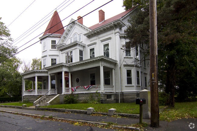
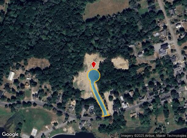
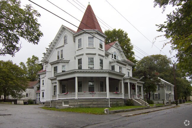
18 Hadley Heights Way
Parkinglot
Bristol
AE
Massachusetts
25005C0262G
0.59 AC
2025
Attleboro/New Bedford
2025
Boston
617101
Providence-Warwick, RI-MA
7,192 SF
FREE-000211-000000-000216
DEMOGRAPHICS near 18 Hadley Heights Way
1 Mile
3 Mile
5 Mile
2024 Total Population
1,269
8,213
34,870
2029 Population
1,250
8,141
34,720
Pop Growth 2024-2029
(1.50%)
(0.88%)
(0.43%)
Average Age
42
42
42
2024 Total Households
456
2,932
12,990
HH Growth 2024-2029
(1.54%)
(0.95%)
(0.42%)
Median Household Inc
$114,655
$113,909
$99,352
Avg Household Size
2.70
2.80
2.60
2024 Avg HH Vehicles
2.00
2.00
2.00
Median Home Value
$443,820
$448,413
$422,041
Median Year Built
1978
1980
1979
Nearby Places
Map Layers
Map Styles
 Street
 Aerial
- Restaurants
- Banks
- Shops
- Fitness
- Groceries
PUBLIC TRANSPORTATION
AIRPORT
Rhode Island Tf Green International
DRIVE
WALK
Distance
Rhode Island Tf Green International
46 min
30.0 mi
Freight Ports
Port of New Bedford Harbor
DRIVE
WALK
Distance
Port of New Bedford Harbor
28 min
21.5 mi
SALE & LEASE HISTORY
LISTING DATE
SALE/LEASE

Sep 11, 2019
For Sale
Nearby Properties
Address
Land Use
TOTAL SIZE
Lot Size
Zoning
Address
Land Use
TOTAL SIZE
Lot Size
Zoning
174.51 AC
I
Address
Land Use
TOTAL SIZE
Lot Size
Zoning
387.83 AC
I
Address
Land Use
TOTAL SIZE
Lot Size
Zoning
53.87 AC
N/A
Address
Land Use
TOTAL SIZE
Lot Size
Zoning
65.74 AC
B
Address
Land Use
TOTAL SIZE
Lot Size
Zoning
26.51 AC
G
Address
Land Use
TOTAL SIZE
Lot Size
Zoning
108,692 SF
10.80 AC
R1
Address
Land Use
TOTAL SIZE
Lot Size
Zoning
10,400 SF
54 AC
G
Address
Land Use
TOTAL SIZE
Lot Size
Zoning
39,944 SF
47.07 AC
I2
Address
Land Use
TOTAL SIZE
Lot Size
Zoning
34.88 AC
G
Address
Land Use
TOTAL SIZE
Lot Size
Zoning
2,295.68 AC
OSR
Address
Land Use
TOTAL SIZE
Lot Size
Zoning
65,800 SF
24.31 AC
I2
Address
Land Use
TOTAL SIZE
Lot Size
Zoning
649 AC
OSR
Address
Land Use
TOTAL SIZE
Lot Size
Zoning
7,867 SF
27 AC
R1
Address
Land Use
TOTAL SIZE
Lot Size
Zoning
3.99 AC
G
Address
Land Use
TOTAL SIZE
Lot Size
Zoning
37,620 SF
12.02 AC
N/A
Address
Land Use
TOTAL SIZE
Lot Size
Zoning
2.50 AC
B
Address
Land Use
TOTAL SIZE
Lot Size
Zoning
90 AC
G
Address
Land Use
TOTAL SIZE
Lot Size
Zoning
5.70 AC
R
Address
Land Use
TOTAL SIZE
Lot Size
Zoning
6,553 SF
4.46 AC
G
Address
Land Use
TOTAL SIZE
Lot Size
Zoning
39 AC
G
Address
Land Use
TOTAL SIZE
Lot Size
Zoning
4.96 AC
I
Address
Land Use
TOTAL SIZE
Lot Size
Zoning
2,520 SF
3.13 AC
B
Address
Land Use
TOTAL SIZE
Lot Size
Zoning
4,000 SF
26 AC
OSR
Address
Land Use
TOTAL SIZE
Lot Size
Zoning
57,900 SF
10.20 AC
I
Address
Land Use
TOTAL SIZE
Lot Size
Zoning
134.03 AC
G
Address
Land Use
TOTAL SIZE
Lot Size
Zoning
16,851 SF
2.59 AC
B
Address
Land Use
TOTAL SIZE
Lot Size
Zoning
4.26 AC
G
Address
Land Use
TOTAL SIZE
Lot Size
Zoning
9,022 SF
16.75 AC
G
Address
Land Use
TOTAL SIZE
Lot Size
Zoning
4.93 AC
I
Address
Land Use
TOTAL SIZE
Lot Size
Zoning
11.40 AC
G
The World's #1 Commercial Real Estate Marketplace
Connect with us
© 2025 CoStar Group
The information above has been obtained from sources believed reliable. While we do not doubt its accuracy we have not verified it and make no guarantee, warranty or representation about it. It is your responsibility to independently confirm its accuracy and completeness. Any projections, opinions, assumptions, or estimates used are for example only and do not represent the current or future performance of the property. The value of this transaction to you depends on tax and other factors which should be evaluated by your tax, financial, and legal advisors. You and your advisors should conduct a careful, independent investigation of the property to determine to your satisfaction the suitability of the property for your needs.