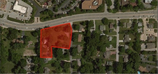
Property Record
18 Sona Ln, Saint Louis, MO 63141
Property Detail
18 Sona Ln
St. Louis, MO-IL
OLIVE CREST FIRST ADDITION LOT PTS 7 THRU 9
17N-61-0688
Saint Louis
Vacantlandnec
Missouri
82C
7-9
B and X Area of moderate flood hazard, usually the area between the limits of the 100-year and 500-year floods.
0.87 AC
2024
Creve Coeur/Hwy-67
2025
St. Louis
215301
NEARBY LISTINGS FOR SALE OR LEASE
DEMOGRAPHICS near 18 Sona Ln
1 mile
3 mile
5 mile
2025 Total Population
9,262
62,691
195,246
2030 Population
9,200
62,205
193,761
Pop Growth 2025-2030
(0.67%)
(0.78%)
(0.76%)
Average Age
43
41
41
2025 Total Households
4,147
26,704
83,044
HH Growth 2025-2030
(0.84%)
(0.86%)
(0.78%)
Median Household Inc
$93,809
$92,769
$89,547
Avg Household Size
2.20
2.30
2.30
2025 Avg HH Vehicles
2.00
2.00
2.00
Median Home Value
$369,952
$369,480
$300,348
Median Year Built
1975
1969
1965
Nearby Places
Map Layers
Map Styles
 Street
 Aerial
Layers
 Traffic
 Biking
Places
Listings with unknown addresses are not visible on the map
- Restaurants
- Banks
- Shops
- Fitness
- Groceries
PUBLIC TRANSPORTATION
COMMUTER RAIL
Clayton (Shrewsbury-Lansdowne I-44 Emerson Park - St. Louis MetroLink (MetroLink))
Drive
Walk
Distance
Clayton (Shrewsbury-Lansdowne I-44 Emerson Park - St. Louis MetroLink (MetroLink))
11 min
5.6 mi
Richmond Heights (Shrewsbury-Lansdowne I-44 Emerson Park - St. Louis MetroLink (MetroLink))
Drive
Walk
Distance
Richmond Heights (Shrewsbury-Lansdowne I-44 Emerson Park - St. Louis MetroLink (MetroLink))
13 min
6.5 mi
AIRPORT
St Louis Lambert International
Drive
Walk
Distance
St Louis Lambert International
17 min
9.9 mi
Scott AFB/Midamerica St Louis
Drive
Walk
Distance
Scott AFB/Midamerica St Louis
60 min
40.0 mi
SALE & LEASE HISTORY
LISTING DATE
SALE/LEASE

Sep 24, 2016
For Sale
Nearby Properties
Address
Land Use
TOTAL SIZE
Lot Size
Zoning
Address
Land Use
TOTAL SIZE
Lot Size
Zoning
20,852 SF
48.33 AC
82PH
Address
Land Use
TOTAL SIZE
Lot Size
Zoning
389,075 SF
19.85 AC
83H
Address
Land Use
TOTAL SIZE
Lot Size
Zoning
1,053,686 SF
31.40 AC
43M-1
Address
Land Use
TOTAL SIZE
Lot Size
Zoning
43,617 SF
7.04 AC
83O
Address
Land Use
TOTAL SIZE
Lot Size
Zoning
52.13 AC
42PA
Address
Land Use
TOTAL SIZE
Lot Size
Zoning
3,220 SF
31.26 AC
CB
Address
Land Use
TOTAL SIZE
Lot Size
Zoning
434,971 SF
24.80 AC
G
Address
Land Use
TOTAL SIZE
Lot Size
Zoning
201,879 SF
29.52 AC
82RO
Address
Land Use
TOTAL SIZE
Lot Size
Zoning
442,503 SF
3.52 AC
82PH
Address
Land Use
TOTAL SIZE
Lot Size
Zoning
56.62 AC
82A
Address
Land Use
TOTAL SIZE
Lot Size
Zoning
1,280,539 SF
151.20 AC
H
Address
Land Use
TOTAL SIZE
Lot Size
Zoning
544,556 SF
95.75 AC
H
Address
Land Use
TOTAL SIZE
Lot Size
Zoning
4,150 SF
21.42 AC
83H
Address
Land Use
TOTAL SIZE
Lot Size
Zoning
31.83 AC
R2
Address
Land Use
TOTAL SIZE
Lot Size
Zoning
292,543 SF
10.11 AC
CB
Address
Land Use
TOTAL SIZE
Lot Size
Zoning
3.52 AC
82PH
Address
Land Use
TOTAL SIZE
Lot Size
Zoning
26.89 AC
C-8
Address
Land Use
TOTAL SIZE
Lot Size
Zoning
252,737 SF
24.69 AC
R3
Address
Land Use
TOTAL SIZE
Lot Size
Zoning
97,479 SF
21.51 AC
82HE
Address
Land Use
TOTAL SIZE
Lot Size
Zoning
337,354 SF
7.40 AC
82CB
Address
Land Use
TOTAL SIZE
Lot Size
Zoning
46,752 SF
3.67 AC
82CB
Address
Land Use
TOTAL SIZE
Lot Size
Zoning
234,421 SF
2.01 AC
82CB
Address
Land Use
TOTAL SIZE
Lot Size
Zoning
228,816 SF
1.70 AC
82CB
Address
Land Use
TOTAL SIZE
Lot Size
Zoning
10.57 AC
33C
Address
Land Use
TOTAL SIZE
Lot Size
Zoning
290,380 SF
9.97 AC
82CB
Address
Land Use
TOTAL SIZE
Lot Size
Zoning
297,247 SF
5.40 AC
82CB
Address
Land Use
TOTAL SIZE
Lot Size
Zoning
288,322 SF
19.72 AC
104PDM
Address
Land Use
TOTAL SIZE
Lot Size
Zoning
160,628 SF
1.47 AC
82R0
Address
Land Use
TOTAL SIZE
Lot Size
Zoning
221,611 SF
7.08 AC
25C-1
Address
Land Use
TOTAL SIZE
Lot Size
Zoning
3,154 SF
38.36 AC
33C
The World's #1 Commercial Real Estate Marketplace
Connect with us
© 2026 CoStar Group
The information above has been obtained from sources believed reliable. While we do not doubt its accuracy we have not verified it and make no guarantee, warranty or representation about it. It is your responsibility to independently confirm its accuracy and completeness. Any projections, opinions, assumptions, or estimates used are for example only and do not represent the current or future performance of the property. The value of this transaction to you depends on tax and other factors which should be evaluated by your tax, financial, and legal advisors. You and your advisors should conduct a careful, independent investigation of the property to determine to your satisfaction the suitability of the property for your needs.