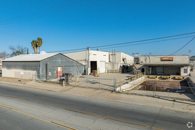
Property Record
180 S E St, Porterville, CA 93257


Property Detail
180 S E St
Visalia, CA
BLK 69 2ND AMEND MAP PORTERVILLE RM 8-17
260-232-008-000
Tulare
Packing
California
B and X Area of moderate flood hazard, usually the area between the limits of the 100-year and 500-year floods.
69
2024
2.91 AC
2025
Porterville
004104
Visalia/Porterville
NEARBY LISTINGS FOR SALE OR LEASE
DEMOGRAPHICS near 180 S E St
1 mile
3 mile
5 mile
2025 Total Population
17,025
66,937
76,737
2030 Population
17,256
67,933
77,878
Pop Growth 2025-2030
+ 1.36%
+ 1.49%
+ 1.49%
Average Age
33
34
35
2025 Total Households
4,818
19,141
22,060
HH Growth 2025-2030
+ 1.41%
+ 1.46%
+ 1.45%
Median Household Inc
$47,727
$59,904
$62,753
Avg Household Size
3.40
3.40
3.40
2025 Avg HH Vehicles
2.00
2.00
2.00
Median Home Value
$245,006
$283,572
$297,987
Median Year Built
1968
1980
1981
Nearby Places
Map Layers
Map Styles
 Street
 Aerial
Layers
 Traffic
 Biking
Places
Listings with unknown addresses are not visible on the map
- Restaurants
- Banks
- Shops
- Fitness
- Groceries
SALE & LEASE HISTORY
LISTING DATE
SALE/LEASE

May 22, 2024
For Sale
Mar 11, 2025
For Sale
Nearby Properties
Address
Land Use
TOTAL SIZE
Lot Size
Zoning
Address
Land Use
TOTAL SIZE
Lot Size
Zoning
Address
Land Use
TOTAL SIZE
Lot Size
Zoning
727,643 SF
43.05 AC
M-1
Address
Land Use
TOTAL SIZE
Lot Size
Zoning
Address
Land Use
TOTAL SIZE
Lot Size
Zoning
Address
Land Use
TOTAL SIZE
Lot Size
Zoning
379,008 SF
36.46 AC
M-1
Address
Land Use
TOTAL SIZE
Lot Size
Zoning
139,487 SF
11.54 AC
CR
Address
Land Use
TOTAL SIZE
Lot Size
Zoning
132,942 SF
10.11 AC
C-2 D
Address
Land Use
TOTAL SIZE
Lot Size
Zoning
73.61 AC
Address
Land Use
TOTAL SIZE
Lot Size
Zoning
Address
Land Use
TOTAL SIZE
Lot Size
Zoning
Address
Land Use
TOTAL SIZE
Lot Size
Zoning
Address
Land Use
TOTAL SIZE
Lot Size
Zoning
2.52 AC
C-2
Address
Land Use
TOTAL SIZE
Lot Size
Zoning
71,583 SF
6.41 AC
Address
Land Use
TOTAL SIZE
Lot Size
Zoning
82,280 SF
6.41 AC
Address
Land Use
TOTAL SIZE
Lot Size
Zoning
52,620 SF
3.82 AC
Address
Land Use
TOTAL SIZE
Lot Size
Zoning
79,504 SF
4.50 AC
Address
Land Use
TOTAL SIZE
Lot Size
Zoning
Address
Land Use
TOTAL SIZE
Lot Size
Zoning
95,450 SF
11.61 AC
CR
Address
Land Use
TOTAL SIZE
Lot Size
Zoning
125,074 SF
5.96 AC
Address
Land Use
TOTAL SIZE
Lot Size
Zoning
48,032 SF
5 AC
P-D(C)
Address
Land Use
TOTAL SIZE
Lot Size
Zoning
79,970 SF
15.54 AC
Address
Land Use
TOTAL SIZE
Lot Size
Zoning
54,129 SF
3.44 AC
C-3
Address
Land Use
TOTAL SIZE
Lot Size
Zoning
32,968 SF
4.96 AC
Address
Land Use
TOTAL SIZE
Lot Size
Zoning
2.07 AC
Address
Land Use
TOTAL SIZE
Lot Size
Zoning
30,036 SF
2.51 AC
PO
Address
Land Use
TOTAL SIZE
Lot Size
Zoning
51,360 SF
3.96 AC
R3-D
Address
Land Use
TOTAL SIZE
Lot Size
Zoning
64,271 SF
1.90 AC
R4D
Address
Land Use
TOTAL SIZE
Lot Size
Zoning
32,167 SF
3.26 AC
The World's #1 Commercial Real Estate Marketplace
Connect with us
© 2026 CoStar Group
The information above has been obtained from sources believed reliable. While we do not doubt its accuracy we have not verified it and make no guarantee, warranty or representation about it. It is your responsibility to independently confirm its accuracy and completeness. Any projections, opinions, assumptions, or estimates used are for example only and do not represent the current or future performance of the property. The value of this transaction to you depends on tax and other factors which should be evaluated by your tax, financial, and legal advisors. You and your advisors should conduct a careful, independent investigation of the property to determine to your satisfaction the suitability of the property for your needs.