Property Record
180 West St, Bolton, CT 06043

NEARBY LISTINGS FOR SALE OR LEASE
-
-
View all Bolton listings for sale on LoopNet.com
Property Detail
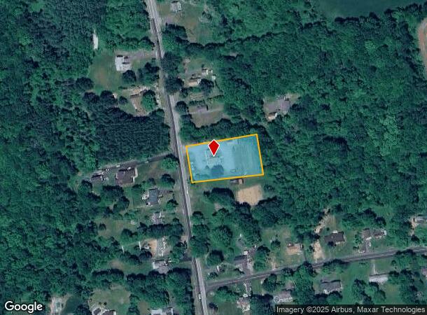
180 West St
BOLT-000017-000066
Tolland
Taxexempt
Connecticut
2024
1.10 AC
2025
Tolland County
529100
Hartford
2,535 SF
Hartford-West Hartford-East Hartford, CT
DEMOGRAPHICS near 180 West St
1 Mile
3 Mile
5 Mile
2024 Total Population
1,286
7,112
44,354
2029 Population
1,273
7,056
44,094
Pop Growth 2024-2029
(1.01%)
(0.79%)
(0.59%)
Average Age
43
45
42
2024 Total Households
492
2,794
17,672
HH Growth 2024-2029
(1.02%)
(0.82%)
(0.65%)
Median Household Inc
$117,129
$109,417
$94,915
Avg Household Size
2.60
2.50
2.40
2024 Avg HH Vehicles
2.00
2.00
2.00
Median Home Value
$317,323
$299,755
$275,901
Median Year Built
1969
1970
1961
Nearby Places
Map Layers
Map Styles
 Street
 Aerial
- Restaurants
- Banks
- Shops
- Fitness
- Groceries
PUBLIC TRANSPORTATION
AIRPORT
Bradley International
DRIVE
WALK
Distance
Bradley International
41 min
26.5 mi
Freight Ports
Port of New Haven
DRIVE
WALK
Distance
Port of New Haven
68 min
51.3 mi
SALE & LEASE HISTORY
LISTING DATE
SALE/LEASE

Mar 02, 2021
For Sale
Jun 02, 2022
For Sale
Dec 08, 2017
For Sale
Nearby Properties
Address
Land Use
TOTAL SIZE
Lot Size
Zoning
Address
Land Use
TOTAL SIZE
Lot Size
Zoning
78,559 SF
25.70 AC
R-1
Address
Land Use
TOTAL SIZE
Lot Size
Zoning
49,572 SF
54.92 AC
R-1
Address
Land Use
TOTAL SIZE
Lot Size
Zoning
6.99 AC
GMUIZ
Address
Land Use
TOTAL SIZE
Lot Size
Zoning
13.92 AC
R-1
Address
Land Use
TOTAL SIZE
Lot Size
Zoning
314.66 AC
RR
Address
Land Use
TOTAL SIZE
Lot Size
Zoning
1,104.50 AC
RL
Address
Land Use
TOTAL SIZE
Lot Size
Zoning
8.58 AC
R-1
Address
Land Use
TOTAL SIZE
Lot Size
Zoning
34,435 SF
2 AC
GB
Address
Land Use
TOTAL SIZE
Lot Size
Zoning
Address
Land Use
TOTAL SIZE
Lot Size
Zoning
3.90 AC
Address
Land Use
TOTAL SIZE
Lot Size
Zoning
20,000 SF
33.04 AC
GB
Address
Land Use
TOTAL SIZE
Lot Size
Zoning
229.56 AC
RR
Address
Land Use
TOTAL SIZE
Lot Size
Zoning
3,990 SF
0.92 AC
GMUIZ
Address
Land Use
TOTAL SIZE
Lot Size
Zoning
22.89 AC
RR/IND
Address
Land Use
TOTAL SIZE
Lot Size
Zoning
8,968 SF
1.43 AC
R-1
Address
Land Use
TOTAL SIZE
Lot Size
Zoning
4,960 SF
16 AC
I
Address
Land Use
TOTAL SIZE
Lot Size
Zoning
11,086 SF
7.63 AC
GB
Address
Land Use
TOTAL SIZE
Lot Size
Zoning
18,600 SF
1.13 AC
NB
Address
Land Use
TOTAL SIZE
Lot Size
Zoning
37,714 SF
3.33 AC
I
Address
Land Use
TOTAL SIZE
Lot Size
Zoning
3.30 AC
Address
Land Use
TOTAL SIZE
Lot Size
Zoning
1.35 AC
GB
Address
Land Use
TOTAL SIZE
Lot Size
Zoning
1,856 SF
24.79 AC
GR80
Address
Land Use
TOTAL SIZE
Lot Size
Zoning
11,484 SF
13.20 AC
NB
Address
Land Use
TOTAL SIZE
Lot Size
Zoning
26,901 SF
6.67 AC
GB
Address
Land Use
TOTAL SIZE
Lot Size
Zoning
1,952 SF
73.92 AC
R-1
Address
Land Use
TOTAL SIZE
Lot Size
Zoning
108.22 AC
R-1
Address
Land Use
TOTAL SIZE
Lot Size
Zoning
8,892 SF
2.17 AC
GB
Address
Land Use
TOTAL SIZE
Lot Size
Zoning
5,524 SF
1.48 AC
R-1
Address
Land Use
TOTAL SIZE
Lot Size
Zoning
1.16 AC
GB
Address
Land Use
TOTAL SIZE
Lot Size
Zoning
2,364 SF
7.46 AC
NB
The World's #1 Commercial Real Estate Marketplace
Connect with us
© 2025 CoStar Group
The information above has been obtained from sources believed reliable. While we do not doubt its accuracy we have not verified it and make no guarantee, warranty or representation about it. It is your responsibility to independently confirm its accuracy and completeness. Any projections, opinions, assumptions, or estimates used are for example only and do not represent the current or future performance of the property. The value of this transaction to you depends on tax and other factors which should be evaluated by your tax, financial, and legal advisors. You and your advisors should conduct a careful, independent investigation of the property to determine to your satisfaction the suitability of the property for your needs.