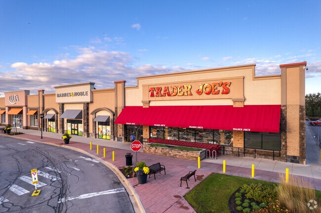
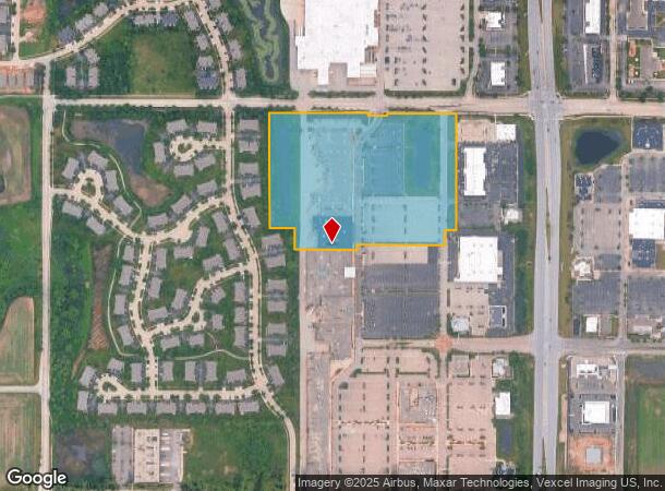
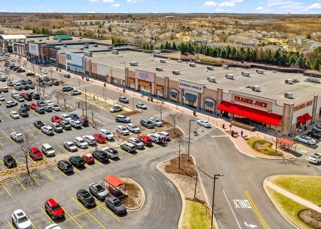
Property Record
1800 S Randall Rd, Algonquin, IL 60102
Current Lease Availabilities
NEARBY LISTINGS FOR SALE OR LEASE
Property Detail
1800 S Randall Rd
Chicago
Algonquin Commons Resub
Chicago-Naperville-Elgin, IL-IN-WI
ALGONQUIN COMMONS RESUB NO 1 LOT 2
03-06-226-003
Kane
Commercialnec
Illinois
2024
2
2024
Far Northwest
850105
DEMOGRAPHICS near 1800 S Randall Rd
1 Mile
3 Mile
5 Mile
2024 Total Population
4,282
49,489
148,125
2029 Population
4,360
49,421
147,979
Pop Growth 2024-2029
+ 1.82%
(0.14%)
(0.10%)
Average Age
41
40
39
2024 Total Households
1,636
17,399
50,592
HH Growth 2024-2029
+ 1.59%
(0.15%)
(0.10%)
Median Household Inc
$119,047
$107,410
$101,192
Avg Household Size
2.50
2.80
2.90
2024 Avg HH Vehicles
2.00
2.00
2.00
Median Home Value
$300,382
$281,318
$265,409
Median Year Built
1998
1994
1993
Nearby Places
- Restaurants
- Banks
- Shops
- Fitness
- Groceries
PUBLIC TRANSPORTATION
COMMUTER RAIL
Pingree Road Station (Union Pacific Northwest Line - Northeast Illinois Regional Commuter Railroad (Metra))
DRIVE
WALK
Distance
Pingree Road Station (Union Pacific Northwest Line - Northeast Illinois Regional Commuter Railroad (Metra))
16 min
7.9 mi
Cary Station (Union Pacific Northwest Line - Northeast Illinois Regional Commuter Railroad (Metra))
DRIVE
WALK
Distance
Cary Station (Union Pacific Northwest Line - Northeast Illinois Regional Commuter Railroad (Metra))
17 min
8.2 mi
AIRPORT
Chicago O'Hare International
DRIVE
WALK
Distance
Chicago O'Hare International
43 min
33.7 mi
Freight Ports
Port Milwaukee
DRIVE
WALK
Distance
Port Milwaukee
110 min
81.7 mi
Nearby Properties
Address
Land Use
TOTAL SIZE
Lot Size
Zoning
Address
Land Use
TOTAL SIZE
Lot Size
Zoning
0.90 AC
Address
Land Use
TOTAL SIZE
Lot Size
Zoning
Address
Land Use
TOTAL SIZE
Lot Size
Zoning
Address
Land Use
TOTAL SIZE
Lot Size
Zoning
173,563 SF
0.48 AC
Address
Land Use
TOTAL SIZE
Lot Size
Zoning
54,472 SF
21 AC
Address
Land Use
TOTAL SIZE
Lot Size
Zoning
Address
Land Use
TOTAL SIZE
Lot Size
Zoning
Address
Land Use
TOTAL SIZE
Lot Size
Zoning
11.91 AC
Address
Land Use
TOTAL SIZE
Lot Size
Zoning
28.69 AC
Address
Land Use
TOTAL SIZE
Lot Size
Zoning
Address
Land Use
TOTAL SIZE
Lot Size
Zoning
195,564 SF
18.76 AC
Address
Land Use
TOTAL SIZE
Lot Size
Zoning
8.32 AC
Address
Land Use
TOTAL SIZE
Lot Size
Zoning
175,185 SF
13 AC
Address
Land Use
TOTAL SIZE
Lot Size
Zoning
Address
Land Use
TOTAL SIZE
Lot Size
Zoning
Address
Land Use
TOTAL SIZE
Lot Size
Zoning
9,614 SF
1.42 AC
Address
Land Use
TOTAL SIZE
Lot Size
Zoning
106,309 SF
12.96 AC
Address
Land Use
TOTAL SIZE
Lot Size
Zoning
Address
Land Use
TOTAL SIZE
Lot Size
Zoning
85,319 SF
12.04 AC
Address
Land Use
TOTAL SIZE
Lot Size
Zoning
Address
Land Use
TOTAL SIZE
Lot Size
Zoning
184,440 SF
16 AC
Address
Land Use
TOTAL SIZE
Lot Size
Zoning
7.95 AC
Address
Land Use
TOTAL SIZE
Lot Size
Zoning
134,523 SF
15.27 AC
Address
Land Use
TOTAL SIZE
Lot Size
Zoning
81,873 SF
9.38 AC
Address
Land Use
TOTAL SIZE
Lot Size
Zoning
Address
Land Use
TOTAL SIZE
Lot Size
Zoning
Address
Land Use
TOTAL SIZE
Lot Size
Zoning
94,825 SF
0.50 AC
Address
Land Use
TOTAL SIZE
Lot Size
Zoning
55,183 SF
4.34 AC
The World's #1 Commercial Real Estate Marketplace
Connect with us
© 2025 CoStar Group
The information above has been obtained from sources believed reliable. While we do not doubt its accuracy we have not verified it and make no guarantee, warranty or representation about it. It is your responsibility to independently confirm its accuracy and completeness. Any projections, opinions, assumptions, or estimates used are for example only and do not represent the current or future performance of the property. The value of this transaction to you depends on tax and other factors which should be evaluated by your tax, financial, and legal advisors. You and your advisors should conduct a careful, independent investigation of the property to determine to your satisfaction the suitability of the property for your needs.