Property Record
1800 Cherokee Rd, Winterville, GA 30683
NEARBY LISTINGS FOR SALE OR LEASE
Property Detail
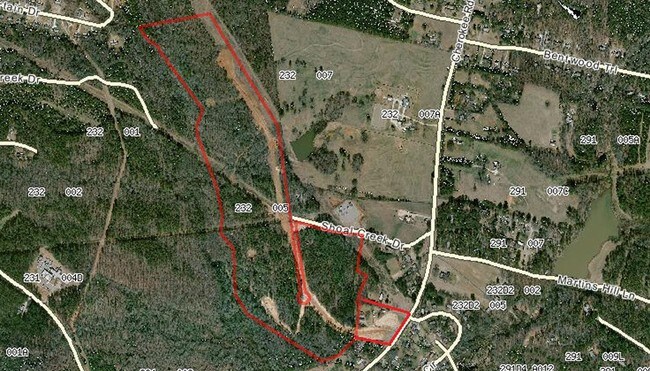
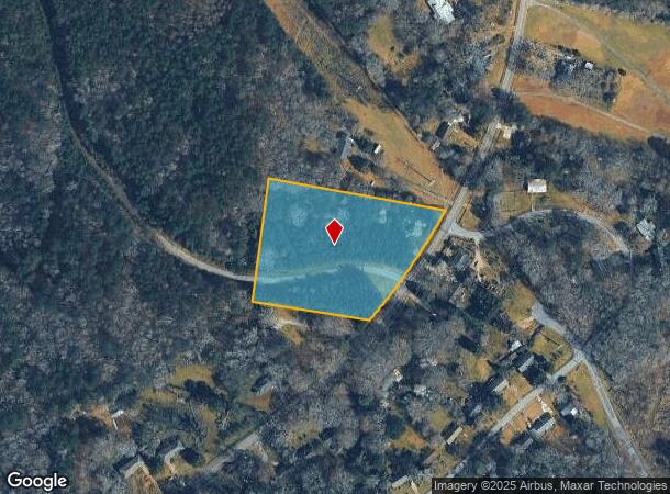
1800 Cherokee Rd
Athens-Clarke County, GA
Res-St-029->00-03
232D2-013
DEEDED ACS: 4.350
Residentialacreage
Clarke
X
Georgia
13059C0028E
3.97 AC
2025
East Athens
2025
Other Market Areas
140600
DEMOGRAPHICS near 1800 Cherokee Rd
1 Mile
3 Mile
5 Mile
2024 Total Population
1,852
23,911
79,741
2029 Population
1,858
23,953
80,278
Pop Growth 2024-2029
+ 0.32%
+ 0.18%
+ 0.67%
Average Age
39
37
33
2024 Total Households
723
10,141
30,634
HH Growth 2024-2029
+ 0.41%
+ 0.22%
+ 0.65%
Median Household Inc
$68,169
$51,603
$47,913
Avg Household Size
2.50
2.30
2.20
2024 Avg HH Vehicles
2.00
2.00
2.00
Median Home Value
$183,879
$196,786
$211,650
Median Year Built
1989
1985
1987
Nearby Places
Map Layers
Map Styles
 Street
 Aerial
- Restaurants
- Banks
- Shops
- Fitness
- Groceries
Nearby Properties
Address
Land Use
TOTAL SIZE
Lot Size
Zoning
Address
Land Use
TOTAL SIZE
Lot Size
Zoning
104,964 SF
40.38 AC
RM-2
Address
Land Use
TOTAL SIZE
Lot Size
Zoning
225,000 SF
98.91 AC
G
Address
Land Use
TOTAL SIZE
Lot Size
Zoning
56.20 AC
G
Address
Land Use
TOTAL SIZE
Lot Size
Zoning
986 SF
40.54 AC
RM-1
Address
Land Use
TOTAL SIZE
Lot Size
Zoning
2,062 SF
24.33 AC
RM-1
Address
Land Use
TOTAL SIZE
Lot Size
Zoning
28.91 AC
G
Address
Land Use
TOTAL SIZE
Lot Size
Zoning
1,624 SF
20.04 AC
RM-1
Address
Land Use
TOTAL SIZE
Lot Size
Zoning
143,200 SF
19.44 AC
RM-1
Address
Land Use
TOTAL SIZE
Lot Size
Zoning
124,959 SF
20.54 AC
E-I
Address
Land Use
TOTAL SIZE
Lot Size
Zoning
46.26 AC
G
Address
Land Use
TOTAL SIZE
Lot Size
Zoning
14,000 SF
42.62 AC
E-I
Address
Land Use
TOTAL SIZE
Lot Size
Zoning
71,472 SF
43.36 AC
E-I
Address
Land Use
TOTAL SIZE
Lot Size
Zoning
3,339 SF
5.91 AC
C-N
Address
Land Use
TOTAL SIZE
Lot Size
Zoning
47,928 SF
80.47 AC
E-I
Address
Land Use
TOTAL SIZE
Lot Size
Zoning
47,808 SF
11.08 AC
RM-2
Address
Land Use
TOTAL SIZE
Lot Size
Zoning
16,800 SF
454.45 AC
G
Address
Land Use
TOTAL SIZE
Lot Size
Zoning
27,918 SF
16.01 AC
RM-1
Address
Land Use
TOTAL SIZE
Lot Size
Zoning
11,700 SF
12.05 AC
RM-2
Address
Land Use
TOTAL SIZE
Lot Size
Zoning
3,050 SF
8.44 AC
C-G
Address
Land Use
TOTAL SIZE
Lot Size
Zoning
77,569 SF
12.18 AC
C-G
Address
Land Use
TOTAL SIZE
Lot Size
Zoning
205,548 SF
22.68 AC
C-G(PD)
Address
Land Use
TOTAL SIZE
Lot Size
Zoning
9,588 SF
12.69 AC
RM-1
Address
Land Use
TOTAL SIZE
Lot Size
Zoning
50,512 SF
10.87 AC
C-G
Address
Land Use
TOTAL SIZE
Lot Size
Zoning
12,032 SF
18.88 AC
RM-1
Address
Land Use
TOTAL SIZE
Lot Size
Zoning
8,664 SF
103.89 AC
E-I
Address
Land Use
TOTAL SIZE
Lot Size
Zoning
31.44 AC
G
Address
Land Use
TOTAL SIZE
Lot Size
Zoning
268,400 SF
34.23 AC
I
Address
Land Use
TOTAL SIZE
Lot Size
Zoning
14,504 SF
10.84 AC
RM-1
Address
Land Use
TOTAL SIZE
Lot Size
Zoning
39,167 SF
42.71 AC
RS-25
Address
Land Use
TOTAL SIZE
Lot Size
Zoning
197,738 SF
60.92 AC
E-I
The World's #1 Commercial Real Estate Marketplace
Connect with us
© 2025 CoStar Group
The information above has been obtained from sources believed reliable. While we do not doubt its accuracy we have not verified it and make no guarantee, warranty or representation about it. It is your responsibility to independently confirm its accuracy and completeness. Any projections, opinions, assumptions, or estimates used are for example only and do not represent the current or future performance of the property. The value of this transaction to you depends on tax and other factors which should be evaluated by your tax, financial, and legal advisors. You and your advisors should conduct a careful, independent investigation of the property to determine to your satisfaction the suitability of the property for your needs.