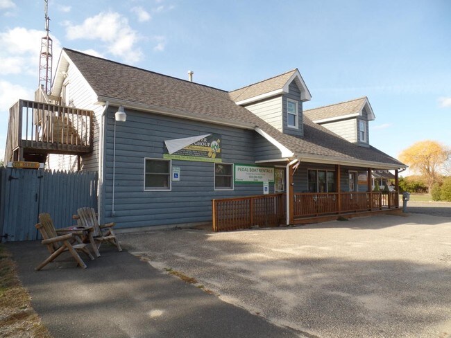
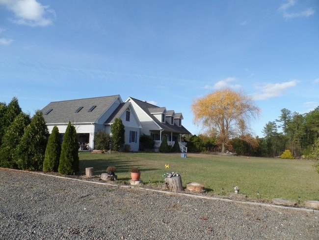
Property Record
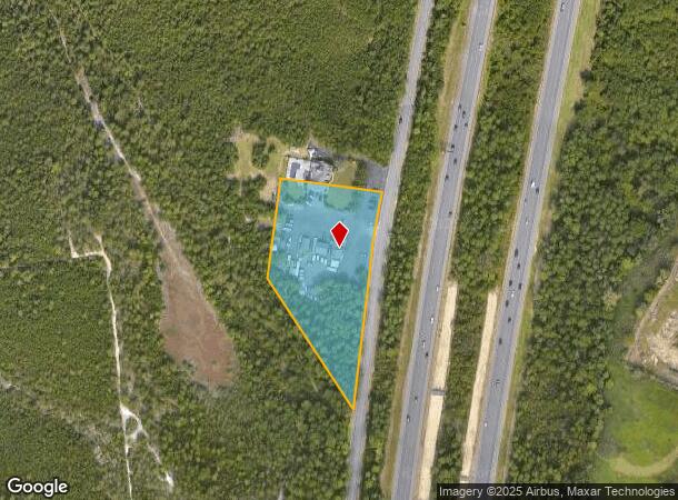
1800 Double Trouble Rd, Beachwood, NJ 08722
NEARBY LISTINGS FOR SALE OR LEASE
Property Detail
1800 Double Trouble Rd
New York-Jersey City-White Plains, NY-NJ
Minor Sub
05-00008-11-00001
3.675 AC TRIPLE T CANOE
Commercialnec
Ocean
X
New Jersey
34029C0312F
1
2024
3.68 AC
2025
Ocean County
725001
Northern New Jersey
4,859 SF
DEMOGRAPHICS near 1800 Double Trouble Rd
1 Mile
3 Mile
5 Mile
2024 Total Population
3,094
33,738
109,760
2029 Population
3,261
35,682
116,409
Pop Growth 2024-2029
+ 5.40%
+ 5.76%
+ 6.06%
Average Age
37
40
43
2024 Total Households
987
12,130
42,919
HH Growth 2024-2029
+ 4.56%
+ 5.23%
+ 5.64%
Median Household Inc
$87,416
$83,784
$76,015
Avg Household Size
3.00
2.70
2.50
2024 Avg HH Vehicles
2.00
2.00
2.00
Median Home Value
$265,304
$282,720
$281,039
Median Year Built
1979
1979
1977
Nearby Places
Map Layers
Map Styles
 Street
 Aerial
- Restaurants
- Banks
- Shops
- Fitness
- Groceries
Nearby Properties
Address
Land Use
TOTAL SIZE
Lot Size
Zoning
Address
Land Use
TOTAL SIZE
Lot Size
Zoning
35,102 SF
139.33 AC
LI
Address
Land Use
TOTAL SIZE
Lot Size
Zoning
2,000 SF
94 AC
CR
Address
Land Use
TOTAL SIZE
Lot Size
Zoning
15.67 AC
RC
Address
Land Use
TOTAL SIZE
Lot Size
Zoning
44,584 SF
11.85 AC
VO
Address
Land Use
TOTAL SIZE
Lot Size
Zoning
8.21 AC
VO
Address
Land Use
TOTAL SIZE
Lot Size
Zoning
8,968 SF
26.36 AC
RMF
Address
Land Use
TOTAL SIZE
Lot Size
Zoning
18,890 SF
24.59 AC
SPLT
Address
Land Use
TOTAL SIZE
Lot Size
Zoning
13,872 SF
22.96 AC
MF8
Address
Land Use
TOTAL SIZE
Lot Size
Zoning
2,549 SF
16.02 AC
RC
Address
Land Use
TOTAL SIZE
Lot Size
Zoning
9,343 SF
31.93 AC
SPLT
Address
Land Use
TOTAL SIZE
Lot Size
Zoning
5,303 SF
2.14 AC
VO
Address
Land Use
TOTAL SIZE
Lot Size
Zoning
23.28 AC
R75
Address
Land Use
TOTAL SIZE
Lot Size
Zoning
22.29 AC
HB
Address
Land Use
TOTAL SIZE
Lot Size
Zoning
36,624 SF
3.15 AC
HMS
Address
Land Use
TOTAL SIZE
Lot Size
Zoning
9,267 SF
401.95 AC
RC
Address
Land Use
TOTAL SIZE
Lot Size
Zoning
8,744 SF
8.70 AC
SAH2
Address
Land Use
TOTAL SIZE
Lot Size
Zoning
17.86 AC
RM
Address
Land Use
TOTAL SIZE
Lot Size
Zoning
1,740 SF
38.81 AC
HB
Address
Land Use
TOTAL SIZE
Lot Size
Zoning
69,798 SF
6.92 AC
R200
Address
Land Use
TOTAL SIZE
Lot Size
Zoning
559.95 AC
GI
Address
Land Use
TOTAL SIZE
Lot Size
Zoning
79,200 SF
8.93 AC
RMF
Address
Land Use
TOTAL SIZE
Lot Size
Zoning
47,440 SF
6.09 AC
R150
Address
Land Use
TOTAL SIZE
Lot Size
Zoning
54,488 SF
3.46 AC
VO
Address
Land Use
TOTAL SIZE
Lot Size
Zoning
2,896 SF
25 AC
R200
Address
Land Use
TOTAL SIZE
Lot Size
Zoning
8.71 AC
HB
Address
Land Use
TOTAL SIZE
Lot Size
Zoning
6.26 AC
RMF
Address
Land Use
TOTAL SIZE
Lot Size
Zoning
1,456 SF
1.36 AC
VB
Address
Land Use
TOTAL SIZE
Lot Size
Zoning
102.71 AC
HB
Address
Land Use
TOTAL SIZE
Lot Size
Zoning
34,492 SF
3.35 AC
VB
Address
Land Use
TOTAL SIZE
Lot Size
Zoning
14.76 AC
ML
The World's #1 Commercial Real Estate Marketplace
Connect with us
© 2025 CoStar Group
The information above has been obtained from sources believed reliable. While we do not doubt its accuracy we have not verified it and make no guarantee, warranty or representation about it. It is your responsibility to independently confirm its accuracy and completeness. Any projections, opinions, assumptions, or estimates used are for example only and do not represent the current or future performance of the property. The value of this transaction to you depends on tax and other factors which should be evaluated by your tax, financial, and legal advisors. You and your advisors should conduct a careful, independent investigation of the property to determine to your satisfaction the suitability of the property for your needs.