Property Record
1800 E Blk E Broussard Rd, Lafayette, LA 70508

Property Detail
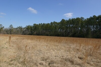
1800 E Blk E Broussard Rd
Lafayette, LA
P TR 1 SECS 37 38 T11S R4E (AKA TR 10-A) (5.278 AC)(2000-9351 PLAT)
6017229
LAFAYETTE
Agriculturalland
Louisiana
B and X Area of moderate flood hazard, usually the area between the limits of the 100-year and 500-year floods.
5.28 AC
2025
Outlying Lafayette Parish
2025
Lafayette
001421
NEARBY LISTINGS FOR SALE OR LEASE
-
-
View all Lafayette listings for sale on LoopNet.com
DEMOGRAPHICS near 1800 E Blk E Broussard Rd
1 mile
3 mile
5 mile
2025 Total Population
4,253
35,609
98,455
2030 Population
4,431
37,122
102,736
Pop Growth 2025-2030
+ 4.19%
+ 4.25%
+ 4.35%
Average Age
36
39
39
2025 Total Households
1,531
13,685
39,740
HH Growth 2025-2030
+ 4.25%
+ 4.34%
+ 4.48%
Median Household Inc
$111,567
$94,243
$84,814
Avg Household Size
2.70
2.50
2.40
2025 Avg HH Vehicles
2.00
2.00
2.00
Median Home Value
$274,221
$313,311
$293,983
Median Year Built
2007
1999
1996
Nearby Places
Map Layers
Map Styles
 Street
 Aerial
Transit
 Traffic
 Biking
Places
Listings with unknown addresses are not visible on the map
- Restaurants
- Banks
- Shops
- Fitness
- Groceries
PUBLIC TRANSPORTATION
COMMUTER RAIL
Lafayette Amtrak Station (Sunset Limited - Amtrak)
Drive
Walk
Distance
Lafayette Amtrak Station (Sunset Limited - Amtrak)
20 min
9.9 mi
AIRPORT
Lafayette Regional/Paul Fournet Field
Drive
Walk
Distance
Lafayette Regional/Paul Fournet Field
19 min
9.4 mi
Freight Ports
Port of Iberia
Drive
Walk
Distance
Port of Iberia
34 min
21.5 mi
Nearby Properties
Address
Land Use
TOTAL SIZE
Lot Size
Zoning
Address
Land Use
TOTAL SIZE
Lot Size
Zoning
432,844 SF
44.64 AC
Address
Land Use
TOTAL SIZE
Lot Size
Zoning
18.28 AC
Address
Land Use
TOTAL SIZE
Lot Size
Zoning
Address
Land Use
TOTAL SIZE
Lot Size
Zoning
24.98 AC
Address
Land Use
TOTAL SIZE
Lot Size
Zoning
200,000 SF
Address
Land Use
TOTAL SIZE
Lot Size
Zoning
120,024 SF
Address
Land Use
TOTAL SIZE
Lot Size
Zoning
4,906 SF
12.65 AC
Address
Land Use
TOTAL SIZE
Lot Size
Zoning
7,354 SF
11.09 AC
Address
Land Use
TOTAL SIZE
Lot Size
Zoning
Address
Land Use
TOTAL SIZE
Lot Size
Zoning
16.16 AC
Address
Land Use
TOTAL SIZE
Lot Size
Zoning
27,294 SF
12.91 AC
Address
Land Use
TOTAL SIZE
Lot Size
Zoning
191,300 SF
29.94 AC
Address
Land Use
TOTAL SIZE
Lot Size
Zoning
10.02 AC
Address
Land Use
TOTAL SIZE
Lot Size
Zoning
98,234 SF
28.71 AC
Address
Land Use
TOTAL SIZE
Lot Size
Zoning
81,704 SF
73.80 AC
Address
Land Use
TOTAL SIZE
Lot Size
Zoning
114,843 SF
12.64 AC
Address
Land Use
TOTAL SIZE
Lot Size
Zoning
173,563 SF
19.13 AC
Address
Land Use
TOTAL SIZE
Lot Size
Zoning
11,768 SF
11.29 AC
Address
Land Use
TOTAL SIZE
Lot Size
Zoning
93,184 SF
0.02 AC
Address
Land Use
TOTAL SIZE
Lot Size
Zoning
156,047 SF
8.89 AC
Address
Land Use
TOTAL SIZE
Lot Size
Zoning
112,082 SF
0.02 AC
Address
Land Use
TOTAL SIZE
Lot Size
Zoning
89,864 SF
3.73 AC
Address
Land Use
TOTAL SIZE
Lot Size
Zoning
107,576 SF
11.58 AC
Address
Land Use
TOTAL SIZE
Lot Size
Zoning
79,495 SF
5.16 AC
Address
Land Use
TOTAL SIZE
Lot Size
Zoning
Address
Land Use
TOTAL SIZE
Lot Size
Zoning
88,182 SF
11.41 AC
Address
Land Use
TOTAL SIZE
Lot Size
Zoning
13,887 SF
6.03 AC
Address
Land Use
TOTAL SIZE
Lot Size
Zoning
4.48 AC
Address
Land Use
TOTAL SIZE
Lot Size
Zoning
Address
Land Use
TOTAL SIZE
Lot Size
Zoning
35,914 SF
12.68 AC
The World's #1 Commercial Real Estate Marketplace
Connect with us
© 2026 CoStar Group
The information above has been obtained from sources believed reliable. While we do not doubt its accuracy we have not verified it and make no guarantee, warranty or representation about it. It is your responsibility to independently confirm its accuracy and completeness. Any projections, opinions, assumptions, or estimates used are for example only and do not represent the current or future performance of the property. The value of this transaction to you depends on tax and other factors which should be evaluated by your tax, financial, and legal advisors. You and your advisors should conduct a careful, independent investigation of the property to determine to your satisfaction the suitability of the property for your needs.