Property Record
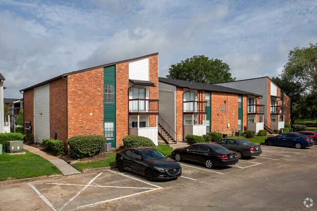
1800 El Paseo St, Houston, TX 77054


NEARBY LISTINGS FOR SALE OR LEASE
Property Detail
1800 El Paseo St
0440940000139
Abst 645 P W Rose
Apartment
TRS 1P-7 & 1P-8 ABST 645 P W ROSE
X
Harris
48201C0860L
Texas
2024
10.32 AC
2025
Medical Center South
314004
Houston
240,120 SF
Houston-Pasadena-The Woodlands, TX
DEMOGRAPHICS near 1800 El Paseo St
1 Mile
3 Mile
5 Mile
2024 Total Population
17,342
145,611
428,185
2029 Population
18,016
150,852
442,781
Pop Growth 2024-2029
+ 3.89%
+ 3.60%
+ 3.41%
Average Age
34
37
38
2024 Total Households
9,655
66,421
189,241
HH Growth 2024-2029
+ 3.77%
+ 3.70%
+ 3.57%
Median Household Inc
$55,090
$64,139
$71,287
Avg Household Size
1.70
2.10
2.10
2024 Avg HH Vehicles
1.00
1.00
2.00
Median Home Value
$173,259
$445,800
$378,951
Median Year Built
1987
1990
1991
Nearby Places
Map Layers
Map Styles
 Street
 Aerial
- Restaurants
- Banks
- Shops
- Fitness
- Groceries
PUBLIC TRANSPORTATION
TRANSIT/SUBWAY
Reliant Park (METRORAIL RED LINE - Metropolitan Transit Authority of Harris County, Redline - Metropolitan Transit Authority of Harris County)
DRIVE
WALK
Distance
Reliant Park (METRORAIL RED LINE - Metropolitan Transit Authority of Harris County, Redline - Metropolitan Transit Authority of Harris County)
2 min
13 min
0.7 mi
Smith Lands (METRORAIL RED LINE - Metropolitan Transit Authority of Harris County, Redline - Metropolitan Transit Authority of Harris County)
DRIVE
WALK
Distance
Smith Lands (METRORAIL RED LINE - Metropolitan Transit Authority of Harris County, Redline - Metropolitan Transit Authority of Harris County)
3 min
20 min
1.1 mi
COMMUTER RAIL
Houston (Sunset Limited - Amtrak)
DRIVE
WALK
Distance
Houston (Sunset Limited - Amtrak)
13 min
7.4 mi
AIRPORT
William P Hobby
DRIVE
WALK
Distance
William P Hobby
24 min
12.7 mi
George Bush Intcntl/Houston
DRIVE
WALK
Distance
George Bush Intcntl/Houston
33 min
24.7 mi
Freight Ports
Port of Houston
DRIVE
WALK
Distance
Port of Houston
21 min
13.0 mi
Nearby Properties
Address
Land Use
TOTAL SIZE
Lot Size
Zoning
Address
Land Use
TOTAL SIZE
Lot Size
Zoning
519,409 SF
1.52 AC
Address
Land Use
TOTAL SIZE
Lot Size
Zoning
1,252,274 SF
2.02 AC
Address
Land Use
TOTAL SIZE
Lot Size
Zoning
704,249 SF
2.34 AC
Address
Land Use
TOTAL SIZE
Lot Size
Zoning
1,359,194 SF
Address
Land Use
TOTAL SIZE
Lot Size
Zoning
402,467 SF
28.30 AC
Address
Land Use
TOTAL SIZE
Lot Size
Zoning
1,009,859 SF
28.73 AC
Address
Land Use
TOTAL SIZE
Lot Size
Zoning
701,043 SF
4.69 AC
Address
Land Use
TOTAL SIZE
Lot Size
Zoning
507,499 SF
7.66 AC
Address
Land Use
TOTAL SIZE
Lot Size
Zoning
310,967 SF
1.38 AC
Address
Land Use
TOTAL SIZE
Lot Size
Zoning
444,589 SF
11 AC
Address
Land Use
TOTAL SIZE
Lot Size
Zoning
577,327 SF
28.80 AC
Address
Land Use
TOTAL SIZE
Lot Size
Zoning
828,746 SF
7.76 AC
Address
Land Use
TOTAL SIZE
Lot Size
Zoning
396,888 SF
2.02 AC
Address
Land Use
TOTAL SIZE
Lot Size
Zoning
171,997 SF
1.15 AC
Address
Land Use
TOTAL SIZE
Lot Size
Zoning
486,076 SF
3.79 AC
Address
Land Use
TOTAL SIZE
Lot Size
Zoning
565,246 SF
1.14 AC
Address
Land Use
TOTAL SIZE
Lot Size
Zoning
320,710 SF
1.19 AC
Address
Land Use
TOTAL SIZE
Lot Size
Zoning
517,548 SF
1.60 AC
Address
Land Use
TOTAL SIZE
Lot Size
Zoning
519,237 SF
1.73 AC
Address
Land Use
TOTAL SIZE
Lot Size
Zoning
316,101 SF
2.12 AC
Address
Land Use
TOTAL SIZE
Lot Size
Zoning
527,457 SF
6.21 AC
Address
Land Use
TOTAL SIZE
Lot Size
Zoning
499,411 SF
5.73 AC
Address
Land Use
TOTAL SIZE
Lot Size
Zoning
1,000,928 SF
18.79 AC
Address
Land Use
TOTAL SIZE
Lot Size
Zoning
271,936 SF
0.83 AC
Address
Land Use
TOTAL SIZE
Lot Size
Zoning
236,010 SF
6.08 AC
Address
Land Use
TOTAL SIZE
Lot Size
Zoning
706,892 SF
5.86 AC
Address
Land Use
TOTAL SIZE
Lot Size
Zoning
550,115 SF
6.38 AC
Address
Land Use
TOTAL SIZE
Lot Size
Zoning
562,131 SF
4.11 AC
Address
Land Use
TOTAL SIZE
Lot Size
Zoning
356,610 SF
2.26 AC
Address
Land Use
TOTAL SIZE
Lot Size
Zoning
557,397 SF
5.58 AC
The World's #1 Commercial Real Estate Marketplace
Connect with us
© 2026 CoStar Group
The information above has been obtained from sources believed reliable. While we do not doubt its accuracy we have not verified it and make no guarantee, warranty or representation about it. It is your responsibility to independently confirm its accuracy and completeness. Any projections, opinions, assumptions, or estimates used are for example only and do not represent the current or future performance of the property. The value of this transaction to you depends on tax and other factors which should be evaluated by your tax, financial, and legal advisors. You and your advisors should conduct a careful, independent investigation of the property to determine to your satisfaction the suitability of the property for your needs.