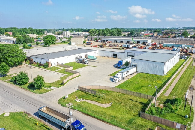
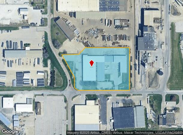
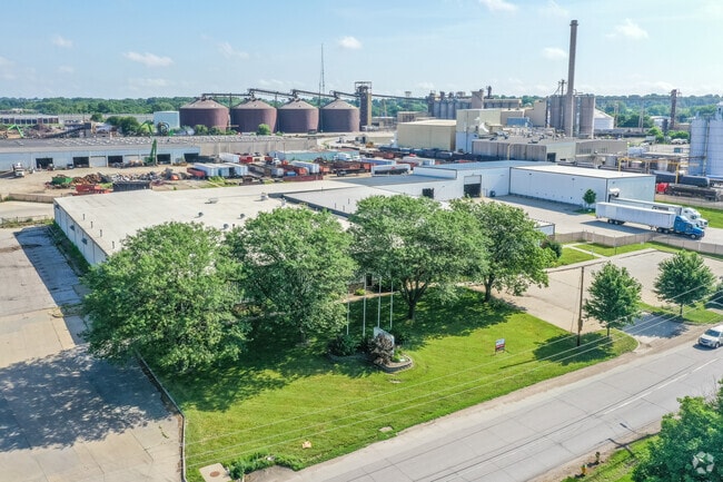
Property Record
1800 Hull Ave, Des Moines, IA 50313

Current Lease Availabilities
NEARBY LISTINGS FOR SALE OR LEASE
Property Detail
1800 Hull Ave
110/06599-009-006
Sec 25-79-24
Heavyindustrial
PARCEL 2020-109 BK 18034 PG 944 BEG SE COR PARCEL O BK 13487 PG 303 THN W 235.27F W 269.46F NW 43.26F N 103.49F NW 251.04F E 167.43F NE 102.35F SE 9.2F E 418.23F S 416.28F TO POB SW 1/4 NE 1/4 SEC 25-79-24
X
Polk
19153C0355F
Iowa
0
5.33 AC
2025
Northeast
000300
Des Moines
70,660 SF
Des Moines-West Des Moines, IA
DEMOGRAPHICS near 1800 Hull Ave
1 Mile
3 Mile
5 Mile
2024 Total Population
8,123
73,085
167,844
2029 Population
8,471
76,002
174,944
Pop Growth 2024-2029
+ 4.28%
+ 3.99%
+ 4.23%
Average Age
38
37
38
2024 Total Households
2,931
28,210
69,204
HH Growth 2024-2029
+ 4.78%
+ 4.30%
+ 4.49%
Median Household Inc
$58,602
$52,645
$57,213
Avg Household Size
2.30
2.40
2.30
2024 Avg HH Vehicles
2.00
2.00
2.00
Median Home Value
$134,073
$131,374
$160,568
Median Year Built
1954
1954
1960
Nearby Places
Map Layers
Map Styles
 Street
 Aerial
- Restaurants
- Banks
- Shops
- Fitness
- Groceries
PUBLIC TRANSPORTATION
AIRPORT
Des Moines International
DRIVE
WALK
Distance
Des Moines International
20 min
10.0 mi
Nearby Properties
Address
Land Use
TOTAL SIZE
Lot Size
Zoning
Address
Land Use
TOTAL SIZE
Lot Size
Zoning
2,157,357 SF
23.95 AC
PUD
Address
Land Use
TOTAL SIZE
Lot Size
Zoning
428,582 SF
6.87 AC
C-0
Address
Land Use
TOTAL SIZE
Lot Size
Zoning
481,030 SF
31.92 AC
PUD
Address
Land Use
TOTAL SIZE
Lot Size
Zoning
675,000 SF
65.27 AC
Address
Land Use
TOTAL SIZE
Lot Size
Zoning
600,000 SF
40.15 AC
Address
Land Use
TOTAL SIZE
Lot Size
Zoning
311,655 SF
2.38 AC
C3
Address
Land Use
TOTAL SIZE
Lot Size
Zoning
177,094 SF
24.60 AC
Address
Land Use
TOTAL SIZE
Lot Size
Zoning
300,115 SF
2.48 AC
Address
Land Use
TOTAL SIZE
Lot Size
Zoning
402,849 SF
0.83 AC
C-3
Address
Land Use
TOTAL SIZE
Lot Size
Zoning
342,000 SF
22.18 AC
Address
Land Use
TOTAL SIZE
Lot Size
Zoning
257,407 SF
1.43 AC
Address
Land Use
TOTAL SIZE
Lot Size
Zoning
312,500 SF
38.14 AC
Address
Land Use
TOTAL SIZE
Lot Size
Zoning
127,000 SF
1.92 AC
Address
Land Use
TOTAL SIZE
Lot Size
Zoning
320,429 SF
22.34 AC
R3
Address
Land Use
TOTAL SIZE
Lot Size
Zoning
123,535 SF
0.63 AC
Address
Land Use
TOTAL SIZE
Lot Size
Zoning
529,161 SF
33.60 AC
HI
Address
Land Use
TOTAL SIZE
Lot Size
Zoning
126,935 SF
28.61 AC
Address
Land Use
TOTAL SIZE
Lot Size
Zoning
603,502 SF
33.03 AC
M-1
Address
Land Use
TOTAL SIZE
Lot Size
Zoning
1,838,971 SF
76.24 AC
HI
Address
Land Use
TOTAL SIZE
Lot Size
Zoning
103,780 SF
3.39 AC
C-3A
Address
Land Use
TOTAL SIZE
Lot Size
Zoning
90,325 SF
5.49 AC
PUD
Address
Land Use
TOTAL SIZE
Lot Size
Zoning
82,202 SF
9.48 AC
PUD
Address
Land Use
TOTAL SIZE
Lot Size
Zoning
152,445 SF
1.52 AC
C-3
Address
Land Use
TOTAL SIZE
Lot Size
Zoning
184,320 SF
9.68 AC
Address
Land Use
TOTAL SIZE
Lot Size
Zoning
218,593 SF
19.31 AC
M-2
Address
Land Use
TOTAL SIZE
Lot Size
Zoning
162,240 SF
9.19 AC
Address
Land Use
TOTAL SIZE
Lot Size
Zoning
118,080 SF
15.76 AC
Address
Land Use
TOTAL SIZE
Lot Size
Zoning
79,991 SF
4.55 AC
M-1
Address
Land Use
TOTAL SIZE
Lot Size
Zoning
1,890,511 SF
39.03 AC
M-2
Address
Land Use
TOTAL SIZE
Lot Size
Zoning
274,160 SF
19.99 AC
M-1
The World's #1 Commercial Real Estate Marketplace
Connect with us
© 2025 CoStar Group
The information above has been obtained from sources believed reliable. While we do not doubt its accuracy we have not verified it and make no guarantee, warranty or representation about it. It is your responsibility to independently confirm its accuracy and completeness. Any projections, opinions, assumptions, or estimates used are for example only and do not represent the current or future performance of the property. The value of this transaction to you depends on tax and other factors which should be evaluated by your tax, financial, and legal advisors. You and your advisors should conduct a careful, independent investigation of the property to determine to your satisfaction the suitability of the property for your needs.