Property Record
1800 Main St E, New Prague, MN 56071
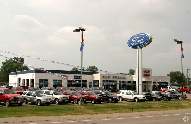

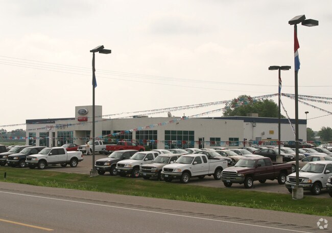
Property Detail
1800 Main St E
Minneapolis-St. Paul-Bloomington, MN-WI
BELZER ADDITION LOT-001 BLOCK-001 15.64 AC
23.415.0100
LE SUEUR
Commercialnec
Minnesota
B and X Area of moderate flood hazard, usually the area between the limits of the 100-year and 500-year floods.
1
2025
15.64 AC
2025
Le Sueur County
950101
Other Market Areas
NEARBY LISTINGS FOR SALE OR LEASE
-
-
View all New Prague listings for sale on LoopNet.com
DEMOGRAPHICS near 1800 Main St E
1 mile
3 mile
5 mile
2025 Total Population
3,308
10,284
13,543
2030 Population
3,416
10,485
13,798
Pop Growth 2025-2030
+ 3.26%
+ 1.95%
+ 1.88%
Average Age
37
39
40
2025 Total Households
1,155
3,752
4,901
HH Growth 2025-2030
+ 3.29%
+ 1.97%
+ 1.94%
Median Household Inc
$112,685
$101,129
$105,806
Avg Household Size
2.80
2.70
2.70
2025 Avg HH Vehicles
2.00
2.00
2.00
Median Home Value
$396,861
$376,077
$401,357
Median Year Built
2000
1993
1992
Nearby Places
Map Layers
Map Styles
 Street
 Aerial
Layers
 Traffic
 Biking
Places
Listings with unknown addresses are not visible on the map
- Restaurants
- Banks
- Shops
- Fitness
- Groceries
PUBLIC TRANSPORTATION
AIRPORT
Minneapolis-St Paul International/Wold-Chamberlain
Drive
Walk
Distance
Minneapolis-St Paul International/Wold-Chamberlain
54 min
39.1 mi
Nearby Properties
Address
Land Use
TOTAL SIZE
Lot Size
Zoning
Address
Land Use
TOTAL SIZE
Lot Size
Zoning
Address
Land Use
TOTAL SIZE
Lot Size
Zoning
54,225 SF
15.07 AC
Address
Land Use
TOTAL SIZE
Lot Size
Zoning
127,595 SF
15.52 AC
Address
Land Use
TOTAL SIZE
Lot Size
Zoning
25,116 SF
4.37 AC
Address
Land Use
TOTAL SIZE
Lot Size
Zoning
26,342 SF
11.10 AC
Address
Land Use
TOTAL SIZE
Lot Size
Zoning
7,688 SF
3.83 AC
Address
Land Use
TOTAL SIZE
Lot Size
Zoning
215,502 SF
7.76 AC
Address
Land Use
TOTAL SIZE
Lot Size
Zoning
18,909 SF
0.94 AC
Address
Land Use
TOTAL SIZE
Lot Size
Zoning
24,440 SF
4.20 AC
Address
Land Use
TOTAL SIZE
Lot Size
Zoning
40,250 SF
10.77 AC
Address
Land Use
TOTAL SIZE
Lot Size
Zoning
62,263 SF
4.88 AC
Address
Land Use
TOTAL SIZE
Lot Size
Zoning
7.99 AC
Address
Land Use
TOTAL SIZE
Lot Size
Zoning
93,092 SF
56.20 AC
Address
Land Use
TOTAL SIZE
Lot Size
Zoning
0.81 AC
Address
Land Use
TOTAL SIZE
Lot Size
Zoning
37,030 SF
1.48 AC
Address
Land Use
TOTAL SIZE
Lot Size
Zoning
7,429 SF
1.49 AC
Address
Land Use
TOTAL SIZE
Lot Size
Zoning
34,636 SF
2.34 AC
Address
Land Use
TOTAL SIZE
Lot Size
Zoning
20,160 SF
5.38 AC
Address
Land Use
TOTAL SIZE
Lot Size
Zoning
26,334 SF
2.31 AC
Address
Land Use
TOTAL SIZE
Lot Size
Zoning
62,906 SF
86.19 AC
Address
Land Use
TOTAL SIZE
Lot Size
Zoning
32,050 SF
3.19 AC
Address
Land Use
TOTAL SIZE
Lot Size
Zoning
51,842 SF
3.06 AC
Address
Land Use
TOTAL SIZE
Lot Size
Zoning
10,320 SF
1.84 AC
Address
Land Use
TOTAL SIZE
Lot Size
Zoning
Address
Land Use
TOTAL SIZE
Lot Size
Zoning
14,953 SF
2.41 AC
Address
Land Use
TOTAL SIZE
Lot Size
Zoning
11,244 SF
2.24 AC
Address
Land Use
TOTAL SIZE
Lot Size
Zoning
Address
Land Use
TOTAL SIZE
Lot Size
Zoning
142.54 AC
UBR
Address
Land Use
TOTAL SIZE
Lot Size
Zoning
6.35 AC
Address
Land Use
TOTAL SIZE
Lot Size
Zoning
62,567 SF
4.21 AC
The World's #1 Commercial Real Estate Marketplace
Connect with us
© 2026 CoStar Group
The information above has been obtained from sources believed reliable. While we do not doubt its accuracy we have not verified it and make no guarantee, warranty or representation about it. It is your responsibility to independently confirm its accuracy and completeness. Any projections, opinions, assumptions, or estimates used are for example only and do not represent the current or future performance of the property. The value of this transaction to you depends on tax and other factors which should be evaluated by your tax, financial, and legal advisors. You and your advisors should conduct a careful, independent investigation of the property to determine to your satisfaction the suitability of the property for your needs.