Property Record
1800 Route 29, Galway, NY 12074


NEARBY LISTINGS FOR SALE OR LEASE
-
-
View all Galway listings for sale on LoopNet.com
Property Detail
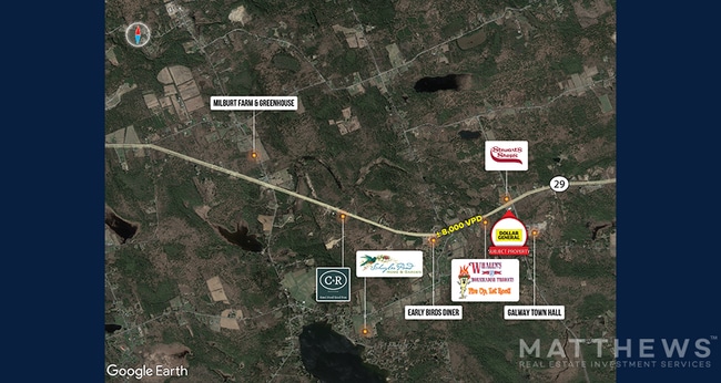
1800 Route 29
Albany-Schenectady-Troy, NY
Saratoga
413289 172.-2-15.12
New York
Storebuilding
15.012
2025
3.31 AC
2024
Saratoga County
061500
Albany/Schenectady/Troy
9,100 SF
DEMOGRAPHICS near 1800 Route 29
1 Mile
3 Mile
5 Mile
2024 Total Population
320
2,810
6,402
2029 Population
329
2,901
6,555
Pop Growth 2024-2029
+ 2.81%
+ 3.24%
+ 2.39%
Average Age
46
45
45
2024 Total Households
133
1,177
2,648
HH Growth 2024-2029
+ 2.26%
+ 3.23%
+ 2.38%
Median Household Inc
$90,865
$83,729
$81,832
Avg Household Size
2.40
2.30
2.40
2024 Avg HH Vehicles
2.00
2.00
2.00
Median Home Value
$272,916
$284,482
$268,335
Median Year Built
1973
1978
1981
Nearby Places
Map Layers
Map Styles
 Street
 Aerial
- Restaurants
- Banks
- Shops
- Fitness
- Groceries
PUBLIC TRANSPORTATION
AIRPORT
Albany International
DRIVE
WALK
Distance
Albany International
51 min
35.4 mi
Freight Ports
Albany, NY Port
DRIVE
WALK
Distance
Albany, NY Port
56 min
39.9 mi
SALE & LEASE HISTORY
LISTING DATE
SALE/LEASE

May 25, 2022
For Sale
Apr 07, 2023
For Sale
Nearby Properties
Address
Land Use
TOTAL SIZE
Lot Size
Zoning
Address
Land Use
TOTAL SIZE
Lot Size
Zoning
125,148 SF
17.89 AC
AR
Address
Land Use
TOTAL SIZE
Lot Size
Zoning
62,906 SF
88.14 AC
07 - MIXED
Address
Land Use
TOTAL SIZE
Lot Size
Zoning
56.49 AC
AC
Address
Land Use
TOTAL SIZE
Lot Size
Zoning
30.85 AC
07 - MIXED
Address
Land Use
TOTAL SIZE
Lot Size
Zoning
550.90 AC
07 - MIXED
Address
Land Use
TOTAL SIZE
Lot Size
Zoning
4,944 SF
26.88 AC
AC
Address
Land Use
TOTAL SIZE
Lot Size
Zoning
5,929 SF
12.82 AC
07 - MIXED
Address
Land Use
TOTAL SIZE
Lot Size
Zoning
3,600 SF
1.50 AC
AC
Address
Land Use
TOTAL SIZE
Lot Size
Zoning
3,924 SF
68.41 AC
07 - MIXED
Address
Land Use
TOTAL SIZE
Lot Size
Zoning
6,528 SF
7.46 AC
AC
Address
Land Use
TOTAL SIZE
Lot Size
Zoning
5,922 SF
3.92 AC
AC
Address
Land Use
TOTAL SIZE
Lot Size
Zoning
3,328 SF
75.11 AC
CONF
Address
Land Use
TOTAL SIZE
Lot Size
Zoning
3,000 SF
3.70 AC
AC
Address
Land Use
TOTAL SIZE
Lot Size
Zoning
4,070 SF
1.39 AC
AR
Address
Land Use
TOTAL SIZE
Lot Size
Zoning
1,684 SF
4.90 AC
AC
Address
Land Use
TOTAL SIZE
Lot Size
Zoning
8,400 SF
5.28 AC
CONF
Address
Land Use
TOTAL SIZE
Lot Size
Zoning
5.23 AC
07 - MIXED
Address
Land Use
TOTAL SIZE
Lot Size
Zoning
625 SF
112.24 AC
AC
Address
Land Use
TOTAL SIZE
Lot Size
Zoning
3,500 SF
0.28 AC
AC
Address
Land Use
TOTAL SIZE
Lot Size
Zoning
4,013 SF
2.58 AC
AC
Address
Land Use
TOTAL SIZE
Lot Size
Zoning
840 SF
15.68 AC
AC
Address
Land Use
TOTAL SIZE
Lot Size
Zoning
8,931 SF
0.68 AC
AC
Address
Land Use
TOTAL SIZE
Lot Size
Zoning
1,800 SF
7.42 AC
AC
Address
Land Use
TOTAL SIZE
Lot Size
Zoning
2,430 SF
99.81 AC
AR
Address
Land Use
TOTAL SIZE
Lot Size
Zoning
1.15 AC
AC
Address
Land Use
TOTAL SIZE
Lot Size
Zoning
2,684 SF
1.17 AC
07 - MIXED
Address
Land Use
TOTAL SIZE
Lot Size
Zoning
800 SF
79.22 AC
AC
Address
Land Use
TOTAL SIZE
Lot Size
Zoning
1,798 SF
13.20 AC
AC
Address
Land Use
TOTAL SIZE
Lot Size
Zoning
1,723 SF
9.10 AC
AC
The World's #1 Commercial Real Estate Marketplace
Connect with us
© 2026 CoStar Group
The information above has been obtained from sources believed reliable. While we do not doubt its accuracy we have not verified it and make no guarantee, warranty or representation about it. It is your responsibility to independently confirm its accuracy and completeness. Any projections, opinions, assumptions, or estimates used are for example only and do not represent the current or future performance of the property. The value of this transaction to you depends on tax and other factors which should be evaluated by your tax, financial, and legal advisors. You and your advisors should conduct a careful, independent investigation of the property to determine to your satisfaction the suitability of the property for your needs.