Property Record
1800 S High St, Longview, TX 75602


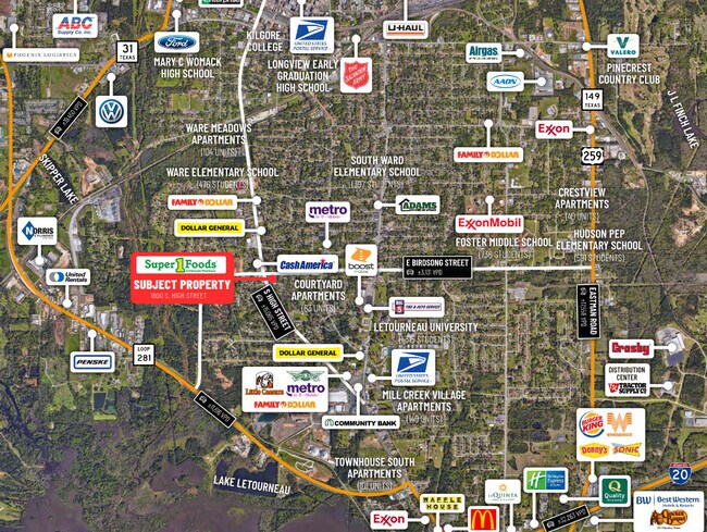

Property Detail
1800 S High St
Longview, TX
LTS 7A; 7B; 7C & 7D NCB 476 JOHNSON ACREAGE
61806
Gregg
Commercialnec
Texas
B and X Area of moderate flood hazard, usually the area between the limits of the 100-year and 500-year floods.
7
2024
2.68 AC
2025
Longview
001300
Other Market Areas
33,299 SF
NEARBY LISTINGS FOR SALE OR LEASE
DEMOGRAPHICS near 1800 S High St
1 mile
3 mile
5 mile
2025 Total Population
6,998
26,857
60,398
2030 Population
7,249
27,679
61,808
Pop Growth 2025-2030
+ 3.59%
+ 3.06%
+ 2.33%
Average Age
35
36
38
2025 Total Households
2,383
9,557
23,687
HH Growth 2025-2030
+ 3.61%
+ 3.12%
+ 2.36%
Median Household Inc
$54,821
$49,605
$57,738
Avg Household Size
2.70
2.50
2.40
2025 Avg HH Vehicles
2.00
2.00
2.00
Median Home Value
$83,247
$105,352
$174,847
Median Year Built
1959
1965
1975
Nearby Places
Map Layers
Map Styles
 Street
 Aerial
Layers
 Traffic
 Biking
Places
Listings with unknown addresses are not visible on the map
- Restaurants
- Banks
- Shops
- Fitness
- Groceries
PUBLIC TRANSPORTATION
COMMUTER RAIL
Longview (Texas Eagle - Amtrak)
Drive
Walk
Distance
Longview (Texas Eagle - Amtrak)
5 min
2.3 mi
Freight Ports
Port of Shreveport
Drive
Walk
Distance
Port of Shreveport
84 min
71.5 mi
SALE & LEASE HISTORY
LISTING DATE
SALE/LEASE

Mar 11, 2021
For Sale
Nearby Properties
Address
Land Use
TOTAL SIZE
Lot Size
Zoning
Address
Land Use
TOTAL SIZE
Lot Size
Zoning
133.06 AC
Address
Land Use
TOTAL SIZE
Lot Size
Zoning
18,200 SF
151.10 AC
Address
Land Use
TOTAL SIZE
Lot Size
Zoning
372,612 SF
5.72 AC
Address
Land Use
TOTAL SIZE
Lot Size
Zoning
138,850 SF
1.72 AC
Address
Land Use
TOTAL SIZE
Lot Size
Zoning
116,362 SF
25.20 AC
Address
Land Use
TOTAL SIZE
Lot Size
Zoning
65,115 SF
Address
Land Use
TOTAL SIZE
Lot Size
Zoning
23,556 SF
6.75 AC
Address
Land Use
TOTAL SIZE
Lot Size
Zoning
450,100 SF
34.15 AC
Address
Land Use
TOTAL SIZE
Lot Size
Zoning
92,222 SF
29.77 AC
Address
Land Use
TOTAL SIZE
Lot Size
Zoning
22.75 AC
Address
Land Use
TOTAL SIZE
Lot Size
Zoning
67,688 SF
7.57 AC
Address
Land Use
TOTAL SIZE
Lot Size
Zoning
11.14 AC
Address
Land Use
TOTAL SIZE
Lot Size
Zoning
Address
Land Use
TOTAL SIZE
Lot Size
Zoning
67,860 SF
12.52 AC
Address
Land Use
TOTAL SIZE
Lot Size
Zoning
20,000 SF
3.03 AC
Address
Land Use
TOTAL SIZE
Lot Size
Zoning
739,048 SF
61 AC
Address
Land Use
TOTAL SIZE
Lot Size
Zoning
144.45 AC
Address
Land Use
TOTAL SIZE
Lot Size
Zoning
155,643 SF
8.25 AC
Address
Land Use
TOTAL SIZE
Lot Size
Zoning
7.61 AC
Address
Land Use
TOTAL SIZE
Lot Size
Zoning
183,834 SF
24.99 AC
Address
Land Use
TOTAL SIZE
Lot Size
Zoning
Address
Land Use
TOTAL SIZE
Lot Size
Zoning
181,036 SF
10.81 AC
Address
Land Use
TOTAL SIZE
Lot Size
Zoning
90,610 SF
4.63 AC
Address
Land Use
TOTAL SIZE
Lot Size
Zoning
15,292 SF
0.43 AC
Address
Land Use
TOTAL SIZE
Lot Size
Zoning
68,723 SF
2.29 AC
Address
Land Use
TOTAL SIZE
Lot Size
Zoning
42,725 SF
1.07 AC
Address
Land Use
TOTAL SIZE
Lot Size
Zoning
11,616 SF
1.38 AC
Address
Land Use
TOTAL SIZE
Lot Size
Zoning
48,084 SF
3.02 AC
Address
Land Use
TOTAL SIZE
Lot Size
Zoning
3,428 SF
21.75 AC
Address
Land Use
TOTAL SIZE
Lot Size
Zoning
108.50 AC
The World's #1 Commercial Real Estate Marketplace
Connect with us
© 2026 CoStar Group
The information above has been obtained from sources believed reliable. While we do not doubt its accuracy we have not verified it and make no guarantee, warranty or representation about it. It is your responsibility to independently confirm its accuracy and completeness. Any projections, opinions, assumptions, or estimates used are for example only and do not represent the current or future performance of the property. The value of this transaction to you depends on tax and other factors which should be evaluated by your tax, financial, and legal advisors. You and your advisors should conduct a careful, independent investigation of the property to determine to your satisfaction the suitability of the property for your needs.